![](/images/other/stat-length.png)
![Trail Walking Roquebrune-sur-Argens - Autour de la Maurette (variante) - Photo](https://media.geolcdn.com/t/1900/400/9e327cd4-b701-4d2e-839f-23509b76ff37.jpg&format=pjpeg&maxdim=2)
Autour de la Maurette (variante)
donda
User GUIDE
![Length](/images/other/stat-length.png)
Length
16.5 km
![Max alt](https://static1.geolcdn.com/siteimages/upload/files/1508320355ic_sort_altitude_max_24dp.png)
Max alt
265 m
![Uphill gradient](https://static1.geolcdn.com/siteimages/upload/files/1508320355ic_sort_den_pos_24dp.png)
Uphill gradient
500 m
![Km-Effort](/images/other/stat-length.png)
Km-Effort
23 km
![Min alt](https://static1.geolcdn.com/siteimages/upload/files/1508320355ic_sort_altitude_min_24dp.png)
Min alt
15 m
![Downhill gradient](https://static1.geolcdn.com/siteimages/upload/files/1508320355ic_sort_den_neg_24dp.png)
Downhill gradient
500 m
![Boucle](https://static1.geolcdn.com/siteimages/upload/files/16400158638029165_repeat_loop_refresh_sync_direction_icon.png)
Boucle
Yes
Creation date :
2022-11-16 07:58:58.547
Updated on :
2022-11-17 14:14:18.755
![Walking](https://static1.geolcdn.com/sitytour/trail-icons/101.png)
4h10
Difficulty : Very difficult
![Scan this QR Code to open this trail in the SityTrail application](https://capi.geolives.com/qq0zvz2zws4bq2lad0pu/sitytour/trails/3458427/qr.png?size=200)
FREE GPS app for hiking
About
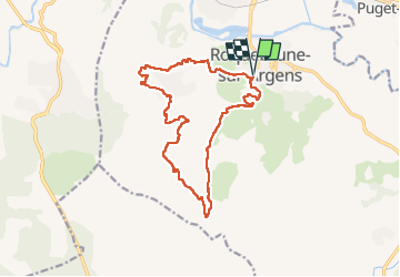
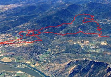
Trail Walking of 16.5 km to be discovered at Provence-Alpes-Côte d'Azur, Var, Roquebrune-sur-Argens. This trail is proposed by donda.
Description
Parking cimetière de Roquebrune-sur-Argens.
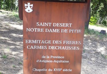
Chapelle Ste Anne - Monastère ND de la Pitié - Les vingt-cinq Ponts - lac des Clos - rocher de Roquebrune.
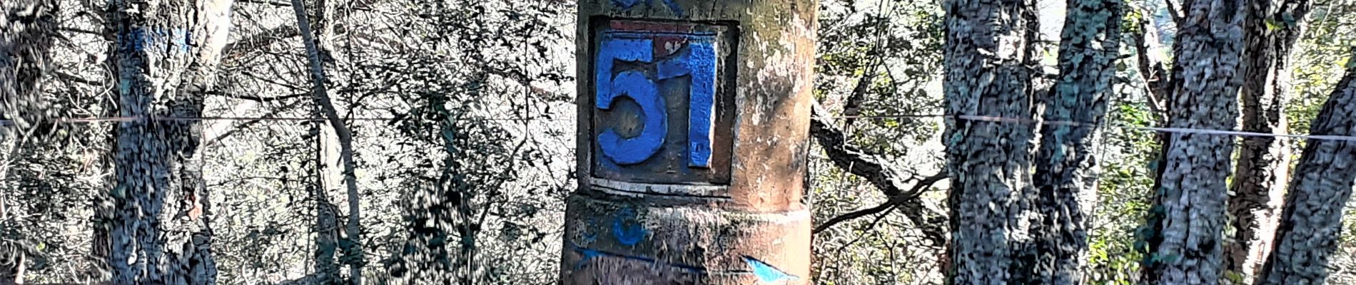
Positioning
Country:
France
Region :
Provence-Alpes-Côte d'Azur
Department/Province :
Var
Municipality :
Roquebrune-sur-Argens
Location:
Unknown
Start:(Dec)
Start:(UTM)
308550 ; 4812502 (32T) N.
Comments
Trails nearby
![Trail Walking Roquebrune-sur-Argens - SityTrail - Les 25 ponts-Roquebrune sur Argens-28-01-22 - Photo](https://media.geolcdn.com/t/375/260/605c9bb1-f90a-4cd2-a653-fe52e6d3d081.jpg&format=jpg&maxdim=2)
![Walking Walking](https://static1.geolcdn.com/sitytour/trail-icons/101.png)
SityTrail - Les 25 ponts-Roquebrune sur Argens-28-01-22
Walking
Medium
(1)
Roquebrune-sur-Argens,
Provence-Alpes-Côte d'Azur,
Var,
France
![](/images/other/stat-length.png)
14.4 km | 20 km-effort
6h 0min
![](https://static1.geolcdn.com/siteimages/upload/files/16400158638029165_repeat_loop_refresh_sync_direction_icon.png)
Yes
![Trail Walking Roquebrune-sur-Argens - Rocher de Roquebrune, les Trois Croix - Photo](https://media.geolcdn.com/t/375/260/ext.jpg?maxdim=2&url=https%3A%2F%2Fservices.sitytrail.com%2FGeolivesWS%2FDownloadMedia.ashx%3FTrailID%3D173163%26Media%3D14736_1.jpg)
![Walking Walking](https://static1.geolcdn.com/sitytour/trail-icons/101.png)
Rocher de Roquebrune, les Trois Croix
Walking
Difficult
(4)
Roquebrune-sur-Argens,
Provence-Alpes-Côte d'Azur,
Var,
France
![](/images/other/stat-length.png)
7 km | 11.4 km-effort
4h 15min
![](https://static1.geolcdn.com/siteimages/upload/files/16400158638029165_repeat_loop_refresh_sync_direction_icon.png)
Yes
![Trail On foot Puget-sur-Argens - PUGET SUR ARGENS- gazoduc-Terres Gastes DRI - Photo](https://media.geolcdn.com/t/375/260/ext.jpg?maxdim=2&url=https%3A%2F%2Fstatic1.geolcdn.com%2Fsiteimages%2Fupload%2Ffiles%2F1545311037marcheuse_200dpi.jpg)
![On foot On foot](https://static1.geolcdn.com/sitytour/trail-icons/100.png)
PUGET SUR ARGENS- gazoduc-Terres Gastes DRI
On foot
Easy
(1)
Puget-sur-Argens,
Provence-Alpes-Côte d'Azur,
Var,
France
![](/images/other/stat-length.png)
7.7 km | 8.9 km-effort
2h 1min
![](https://static1.geolcdn.com/siteimages/upload/files/16400158638029165_repeat_loop_refresh_sync_direction_icon.png)
Yes
![Trail Walking Roquebrune-sur-Argens - les merles 2 - Photo](https://media.geolcdn.com/t/375/260/ext.jpg?maxdim=2&url=https%3A%2F%2Fstatic1.geolcdn.com%2Fsiteimages%2Fupload%2Ffiles%2F1553511878bg_sport_marche.png)
![Walking Walking](https://static1.geolcdn.com/sitytour/trail-icons/101.png)
les merles 2
Walking
Medium
(1)
Roquebrune-sur-Argens,
Provence-Alpes-Côte d'Azur,
Var,
France
![](/images/other/stat-length.png)
6.6 km | 7.9 km-effort
1h 47min
![](https://static1.geolcdn.com/siteimages/upload/files/16400158638029165_repeat_loop_refresh_sync_direction_icon.png)
Yes
![Trail Walking Roquebrune-sur-Argens - 2023-10-25_17h14m36_Randonn_e-27 - Photo](https://media.geolcdn.com/t/375/260/ext.jpg?maxdim=2&url=https%3A%2F%2Fstatic1.geolcdn.com%2Fsiteimages%2Fupload%2Ffiles%2F1553511878bg_sport_marche.png)
![Walking Walking](https://static1.geolcdn.com/sitytour/trail-icons/101.png)
2023-10-25_17h14m36_Randonn_e-27
Walking
Difficult
(1)
Roquebrune-sur-Argens,
Provence-Alpes-Côte d'Azur,
Var,
France
![](/images/other/stat-length.png)
9.2 km | 12.6 km-effort
2h 52min
![](https://static1.geolcdn.com/siteimages/upload/files/16400158638029165_repeat_loop_refresh_sync_direction_icon.png)
Yes
![Trail On foot Roquebrune-sur-Argens - Roquebrune sur argens-Les 25 Ponds-ND de la pitié- Lac des clos - Photo](https://media.geolcdn.com/t/375/260/ext.jpg?maxdim=2&url=https%3A%2F%2Fstatic1.geolcdn.com%2Fsiteimages%2Fupload%2Ffiles%2F1545311037marcheuse_200dpi.jpg)
![On foot On foot](https://static1.geolcdn.com/sitytour/trail-icons/100.png)
Roquebrune sur argens-Les 25 Ponds-ND de la pitié- Lac des clos
On foot
Easy
(1)
Roquebrune-sur-Argens,
Provence-Alpes-Côte d'Azur,
Var,
France
![](/images/other/stat-length.png)
11.9 km | 17 km-effort
3h 51min
![](https://static1.geolcdn.com/siteimages/upload/files/16400158638029165_repeat_loop_refresh_sync_direction_icon.png)
Yes
![Trail Walking Roquebrune-sur-Argens - les hauts de Roquebrune sur Argens - Photo](https://media.geolcdn.com/t/375/260/fb3b5c94-db8e-400d-a9b2-b3a4bc6a654b.jpg&format=jpg&maxdim=2)
![Walking Walking](https://static1.geolcdn.com/sitytour/trail-icons/101.png)
les hauts de Roquebrune sur Argens
Walking
Easy
(1)
Roquebrune-sur-Argens,
Provence-Alpes-Côte d'Azur,
Var,
France
![](/images/other/stat-length.png)
6.2 km | 8.9 km-effort
2h 9min
![](https://static1.geolcdn.com/siteimages/upload/files/16400158638029165_repeat_loop_refresh_sync_direction_icon.png)
Yes
![Trail Walking Roquebrune-sur-Argens - Le sentier découverte des 25 ponts - Photo](https://media.geolcdn.com/t/375/260/ext.jpg?maxdim=2&url=https%3A%2F%2Fstatic1.geolcdn.com%2Fsiteimages%2Fupload%2Ffiles%2F1553511878bg_sport_marche.png)
![Walking Walking](https://static1.geolcdn.com/sitytour/trail-icons/101.png)
Le sentier découverte des 25 ponts
Walking
Very easy
(1)
Roquebrune-sur-Argens,
Provence-Alpes-Côte d'Azur,
Var,
France
![](/images/other/stat-length.png)
4.5 km | 6 km-effort
Unknown
![](https://static1.geolcdn.com/siteimages/upload/files/16400158638029165_repeat_loop_refresh_sync_direction_icon.png)
Yes
![Trail Mountain bike Roquebrune-sur-Argens - 2013 05 01 - Photo](https://media.geolcdn.com/t/375/260/ext.jpg?maxdim=2&url=https%3A%2F%2Fstatic1.geolcdn.com%2Fsiteimages%2Fupload%2Ffiles%2F1524743154velo.jpg)
![Mountain bike Mountain bike](https://static1.geolcdn.com/sitytour/trail-icons/202.png)
2013 05 01
Mountain bike
Medium
(1)
Roquebrune-sur-Argens,
Provence-Alpes-Côte d'Azur,
Var,
France
![](/images/other/stat-length.png)
23 km | 33 km-effort
4h 8min
![](https://static1.geolcdn.com/siteimages/upload/files/16400158638029165_repeat_loop_refresh_sync_direction_icon.png)
No