Trail Walking La Bresse - Rando du Sotré - Photo

Rando du Sotré

© OpenStreetMap contributors
Length
Length
13.5 km
Max alt
Max alt
1303 m
Uphill gradient
Uphill gradient
488 m
Km-Effort
Km-Effort  
19.9 km
Min alt
Min alt
921 m
Downhill gradient
Downhill gradient
480 m
Boucle
Boucle
Yes
Creation date :
2014-12-10 00:00:00.0
Updated on :
2014-12-10 00:00:00.0

(0 Reviews)

Walking
Walking
3h40
Difficulty : Medium

Scan this QR Code to open this trail in the SityTrail application

FREE GPS app for hiking

Logo SityTrail SityTrail

IGN / Geographical institutes

Download SityTrail from the App Store Download SityTrail from Google Play

Logo SityTrail SityTrail World

The world is yours!

Download SityTrail from the App Store Download SityTrail from Google Play Download SityTrail on Huawei AppGallery

About

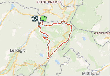
Trail Walking of 13.5 km to be discovered at Grand Est, Vosges, La Bresse. This trail is proposed by jeanclaude12.

Description

Belle randonnée par le Lac de la Lande, la face Est du Grand Artimon, puis vers Ferschmuss entre le Rainkopf et le Kastelberg, la face Ouest du Hohneck, le Col de Thiaville, la Chaume du Bas Chitelet et retour au Parking des Pistes de Vologne (La Bresse)

Elevation profile

Photos

Points of interest

Point of interest La Bresse - Point 3 - Photo
jeanclaude12
LA BRESSE 
Point of interest La Bresse - Lac de la Lande - Photo
jeanclaude12
LA BRESSE 
Point of interest La Bresse - Vue sur le Hohneck depuis le Kastelberg - Photo
jeanclaude12

Positioning

Country:
France
Region :
Grand Est
Department/Province :
Vosges
Municipality :
La Bresse
Location:
Unknown
Start:(UTM)
349039 ; 5322709 (32U) N.

Trails nearby

Trail Walking La Bresse - 2023-04-16 Marche Abri Lac de Blanchemer vers Lac de Lispach - Photo
Walking
GUIDE
holtzv

Walking

Very difficult
(1)
La Bresse, Grand Est, Vosges, France
23 km | 36 km-effort
8h 4min
No
Trail Walking La Bresse - 2023-04-15 Marche Abri Collet de Etang vers Abri Lac de Blanchemer - Photo
Walking
GUIDE
holtzv

Walking

Medium
(1)
La Bresse, Grand Est, Vosges, France
22 km | 35 km-effort
7h 51min
No
Trail Walking Le Valtin - Les Rochers des Hirschsteine - Lac Vert - Photo
Walking
GUIDE
Michel1963

Walking

Difficult
(2)
Le Valtin, Grand Est, Vosges, France
14.4 km | 22 km-effort
5h 2min
Yes
Trail Walking Le Valtin - Le Sentier des Roches - Photo
Walking
GUIDE
Michel1963

Walking

Difficult
(2)
Le Valtin, Grand Est, Vosges, France
20 km | 34 km-effort
7h 43min
Yes
Trail Walking La Bresse - Lac de Lispach et sentier Dielaine  - Photo
Walking
zazie

Walking

Medium
(1)
La Bresse, Grand Est, Vosges, France
9.7 km | 14.9 km-effort
2h 30min
Yes
Trail Walking Stosswihr - Tour du belvedere avec le passage sur les crêtes  - Photo
Walking
ocepee

Walking

Very easy
(2)
Stosswihr, Grand Est, Haut-Rhin, France
8.5 km | 0 m-effort
2h 28min
Yes
Trail Walking La Bresse - Kastelberg des pierres, des lacs, des panoramas magnifiques  - Photo
Walking
Alfredy

Walking

Difficult
(1)
La Bresse, Grand Est, Vosges, France
15.1 km | 26 km-effort
6h 11min
Yes
Trail Walking La Bresse - Les 5 lacs autour du Hohneck - Photo
Walking
tiene

Walking

Very difficult
(1)
La Bresse, Grand Est, Vosges, France
21 km | 36 km-effort
7h 21min
Yes
Trail Walking Wildenstein - Col du Bramont - Machey - Blanchemer - Photo
Walking
VacheKiri67

Walking

Medium
(1)
Wildenstein, Grand Est, Haut-Rhin, France
15.3 km | 22 km-effort
4h 27min
Yes


Close
My subscriptions