


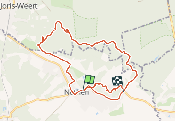


23 km | 28 km-effort


User


FREE GPS app for hiking
 SityTrail
IGN / Geographical institutes
SityTrail World
The world is yours!
Trail Walking of 10.5 km to be discovered at Wallonia, Walloon Brabant, Grez-Doiceau. This trail is proposed by micheldutilleul.
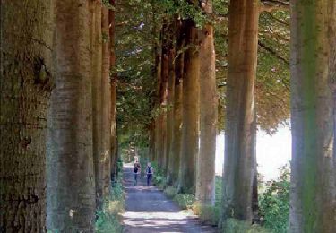
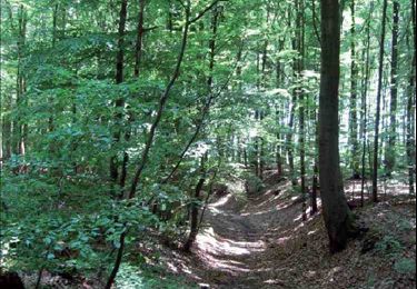
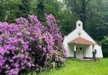
Très chouette balade à travers des petits chemins dans les differents petits villages que l on traverse et bois de Meerdael.
Chemins variés et un peu de dénivelé.

Walking

Walking
Walking

Walking
Walking
Walking
Walking
Walking
Walking