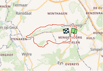
![](/images/other/stat-length.png)
![Trail Walking Voerendaal - 2022-11-11_17h26m07_route-des-vins-land-van-kalk-ubachsberg-vi3 - Photo](https://media.geolcdn.com/t/1900/400/ext.pjpeg?maxdim=2&url=https%3A%2F%2Fstatic1.geolcdn.com%2Fsiteimages%2Fupload%2Ffiles%2F1553511878bg_sport_marche.png)
2022-11-11_17h26m07_route-des-vins-land-van-kalk-ubachsberg-vi3
mumu.larandonneuse
User GUIDE
![Length](/images/other/stat-length.png)
![Max alt](https://static1.geolcdn.com/siteimages/upload/files/1508320355ic_sort_altitude_max_24dp.png)
![Uphill gradient](https://static1.geolcdn.com/siteimages/upload/files/1508320355ic_sort_den_pos_24dp.png)
![Km-Effort](/images/other/stat-length.png)
![Min alt](https://static1.geolcdn.com/siteimages/upload/files/1508320355ic_sort_altitude_min_24dp.png)
![Downhill gradient](https://static1.geolcdn.com/siteimages/upload/files/1508320355ic_sort_den_neg_24dp.png)
![Boucle](https://static1.geolcdn.com/siteimages/upload/files/16400158638029165_repeat_loop_refresh_sync_direction_icon.png)
![Walking](https://static1.geolcdn.com/sitytour/trail-icons/101.png)
3h08
Difficulty : Easy
![Scan this QR Code to open this trail in the SityTrail application](https://capi.geolives.com/qq0zvz2zws4bq2lad0pu/sitytour/trails/3453628/qr.png?size=200)
FREE GPS app for hiking
About
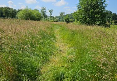
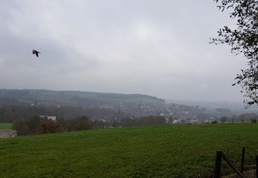
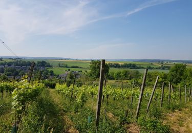
Trail Walking of 11.7 km to be discovered at Limburg, Unknown, Voerendaal. This trail is proposed by mumu.larandonneuse.
Description
ℹ www.visitzuidlimburg.nl
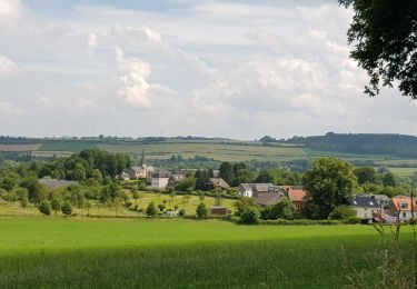
➡️ Découvrez le vin du sud du Limbourg autour d'Ubachsberg dans le Land van Kalk sur une route des vins à couper le souffle d'environ 12 kilomètres. En chemin, vous passerez devant 3 vignobles avec une vue imprenable et de nombreux faits viticoles. Grâce à des panneaux d'information dans les vignes, vous ferez connaissance avec l'entreprise, le terroir, les cépages, les types de vins et la vinification.
Point de départ : Herberg de Bernardushoeve, Mingersborg 20-22 à Voerendaal.
Positioning
Comments
Trails nearby
![Trail Walking Gulpen-Wittem - 2024-07-05_10h26m55_landsrade-g4-gulpen-wittem- - Photo](https://media.geolcdn.com/t/375/260/21c97729-ea16-405b-b733-eb2ef5b79dcc.jpg&format=jpg&maxdim=2)
![Walking Walking](https://static1.geolcdn.com/sitytour/trail-icons/101.png)
Walking
![](/images/other/stat-length.png)
![](https://static1.geolcdn.com/siteimages/upload/files/16400158638029165_repeat_loop_refresh_sync_direction_icon.png)
![Trail Walking Gulpen-Wittem - 2021-11-26_14h13m03_1450 (2) - Photo](https://media.geolcdn.com/t/375/260/c6f56cbd-561d-45be-8633-9d909ae47436.jpg&format=jpg&maxdim=2)
![Walking Walking](https://static1.geolcdn.com/sitytour/trail-icons/101.png)
Walking
![](/images/other/stat-length.png)
![](https://static1.geolcdn.com/siteimages/upload/files/16400158638029165_repeat_loop_refresh_sync_direction_icon.png)
![Trail Walking Gulpen-Wittem - 2021-10-28_12h14m38_1475 - Photo](https://media.geolcdn.com/t/375/260/ce7340b1-9a84-4087-960a-062e447143e0.jpg&format=jpg&maxdim=2)
![Walking Walking](https://static1.geolcdn.com/sitytour/trail-icons/101.png)
Walking
![](/images/other/stat-length.png)
![](https://static1.geolcdn.com/siteimages/upload/files/16400158638029165_repeat_loop_refresh_sync_direction_icon.png)
![Trail Walking Gulpen-Wittem - 2021-10-27_21h13m45_1225 - Photo](https://media.geolcdn.com/t/375/260/5eb7c815-cdad-419c-9110-728d3ac43338.jpg&format=jpg&maxdim=2)
![Walking Walking](https://static1.geolcdn.com/sitytour/trail-icons/101.png)
Walking
![](/images/other/stat-length.png)
![](https://static1.geolcdn.com/siteimages/upload/files/16400158638029165_repeat_loop_refresh_sync_direction_icon.png)
![Trail Walking Gulpen-Wittem - 2021-10-27_20h47m33_1105 - Photo](https://media.geolcdn.com/t/375/260/115742d6-93f7-467f-9808-8e4bc3de0870.jpg&format=jpg&maxdim=2)
![Walking Walking](https://static1.geolcdn.com/sitytour/trail-icons/101.png)
Walking
![](/images/other/stat-length.png)
![](https://static1.geolcdn.com/siteimages/upload/files/16400158638029165_repeat_loop_refresh_sync_direction_icon.png)
![Trail Walking Gulpen-Wittem - 2021-07-01_13h51m24_077 - Photo](https://media.geolcdn.com/t/375/260/215e9d9a-5676-4aab-b7ac-fe070e30f244.jpg&format=jpg&maxdim=2)
![Walking Walking](https://static1.geolcdn.com/sitytour/trail-icons/101.png)
Walking
![](/images/other/stat-length.png)
![](https://static1.geolcdn.com/siteimages/upload/files/16400158638029165_repeat_loop_refresh_sync_direction_icon.png)
![Trail Walking Gulpen-Wittem - 2021-06-14_21h05m37_853 - Photo](https://media.geolcdn.com/t/375/260/4793f524-5e32-489e-afec-b0432ab44946.jpg&format=jpg&maxdim=2)
![Walking Walking](https://static1.geolcdn.com/sitytour/trail-icons/101.png)
Walking
![](/images/other/stat-length.png)
![](https://static1.geolcdn.com/siteimages/upload/files/16400158638029165_repeat_loop_refresh_sync_direction_icon.png)
![Trail Walking Gulpen-Wittem - 2022-06-10_16h45m42_1555 - Photo](https://media.geolcdn.com/t/375/260/ext.jpg?maxdim=2&url=https%3A%2F%2Fstatic1.geolcdn.com%2Fsiteimages%2Fupload%2Ffiles%2F1553511878bg_sport_marche.png)
![Walking Walking](https://static1.geolcdn.com/sitytour/trail-icons/101.png)
Walking
![](/images/other/stat-length.png)
![](https://static1.geolcdn.com/siteimages/upload/files/16400158638029165_repeat_loop_refresh_sync_direction_icon.png)
![Trail Walking Gulpen-Wittem - Wijlre - Photo](https://media.geolcdn.com/t/375/260/1f37460d-555a-4cb4-9779-3e8cd2d4f315.jpg&format=jpg&maxdim=2)
![Walking Walking](https://static1.geolcdn.com/sitytour/trail-icons/101.png)