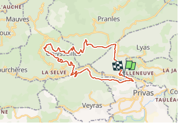
Trail Walking Lyas - Le Petit Tournon 18km - Photo

Le Petit Tournon 18km

 thonyc
thonyc

User GUIDE

© OpenStreetMap contributors
Length
Length
18.2 km
Max alt
Max alt
665 m
Uphill gradient
Uphill gradient
782 m
Km-Effort
Km-Effort  
29 km
Min alt
Min alt
279 m
Downhill gradient
Downhill gradient
771 m
Boucle
Boucle
Yes
Creation date :
2022-11-10 14:11:45.954
Updated on :
2022-11-10 14:19:46.554

(0 Reviews)

Walking
Walking
5h40
Difficulty : Difficult

Scan this QR Code to open this trail in the SityTrail application

FREE GPS app for hiking

Logo SityTrail SityTrail

IGN / Geographical institutes

Download SityTrail from the App Store Download SityTrail from Google Play

Logo SityTrail SityTrail World

The world is yours!

Download SityTrail from the App Store Download SityTrail from Google Play Download SityTrail on Huawei AppGallery

About

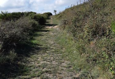
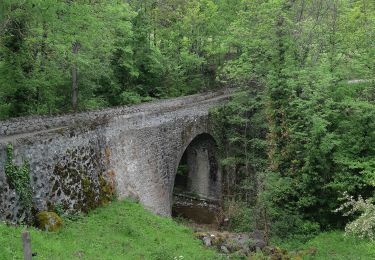
Trail Walking of 18.2 km to be discovered at Auvergne-Rhône-Alpes, Ardèche, Lyas. This trail is proposed by thonyc.

Description

Rando assez difficile avec une succession de montées et descentes.
Parcours varié.

Elevation profile

Positioning

Country:
France
Region :
Auvergne-Rhône-Alpes
Department/Province :
Ardèche
Municipality :
Lyas
Location:
Unknown
Start:(UTM)
625495 ; 4955636 (31T) N.

Trails nearby

Trail Walking Creysseilles - Magerouan Le Chier 14KM - Photo
Walking
GUIDE
thonyc

Walking

Very difficult
Creysseilles, Auvergne-Rhône-Alpes, Ardèche, France
14 km | 22 km-effort
4h 59min
Yes
Trail Walking Lyas - 07 privas Livier zel - Photo
Walking
GUIDE
randodyssée

Walking

Medium
Lyas, Auvergne-Rhône-Alpes, Ardèche, France
18.1 km | 28 km-effort
6h 46min
Yes
Trail Walking Alissas - 07 Alissas rochessauve zel 23.11.22 - Photo
Walking
GUIDE
randodyssée

Walking

Easy
Alissas, Auvergne-Rhône-Alpes, Ardèche, France
15.3 km | 22 km-effort
6h 5min
Yes
Trail Walking Pranles - 07 chirouze prandes - Photo
Walking
GUIDE
randodyssée

Walking

Easy
Pranles, Auvergne-Rhône-Alpes, Ardèche, France
11.3 km | 17.6 km-effort
5h 12min
No
Trail Walking Coux - Coux Serre Gruas 19km - Photo
Walking
GUIDE
thonyc

Walking

Medium
Coux, Auvergne-Rhône-Alpes, Ardèche, France
19.4 km | 29 km-effort
5h 25min
Yes
Trail Walking Saint-Étienne-de-Serre - 07 chier magerouan - Photo
Walking
GUIDE
randodyssée

Walking

Medium
Saint-Étienne-de-Serre, Auvergne-Rhône-Alpes, Ardèche, France
15.6 km | 26 km-effort
6h 27min
No
Trail Walking Saint-Priest - 07 st priest roc de gourdon - Photo
Walking
GUIDE
randodyssée

Walking

Difficult
Saint-Priest, Auvergne-Rhône-Alpes, Ardèche, France
18.3 km | 29 km-effort
8h 31min
Yes
Trail Walking Coux - Jaubernie - Photo
Walking
OscarMa

Walking

Easy
(2)
Coux, Auvergne-Rhône-Alpes, Ardèche, France
14.8 km | 22 km-effort
4h 41min
Yes
Trail Walking Coux - w-frankrijk-wandelroute-coux-ardeche - Photo
Walking
gpstracks

Walking

Very easy
(1)
Coux, Auvergne-Rhône-Alpes, Ardèche, France
5.8 km | 9.3 km-effort
Unknown
Yes


Close
My subscriptions