![](/images/other/stat-length.png)
![Trail Walking Saint-Quentin-sur-Isère - Sentier patrimonial complet - Photo](https://media.geolcdn.com/t/1900/400/ext.pjpeg?maxdim=2&url=https%3A%2F%2Fstatic1.geolcdn.com%2Fsiteimages%2Fupload%2Ffiles%2F1553511878bg_sport_marche.png)
Sentier patrimonial complet
© OpenStreetMap contributors
![Walking](https://static1.geolcdn.com/sitytour/trail-icons/101.png)
Walking
2h27
Difficulty : Medium
![Length](/images/other/stat-length.png)
Length
6.2 km
![Max alt](https://static1.geolcdn.com/siteimages/upload/files/1508320355ic_sort_altitude_max_24dp.png)
Max alt
492 m
![Uphill gradient](https://static1.geolcdn.com/siteimages/upload/files/1508320355ic_sort_den_pos_24dp.png)
Uphill gradient
344 m
![Km-Effort](/images/other/stat-length.png)
Km-Effort
10.8 km
![Min alt](https://static1.geolcdn.com/siteimages/upload/files/1508320355ic_sort_altitude_min_24dp.png)
Min alt
183 m
![Downhill gradient](https://static1.geolcdn.com/siteimages/upload/files/1508320355ic_sort_den_neg_24dp.png)
Downhill gradient
344 m
![Boucle](https://static1.geolcdn.com/siteimages/upload/files/16400158638029165_repeat_loop_refresh_sync_direction_icon.png)
Boucle
Yes
Creation date :
2022-11-07 15:32:13.594
Updated on :
2023-01-29 15:12:11.381
![Walking](https://static1.geolcdn.com/sitytour/trail-icons/101.png)
2h27
Difficulty : Medium
![Scan this QR Code to open this trail in the SityTrail application](https://capi.geolives.com/qq0zvz2zws4bq2lad0pu/sitytour/trails/3449172/qr.png?size=200)
FREE GPS app for hiking
About
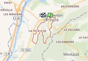
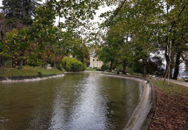
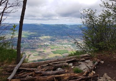
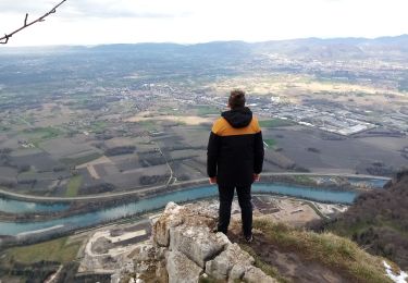
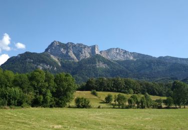
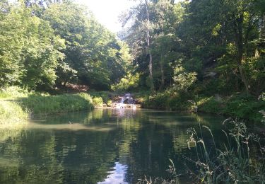
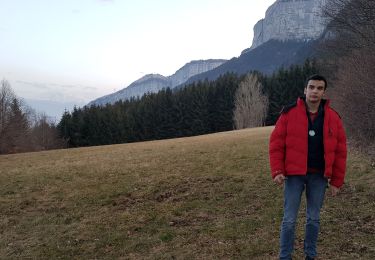
Trail Walking of 6.2 km to be discovered at Auvergne-Rhône-Alpes, Isère, Saint-Quentin-sur-Isère. This trail is proposed by Eric BESSOUD-CAVILLOT.
Description
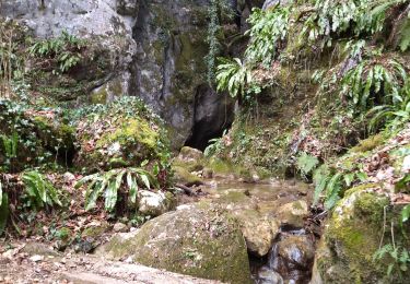
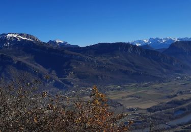
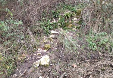
Boucle au départ du parking de la médiathèque de Saint Quentin sur Isère permettant de découvrir quelques sites patrimoniaux de la commune.
Positioning
Country:
France
Region :
Auvergne-Rhône-Alpes
Department/Province :
Isère
Municipality :
Saint-Quentin-sur-Isère
Location:
Unknown
Start:(Dec)
Start:(UTM)
699544 ; 5017191 (31T) N.
Comments
Trails nearby
![Trail Walking Saint-Quentin-sur-Isère - Dent de Moirans - Photo](https://media.geolcdn.com/t/375/260/ext.jpg?maxdim=2&url=https%3A%2F%2Fmedia.geolcdn.com%2Ff%2Fcc5b3296-26ad-4d08-b80e-e1eedf7283f6.jpg)
![Walking Walking](https://static1.geolcdn.com/sitytour/trail-icons/101.png)
Dent de Moirans
Walking
Very difficult
Saint-Quentin-sur-Isère,
Auvergne-Rhône-Alpes,
Isère,
France
![](/images/other/stat-length.png)
14.7 km | 26 km-effort
6h 17min
![](https://static1.geolcdn.com/siteimages/upload/files/16400158638029165_repeat_loop_refresh_sync_direction_icon.png)
Yes
![Trail Walking Saint-Quentin-sur-Isère - 38 St Quentin sur isere - Photo](https://media.geolcdn.com/t/375/260/ext.jpg?maxdim=2&url=https%3A%2F%2Fmedia.geolcdn.com%2Ff%2Fa8213203-4838-4b30-a9a1-6f63f9fa0c7f.jpg)
![Walking Walking](https://static1.geolcdn.com/sitytour/trail-icons/101.png)
38 St Quentin sur isere
Walking
Medium
Saint-Quentin-sur-Isère,
Auvergne-Rhône-Alpes,
Isère,
France
![](/images/other/stat-length.png)
17 km | 28 km-effort
7h 22min
![](https://static1.geolcdn.com/siteimages/upload/files/16400158638029165_repeat_loop_refresh_sync_direction_icon.png)
Yes
![Trail Walking Tullins - Clos des Chartreux Parmenie 2 - Photo](https://media.geolcdn.com/t/375/260/ext.jpg?maxdim=2&url=https%3A%2F%2Fmedia.geolcdn.com%2Ff%2F3e5993b5-a74b-4c7a-a6d9-a420eaf80d04.jpg)
![Walking Walking](https://static1.geolcdn.com/sitytour/trail-icons/101.png)
Clos des Chartreux Parmenie 2
Walking
Medium
Tullins,
Auvergne-Rhône-Alpes,
Isère,
France
![](/images/other/stat-length.png)
14.1 km | 23 km-effort
5h 29min
![](https://static1.geolcdn.com/siteimages/upload/files/16400158638029165_repeat_loop_refresh_sync_direction_icon.png)
Yes
![Trail Walking Montaud - La Dent de Moirans - Photo](https://media.geolcdn.com/t/375/260/ext.jpg?maxdim=2&url=https%3A%2F%2Fmedia.geolcdn.com%2Ff%2F42159542-0525-485e-906a-e99c0c2c152d.jpg)
![Walking Walking](https://static1.geolcdn.com/sitytour/trail-icons/101.png)
La Dent de Moirans
Walking
Easy
Montaud,
Auvergne-Rhône-Alpes,
Isère,
France
![](/images/other/stat-length.png)
11 km | 16.4 km-effort
4h 38min
![](https://static1.geolcdn.com/siteimages/upload/files/16400158638029165_repeat_loop_refresh_sync_direction_icon.png)
Yes
![Trail Walking Montaud - La dent de Moirans - Photo](https://media.geolcdn.com/t/375/260/ext.jpg?maxdim=2&url=https%3A%2F%2Fmedia.geolcdn.com%2Ff%2Fc31d5ba7-98c1-4d2c-8f51-1281362b0eb5.jpg)
![Walking Walking](https://static1.geolcdn.com/sitytour/trail-icons/101.png)
La dent de Moirans
Walking
Very easy
(1)
Montaud,
Auvergne-Rhône-Alpes,
Isère,
France
![](/images/other/stat-length.png)
8.9 km | 13.5 km-effort
2h 57min
![](https://static1.geolcdn.com/siteimages/upload/files/16400158638029165_repeat_loop_refresh_sync_direction_icon.png)
Yes
![Trail Walking Montaud - BOUCLE MONTAUD DE T DE MOIRANS - Photo](https://media.geolcdn.com/t/375/260/ext.jpg?maxdim=2&url=https%3A%2F%2Fmedia.geolcdn.com%2Ff%2Fe130ea2b-4587-4c00-ae7c-a57eb66385d6.jpg)
![Walking Walking](https://static1.geolcdn.com/sitytour/trail-icons/101.png)
BOUCLE MONTAUD DE T DE MOIRANS
Walking
Medium
Montaud,
Auvergne-Rhône-Alpes,
Isère,
France
![](/images/other/stat-length.png)
11.1 km | 16.7 km-effort
3h 12min
![](https://static1.geolcdn.com/siteimages/upload/files/16400158638029165_repeat_loop_refresh_sync_direction_icon.png)
Yes
![Trail Walking Saint-Quentin-sur-Isère - st Quentin montaud boucle - Photo](https://media.geolcdn.com/t/375/260/ext.jpg?maxdim=2&url=https%3A%2F%2Fmedia.geolcdn.com%2Ff%2F0aa42cac-7efa-41f8-ab64-12fb04627411.jpg)
![Walking Walking](https://static1.geolcdn.com/sitytour/trail-icons/101.png)
st Quentin montaud boucle
Walking
Medium
Saint-Quentin-sur-Isère,
Auvergne-Rhône-Alpes,
Isère,
France
![](/images/other/stat-length.png)
8.9 km | 16.3 km-effort
2h 58min
![](https://static1.geolcdn.com/siteimages/upload/files/16400158638029165_repeat_loop_refresh_sync_direction_icon.png)
Yes
![Trail Walking Noyarey - Ezy Montaud par les chemins communaux - Photo](https://media.geolcdn.com/t/375/260/ext.jpg?maxdim=2&url=https%3A%2F%2Fmedia.geolcdn.com%2Ff%2F0cea62fe-ffe7-4b76-832e-d8e78db74c24.jpg)
![Walking Walking](https://static1.geolcdn.com/sitytour/trail-icons/101.png)
Ezy Montaud par les chemins communaux
Walking
Very easy
(1)
Noyarey,
Auvergne-Rhône-Alpes,
Isère,
France
![](/images/other/stat-length.png)
6.5 km | 10.6 km-effort
1h 51min
![](https://static1.geolcdn.com/siteimages/upload/files/16400158638029165_repeat_loop_refresh_sync_direction_icon.png)
Yes
![Trail Walking Montaud - Pas Brochier - Photo](https://media.geolcdn.com/t/375/260/ext.jpg?maxdim=2&url=https%3A%2F%2Fmedia.geolcdn.com%2Ff%2F4a42f92b-3781-4449-8214-42e3d818bec3.jpg)
![Walking Walking](https://static1.geolcdn.com/sitytour/trail-icons/101.png)
Pas Brochier
Walking
Very difficult
Montaud,
Auvergne-Rhône-Alpes,
Isère,
France
![](/images/other/stat-length.png)
11.5 km | 27 km-effort
6h 0min
![](https://static1.geolcdn.com/siteimages/upload/files/16400158638029165_repeat_loop_refresh_sync_direction_icon.png)
Yes