

Marcilly le Chatel

gannet1
User

Length
8.3 km

Max alt
631 m

Uphill gradient
244 m

Km-Effort
11.5 km

Min alt
470 m

Downhill gradient
242 m
Boucle
Yes
Creation date :
2016-06-08 00:00:00.0
Updated on :
2016-06-08 00:00:00.0
2h29
Difficulty : Easy

FREE GPS app for hiking
About
Trail Walking of 8.3 km to be discovered at Auvergne-Rhône-Alpes, Loire, Marcilly-le-Châtel. This trail is proposed by gannet1.
Description
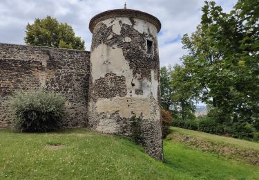
Passage au chateau St. Anne (néoforteresse) qui abrite une volerie de rapaces (printemps, été) et des jeux pour les enfants. Remarquer des orgues basaltiques au pied du chateau.
Testé par le groupe de marche de SELM
Positioning
Country:
France
Region :
Auvergne-Rhône-Alpes
Department/Province :
Loire
Municipality :
Marcilly-le-Châtel
Location:
Unknown
Start:(Dec)
Start:(UTM)
579848 ; 5061236 (31T) N.
Comments
Trails nearby

De la cave à la grotte aux fées


Walking
Medium
(2)
Trelins,
Auvergne-Rhône-Alpes,
Loire,
France

18.8 km | 27 km-effort
3h 31min
Yes
Ballade au volcan Montaubourg


Walking
Easy
Marcoux,
Auvergne-Rhône-Alpes,
Loire,
France

5 km | 7.3 km-effort
1h 46min
Yes
Randonnée entre Boen et Sail sous Couzan


Walking
Medium
Boën-sur-Lignon,
Auvergne-Rhône-Alpes,
Loire,
France

17.2 km | 24 km-effort
4h 0min
Yes
Randonnée autour de Montverdun


Walking
Easy
Montverdun,
Auvergne-Rhône-Alpes,
Loire,
France

15.7 km | 17.6 km-effort
2h 59min
Yes

Marcillyvers Goutteras


Walking
Easy
(2)
Marcilly-le-Châtel,
Auvergne-Rhône-Alpes,
Loire,
France

11.1 km | 15.7 km-effort
3h 25min
Yes

St Etienne le Molard Montverdun


Walking
Easy
(1)
Saint-Étienne-le-Molard,
Auvergne-Rhône-Alpes,
Loire,
France

11.6 km | 13.1 km-effort
2h 53min
No

Le couzan


On foot
Difficult
(1)
Sail-sous-Couzan,
Auvergne-Rhône-Alpes,
Loire,
France

12.8 km | 18.8 km-effort
Unknown
Yes
De Chozieux à Chorigneux


Walking
Medium
Boën-sur-Lignon,
Auvergne-Rhône-Alpes,
Loire,
France

15.9 km | 23 km-effort
2h 59min
Yes

Bois de la dame.


Walking
Medium
(1)
Marcoux,
Auvergne-Rhône-Alpes,
Loire,
France

8.5 km | 12.8 km-effort
2h 43min
Yes


 SityTrail


