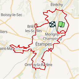
Trail Mountain bike Morigny-Champigny - 2014-09-06 morigny champigny 60km - Photo

2014-09-06 morigny champigny 60km

© OpenStreetMap contributors
Length
Length
56 km
Max alt
Max alt
154 m
Uphill gradient
Uphill gradient
997 m
Km-Effort
Km-Effort  
69 km
Min alt
Min alt
62 m
Downhill gradient
Downhill gradient
997 m
Boucle
Boucle
Yes
Creation date :
2018-09-15 15:06:33.407
Updated on :
2018-09-15 15:06:33.727

(0 Reviews)

Mountain bike
Mountain bike
6h26
Difficulty : Difficult

Scan this QR Code to open this trail in the SityTrail application

FREE GPS app for hiking

Logo SityTrail SityTrail

IGN / Geographical institutes

Download SityTrail from the App Store Download SityTrail from Google Play

Logo SityTrail SityTrail World

The world is yours!

Download SityTrail from the App Store Download SityTrail from Google Play Download SityTrail on Huawei AppGallery

About

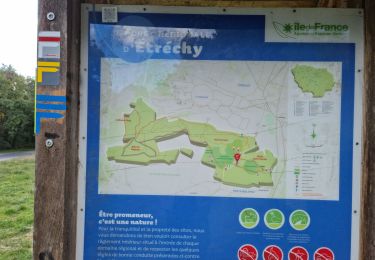
Trail Mountain bike of 56 km to be discovered at Ile-de-France, Essonne, Morigny-Champigny. This trail is proposed by Lucquiaud.

Description

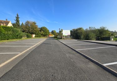
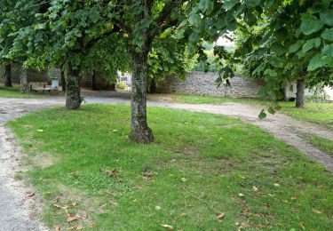
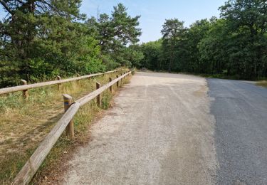
parcours intéressant, très varié, avec des sigles, des raidillons, du plat

Elevation profile

Positioning

Country:
France
Region :
Ile-de-France
Department/Province :
Essonne
Municipality :
Morigny-Champigny
Location:
Unknown
Start:(UTM)
440216 ; 5367021 (31U) N.

Trails nearby

Trail On foot Auvers-Saint-Georges - Au grès de la Juine - Photo
On foot
GUIDE+

On foot

Medium
Auvers-Saint-Georges, Ile-de-France, Essonne, France
22 km | 27 km-effort
6h 10min
No
Trail Walking Étréchy - Boucle de 2 jours au départ d'Etréchy via Etampes Chalo St Mars - Photo
Walking
philippebenne

Walking

Very difficult
(1)
Étréchy, Ile-de-France, Essonne, France
42 km | 51 km-effort
11h 28min
Yes
Trail Walking Brières-les-Scellés - Brières-les-Scellés - Photo
Walking
guydu41

Walking

Medium
Brières-les-Scellés, Ile-de-France, Essonne, France
7.8 km | 9.8 km-effort
2h 14min
Yes
Trail Walking Auvers-Saint-Georges - Auvers-Saint-Georges - Photo
Walking
guydu41

Walking

Medium
Auvers-Saint-Georges, Ile-de-France, Essonne, France
8.3 km | 10.3 km-effort
2h 20min
Yes
Trail Walking Étréchy - Forêt Régionale d'Etréchy - Photo
Walking
guydu41

Walking

Medium
Étréchy, Ile-de-France, Essonne, France
7.3 km | 8.8 km-effort
2h 0min
Yes
Trail On foot Étréchy - d'Etrechy à Saint Chéron - Photo
On foot
Annie Leduc

On foot

Medium
(1)
Étréchy, Ile-de-France, Essonne, France
19 km | 24 km-effort
5h 13min
No
Trail Walking Chauffour-lès-Étréchy - Chauffour-lès-Etréchy Coteau des Verts Galants - Photo
Walking
guydu41

Walking

Easy
Chauffour-lès-Étréchy, Ile-de-France, Essonne, France
4.4 km | 5.7 km-effort
1h 25min
Yes
Trail Walking Étréchy - Forêt Régionale d'Etrechy - Photo
Walking
guydu41

Walking

Medium
(1)
Étréchy, Ile-de-France, Essonne, France
7.3 km | 9.2 km-effort
2h 34min
Yes
Trail Walking Étampes - base de loisirs d'Etampes - Photo
Walking
c.chehere

Walking

Medium
Étampes, Ile-de-France, Essonne, France
14.6 km | 17.1 km-effort
4h 56min
Yes


Close
My subscriptions