


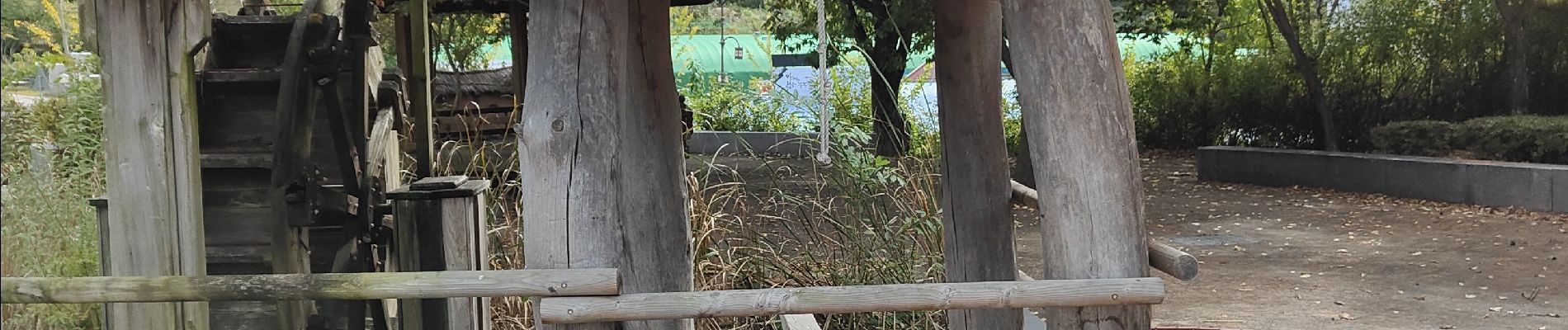
Village historique Andong Hahoe

dudu42
User GUIDE
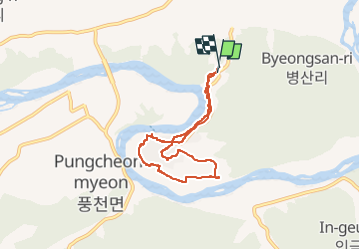

Length
7.7 km

Max alt
100 m

Uphill gradient
121 m
Km-Effort
9.3 km

Min alt
68 m

Downhill gradient
115 m
Boucle
Yes
Creation date :
2022-10-14 01:28:58.274
Updated on :
2022-10-14 03:39:27.699
1h49
Difficulty : Easy

FREE GPS app for hiking
 SityTrail
IGN / Geographical institutes
SityTrail World
The world is yours!
About
Trail Other activity of 7.7 km to be discovered at Gyeongsangbuk-do. This trail is proposed by dudu42.
Description
Joli village contourné par la rivière et parsemer de rizières
Photos


Positioning
Country:
Korea, Republic of
Region :
Gyeongsangbuk-do
Department/Province :
Unknown
Municipality :
Unknown
Location:
Unknown
Start:(Dec)
Start:(UTM)
457806 ; 4045047 (52S) N.
Comments
Trails nearby