Trail Walking Municipality of Kato Chorion - Thripti Afendis Kavouusi - Photo
© OpenStreetMap contributors
Length
Length
40 km
Max alt
Max alt
867 m
Uphill gradient
Uphill gradient
1080 m
Km-Effort
Km-Effort  
57 km
Min alt
Min alt
-2 m
Downhill gradient
Downhill gradient
1874 m
Boucle
Boucle
No
Creation date :
2022-10-13 10:20:32.472
Updated on :
2022-10-13 17:00:40.097

(0 Reviews)

Walking
Walking
3h57
Difficulty : Easy

Scan this QR Code to open this trail in the SityTrail application

FREE GPS app for hiking

Logo SityTrail SityTrail

IGN / Geographical institutes

Download SityTrail from the App Store Download SityTrail from Google Play

Logo SityTrail SityTrail World

The world is yours!

Download SityTrail from the App Store Download SityTrail from Google Play Download SityTrail on Huawei AppGallery

About

Trail Walking of 40 km to be discovered at Region of Crete, Lasithi Regional Unit, Municipality of Kato Chorion. This trail is proposed by reury1948.

Description

randonnée  3h   retour scooter

Elevation profile

Positioning

Country:
Greece
Region :
Region of Crete
Department/Province :
Lasithi Regional Unit
Municipality :
Municipality of Kato Chorion
Location:
Unknown
Start:(UTM)
396580 ; 3883709 (35S) N.

Trails nearby

Trail Walking Municipality of Pachia Ammos - Monastiraki  - Photo
Walking
cobut.jp@gmail.com

Walking

Very difficult
Municipality of Pachia Ammos, Region of Crete, Lasithi Regional Unit, Greece
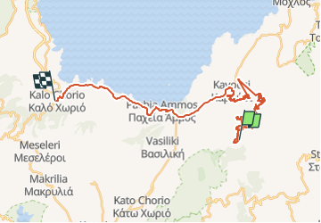
13.6 km | 24 km-effort
4h 14min
No
Trail Walking Municipality of Pachia Ammos - Cayon du Ha - Kavousi  - Photo
Walking
cobut.jp@gmail.com

Walking

Very difficult
Municipality of Pachia Ammos, Region of Crete, Lasithi Regional Unit, Greece
19.7 km | 43 km-effort
5h 26min
No
Trail Walking Unknown - Gorge :de Messonas Kavousi  - Photo
Walking
cobut.jp@gmail.com

Walking

Very difficult
Unknown, Region of Crete, Lasithi Regional Unit, Greece
22 km | 34 km-effort
5h 58min
No
Trail Walking  - Crête 2 eme jour névadas - Photo
Walking
CriCri

Walking

Very difficult
, Region of Crete, Lasithi Regional Unit, Greece
13.3 km | 23 km-effort
3h 37min
Yes
Trail Walking Municipality of Kato Chorion - Thripti Afentis 1476 m - Photo
Walking
Lauvalarnoult

Walking

Medium
Municipality of Kato Chorion, Region of Crete, Lasithi Regional Unit, Greece
10.4 km | 19 km-effort
3h 20min
Yes
Trail Walking Unknown - gorges de Mesonas chapelle st nikalas - Photo
Walking
Lauvalarnoult

Walking

Difficult
Unknown, Region of Crete, Lasithi Regional Unit, Greece
7.4 km | 14.7 km-effort
2h 49min
Yes
Trail Walking Municipality of Kato Chorion - Entrée supérieure du canyon de Ha - Photo
Walking
Lauvalarnoult

Walking

Very easy
Municipality of Kato Chorion, Region of Crete, Lasithi Regional Unit, Greece
1.3 km | 2 km-effort
24min
No


Close
My subscriptions