


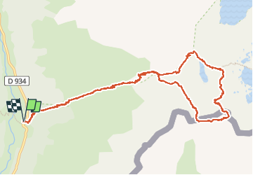


10.6 km | 19.3 km-effort


User


FREE GPS app for hiking
 SityTrail
IGN / Geographical institutes
SityTrail World
The world is yours!
Trail Walking of 14.1 km to be discovered at New Aquitaine, Pyrénées-Atlantiques, Laruns. This trail is proposed by Bearn64230.
Très belle randonnée mais exigeante. Par contre c’est magnifique !!


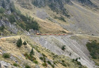
75 photos in total. Please click on a photo to see them all in the gallery.

Walking
Walking

Walking

On foot
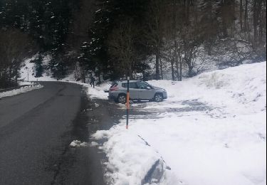
Snowshoes

Walking

Walking

Walking

Walking