![](/images/other/stat-length.png)
![Trail Walking Unknown - Seseok Shelter Jirisan - Photo](https://media.geolcdn.com/t/1900/400/ext.pjpeg?maxdim=2&url=https%3A%2F%2Fmedia.geolcdn.com%2Ff%2Fe61fce5f-0dd5-4699-933c-72ebca7db5f3.jpg)
Seseok Shelter Jirisan
dudu42
User
![Length](/images/other/stat-length.png)
Length
13.4 km
![Max alt](https://static1.geolcdn.com/siteimages/upload/files/1508320355ic_sort_altitude_max_24dp.png)
Max alt
1560 m
![Uphill gradient](https://static1.geolcdn.com/siteimages/upload/files/1508320355ic_sort_den_pos_24dp.png)
Uphill gradient
926 m
![Km-Effort](/images/other/stat-length.png)
Km-Effort
26 km
![Min alt](https://static1.geolcdn.com/siteimages/upload/files/1508320355ic_sort_altitude_min_24dp.png)
Min alt
622 m
![Downhill gradient](https://static1.geolcdn.com/siteimages/upload/files/1508320355ic_sort_den_neg_24dp.png)
Downhill gradient
929 m
![Boucle](https://static1.geolcdn.com/siteimages/upload/files/16400158638029165_repeat_loop_refresh_sync_direction_icon.png)
Boucle
Yes
Creation date :
2022-10-09 00:54:16.211
Updated on :
2022-10-09 07:14:23.913
![Walking](https://static1.geolcdn.com/sitytour/trail-icons/101.png)
5h09
Difficulty : Difficult
![Scan this QR Code to open this trail in the SityTrail application](https://capi.geolives.com/qq0zvz2zws4bq2lad0pu/sitytour/trails/3417548/qr.png?size=200)
FREE GPS app for hiking
About
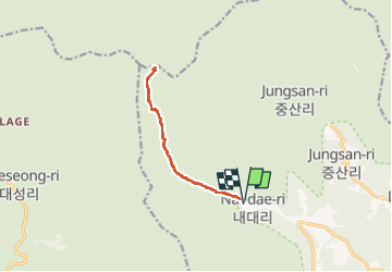
Trail Walking of 13.4 km to be discovered at Gyeongsangnam-do, Sancheong-gun. This trail is proposed by dudu42.
Description
Belle randonnée en sous bois. Chemin et marches en pierre. A l arrivée ,le refuge permet de cuisiner si vous amener votre rechaud et cela dans des boxes vitrées.
Positioning
Country:
Korea, Republic of
Region :
Gyeongsangnam-do
Department/Province :
Sancheong-gun
Municipality :
Unknown
Location:
Unknown
Start:(Dec)
Start:(UTM)
383768 ; 3905225 (52S) N.
Comments
Trails nearby
![Trail Walking - Boucle du Peak Cheonwangbong - Photo](https://media.geolcdn.com/t/375/260/ext.jpg?maxdim=2&url=https%3A%2F%2Fmedia.geolcdn.com%2Ff%2Ff27ecb3e-e6c8-4213-b1f9-a672b7dbb0bc.jpg)
![Walking Walking](https://static1.geolcdn.com/sitytour/trail-icons/101.png)
Boucle du Peak Cheonwangbong
Walking
Very difficult
,
Gyeongsangnam-do,
Sancheong-gun,
Korea, Republic of
![](/images/other/stat-length.png)
13.2 km | 31 km-effort
6h 1min
![](https://static1.geolcdn.com/siteimages/upload/files/16400158638029165_repeat_loop_refresh_sync_direction_icon.png)
Yes