![](/images/other/stat-length.png)
![Trail Walking La Ville-aux-Dames - Île de la Métairie à La Ville-aux-Dames - Photo](https://media.geolcdn.com/t/1900/400/86976435-9972-4a82-aa4d-1b9beb39a4d5.jpg&format=pjpeg&maxdim=2)
Île de la Métairie à La Ville-aux-Dames
guydu41
User
![Length](/images/other/stat-length.png)
Length
6 km
![Max alt](https://static1.geolcdn.com/siteimages/upload/files/1508320355ic_sort_altitude_max_24dp.png)
Max alt
60 m
![Uphill gradient](https://static1.geolcdn.com/siteimages/upload/files/1508320355ic_sort_den_pos_24dp.png)
Uphill gradient
45 m
![Km-Effort](/images/other/stat-length.png)
Km-Effort
6.6 km
![Min alt](https://static1.geolcdn.com/siteimages/upload/files/1508320355ic_sort_altitude_min_24dp.png)
Min alt
44 m
![Downhill gradient](https://static1.geolcdn.com/siteimages/upload/files/1508320355ic_sort_den_neg_24dp.png)
Downhill gradient
45 m
![Boucle](https://static1.geolcdn.com/siteimages/upload/files/16400158638029165_repeat_loop_refresh_sync_direction_icon.png)
Boucle
Yes
Creation date :
2022-10-06 12:03:28.624
Updated on :
2022-10-11 05:23:00.933
![Walking](https://static1.geolcdn.com/sitytour/trail-icons/101.png)
2h01
Difficulty : Easy
![Scan this QR Code to open this trail in the SityTrail application](https://capi.geolives.com/qq0zvz2zws4bq2lad0pu/sitytour/trails/3414884/qr.png?size=200)
FREE GPS app for hiking
About
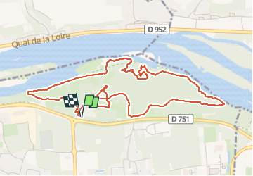
Trail Walking of 6 km to be discovered at Centre-Loire Valley, Indre-et-Loire, La Ville-aux-Dames. This trail is proposed by guydu41.
Description
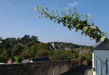
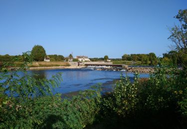
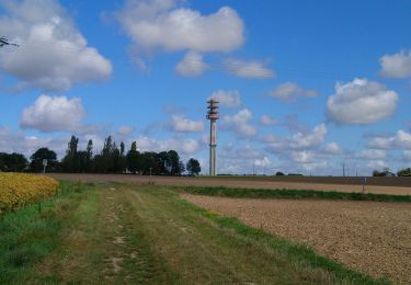
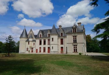
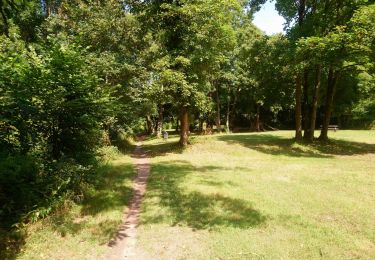
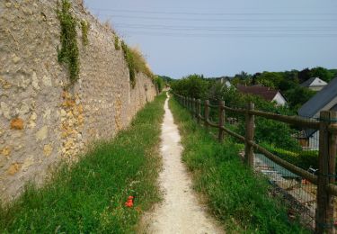
Ce petit circuit de 6 km sur l'Île de la Métairie permet de découvrir de nombreux parcs aménagés, des passerelles, des chemins en bord de Loire, d'admirer les coteaux avec ses grandes demeures de l'autre côté du fleuve, des sentiers tortueux à travers bois, etc.
Positioning
Country:
France
Region :
Centre-Loire Valley
Department/Province :
Indre-et-Loire
Municipality :
La Ville-aux-Dames
Location:
Unknown
Start:(Dec)
Start:(UTM)
331805 ; 5252376 (31T) N.
Comments
Trails nearby
![Trail Walking Tours - Tours - Marmoutier GR3 GR655 Rochecorbon - 8.2km 105m 1h50 - 2021 10 09 - Photo](https://media.geolcdn.com/t/375/260/8eec29df-bf69-4696-8607-c35bff826c99.jpg&format=jpg&maxdim=2)
![Walking Walking](https://static1.geolcdn.com/sitytour/trail-icons/101.png)
Tours - Marmoutier GR3 GR655 Rochecorbon - 8.2km 105m 1h50 - 2021 10 09
Walking
Very easy
(1)
Tours,
Centre-Loire Valley,
Indre-et-Loire,
France
![](/images/other/stat-length.png)
8.2 km | 9.6 km-effort
1h 50min
![](https://static1.geolcdn.com/siteimages/upload/files/16400158638029165_repeat_loop_refresh_sync_direction_icon.png)
Yes
![Trail Walking Rochecorbon - Rochecorbon - Zig zag autour de Rochecorbon - 17km 295m 3h50 - 2024 03 13 - Photo](https://media.geolcdn.com/t/375/260/c0145acf-b15a-4f41-833a-811e7495297d.jpg&format=jpg&maxdim=2)
![Walking Walking](https://static1.geolcdn.com/sitytour/trail-icons/101.png)
Rochecorbon - Zig zag autour de Rochecorbon - 17km 295m 3h50 - 2024 03 13
Walking
Medium
Rochecorbon,
Centre-Loire Valley,
Indre-et-Loire,
France
![](/images/other/stat-length.png)
17.1 km | 21 km-effort
3h 50min
![](https://static1.geolcdn.com/siteimages/upload/files/16400158638029165_repeat_loop_refresh_sync_direction_icon.png)
Yes
![Trail Walking Véretz - Véretz - PR Sentier de Bacchus - 14.9km 90m 3h00 - 2023 11 25 - Photo](https://media.geolcdn.com/t/375/260/ba6757e2-3664-4b27-83f8-18e13d10493f.jpg&format=jpg&maxdim=2)
![Walking Walking](https://static1.geolcdn.com/sitytour/trail-icons/101.png)
Véretz - PR Sentier de Bacchus - 14.9km 90m 3h00 - 2023 11 25
Walking
Easy
Véretz,
Centre-Loire Valley,
Indre-et-Loire,
France
![](/images/other/stat-length.png)
14.9 km | 16.1 km-effort
3h 0min
![](https://static1.geolcdn.com/siteimages/upload/files/16400158638029165_repeat_loop_refresh_sync_direction_icon.png)
Yes
![Trail Walking Saint-Pierre-des-Corps - Saint-Pierre-des-Corps - PR Sentier du bord de Loire avec variantes - 13.6km 75m 2h55 (30mn) - 2023 10 22 - Photo](https://media.geolcdn.com/t/375/260/6a165834-3cba-4860-930a-9c6f29b052c7.jpg&format=jpg&maxdim=2)
![Walking Walking](https://static1.geolcdn.com/sitytour/trail-icons/101.png)
Saint-Pierre-des-Corps - PR Sentier du bord de Loire avec variantes - 13.6km ...
Walking
Easy
Saint-Pierre-des-Corps,
Centre-Loire Valley,
Indre-et-Loire,
France
![](/images/other/stat-length.png)
13.6 km | 14.7 km-effort
2h 55min
![](https://static1.geolcdn.com/siteimages/upload/files/16400158638029165_repeat_loop_refresh_sync_direction_icon.png)
Yes
![Trail Walking Montlouis-sur-Loire - Montlouis-sur-Loire - gare GR41 Veretz Azay-sur-Cher - 13km 85m 2h45 - 2023 10 07 - Photo](https://media.geolcdn.com/t/375/260/0a795f12-7cb8-451f-a494-3acd28ec6c5f.jpg&format=jpg&maxdim=2)
![Walking Walking](https://static1.geolcdn.com/sitytour/trail-icons/101.png)
Montlouis-sur-Loire - gare GR41 Veretz Azay-sur-Cher - 13km 85m 2h45 - 2023 1...
Walking
Easy
Montlouis-sur-Loire,
Centre-Loire Valley,
Indre-et-Loire,
France
![](/images/other/stat-length.png)
13 km | 14.2 km-effort
2h 45min
![](https://static1.geolcdn.com/siteimages/upload/files/16400158638029165_repeat_loop_refresh_sync_direction_icon.png)
Yes
![Trail Walking Parçay-Meslay - Parcay-Meslay - lieu-dit le Houdeau de Monnaie - 21.3km 190m 4h50 (50mn) - 2023 08 27 - Photo](https://media.geolcdn.com/t/375/260/12319d71-2676-4fa6-b6d8-bd3dc55c96dc.jpg&format=jpg&maxdim=2)
![Walking Walking](https://static1.geolcdn.com/sitytour/trail-icons/101.png)
Parcay-Meslay - lieu-dit le Houdeau de Monnaie - 21.3km 190m 4h50 (50mn) - 20...
Walking
Easy
Parçay-Meslay,
Centre-Loire Valley,
Indre-et-Loire,
France
![](/images/other/stat-length.png)
21 km | 24 km-effort
4h 50min
![](https://static1.geolcdn.com/siteimages/upload/files/16400158638029165_repeat_loop_refresh_sync_direction_icon.png)
Yes
![Trail Walking Saint-Avertin - Saint-Avertin - PR Sentier du vieux Cher, Cangé - 9.3km 95m 2h05 (20mn) - 2023 07 12 - Photo](https://media.geolcdn.com/t/375/260/1c5742ed-1795-4a54-ac46-a850f2d399d9.jpg&format=jpg&maxdim=2)
![Walking Walking](https://static1.geolcdn.com/sitytour/trail-icons/101.png)
Saint-Avertin - PR Sentier du vieux Cher, Cangé - 9.3km 95m 2h05 (20mn) - 202...
Walking
Easy
Saint-Avertin,
Centre-Loire Valley,
Indre-et-Loire,
France
![](/images/other/stat-length.png)
9.3 km | 10.5 km-effort
2h 5min
![](https://static1.geolcdn.com/siteimages/upload/files/16400158638029165_repeat_loop_refresh_sync_direction_icon.png)
Yes
![Trail Walking Montlouis-sur-Loire - Montlouis-sur-Loire - PR Sur les pas de Gabrielle d'Estrées - 9.5km 100m 2h20 - 2023 07 08 - Photo](https://media.geolcdn.com/t/375/260/b211a3c9-f8d2-42f6-bf4b-d2bf5553a450.jpg&format=jpg&maxdim=2)
![Walking Walking](https://static1.geolcdn.com/sitytour/trail-icons/101.png)
Montlouis-sur-Loire - PR Sur les pas de Gabrielle d'Estrées - 9.5km 100m 2h20...
Walking
Easy
Montlouis-sur-Loire,
Centre-Loire Valley,
Indre-et-Loire,
France
![](/images/other/stat-length.png)
9.5 km | 10.9 km-effort
2h 20min
![](https://static1.geolcdn.com/siteimages/upload/files/16400158638029165_repeat_loop_refresh_sync_direction_icon.png)
Yes
![Trail Walking Vouvray - Vouvray - PR balisé en bleu - 15.1km 125m 3h30 - 2023 06 28 - Photo](https://media.geolcdn.com/t/375/260/60d19163-b23a-4217-bba8-93e697ea97cd.jpg&format=jpg&maxdim=2)
![Walking Walking](https://static1.geolcdn.com/sitytour/trail-icons/101.png)
Vouvray - PR balisé en bleu - 15.1km 125m 3h30 - 2023 06 28
Walking
Easy
Vouvray,
Centre-Loire Valley,
Indre-et-Loire,
France
![](/images/other/stat-length.png)
15.1 km | 16.8 km-effort
3h 30min
![](https://static1.geolcdn.com/siteimages/upload/files/16400158638029165_repeat_loop_refresh_sync_direction_icon.png)
Yes