


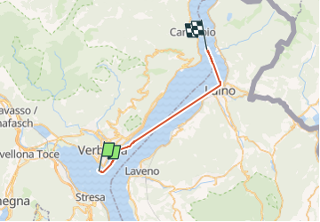

10.9 km | 14 km-effort


User


FREE GPS app for hiking
 SityTrail
IGN / Geographical institutes
SityTrail World
The world is yours!
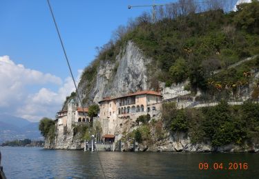
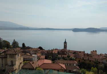
Trail Motorboat of 24 km to be discovered at Piemont, Verbano-Cusio-Ossola, Verbania. This trail is proposed by remirando.
On foot

On foot

On foot

On foot

On foot

On foot

On foot

Mountain bike
Walking