


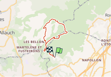


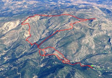
14.2 km | 24 km-effort


User


FREE GPS app for hiking
 SityTrail
IGN / Geographical institutes
SityTrail World
The world is yours!
Trail Walking of 14.2 km to be discovered at Provence-Alpes-Côte d'Azur, Bouches-du-Rhône, Aubagne. This trail is proposed by cousam.
Puits de Raimu
Maison d'Angèle et de Panturle
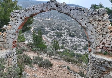
Arche du Village d'Aubignagne
grotte de Manon
Grotte du cerf (empruntes des mains de Marcel Pagnol 1934)
gravures de Louis Drouard
la Baume Saourne
la grotte grosibou


37 photos in total. Please click on a photo to see them all in the gallery.
Walking
Walking

On foot

Walking
Walking
Other activity
Walking

Walking
Walking