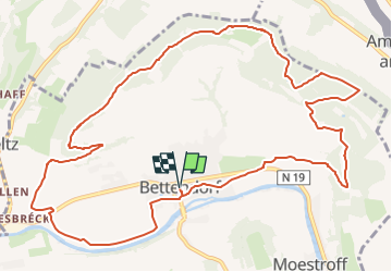
![](/images/other/stat-length.png)
![Trail Walking Bettendorf - 2022-09-22_13h06m23_t62862476_eislek pad bettendorf - Photo](https://media.geolcdn.com/t/1900/400/ba8011a2-7a43-4fed-95b2-07279fc87c67.jpg&format=pjpeg&maxdim=2)
2022-09-22_13h06m23_t62862476_eislek pad bettendorf
mumu.larandonneuse
User GUIDE
![Length](/images/other/stat-length.png)
![Max alt](https://static1.geolcdn.com/siteimages/upload/files/1508320355ic_sort_altitude_max_24dp.png)
![Uphill gradient](https://static1.geolcdn.com/siteimages/upload/files/1508320355ic_sort_den_pos_24dp.png)
![Km-Effort](/images/other/stat-length.png)
![Min alt](https://static1.geolcdn.com/siteimages/upload/files/1508320355ic_sort_altitude_min_24dp.png)
![Downhill gradient](https://static1.geolcdn.com/siteimages/upload/files/1508320355ic_sort_den_neg_24dp.png)
![Boucle](https://static1.geolcdn.com/siteimages/upload/files/16400158638029165_repeat_loop_refresh_sync_direction_icon.png)
![Walking](https://static1.geolcdn.com/sitytour/trail-icons/101.png)
3h52
Difficulty : Medium
![Scan this QR Code to open this trail in the SityTrail application](https://capi.geolives.com/qq0zvz2zws4bq2lad0pu/sitytour/trails/3399956/qr.png?size=200)
FREE GPS app for hiking
About
Trail Walking of 12.9 km to be discovered at Unknown, Canton Diekirch, Bettendorf. This trail is proposed by mumu.larandonneuse.
Description
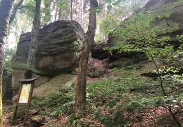
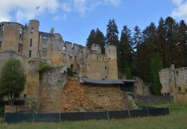
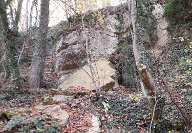
Ce sentier allie histoire et nature. D'abord, vous marchez sur la digue, le long de la Sûre. Après une ascension, vous suivez une ancienne ligne de bataille de la Seconde Guerre mondiale, bordée de tranchées. Les ruines de Niederberghaff, devant lesquelles vous passez, vous rappellent également des temps passés. C'est une bonne occasion de découvrir l'histoire de l'Éislek de façon exploratoire.
ℹ️ www.visit-eislek.lu
Positioning
Comments
Trails nearby
![Trail Walking Beaufort - 2021-07-05_20h10m00_gpx-file (1) - Photo](https://media.geolcdn.com/t/375/260/9b40ebf8-55f0-408d-8504-76ef1490c879.jpg&format=jpg&maxdim=2)
![Walking Walking](https://static1.geolcdn.com/sitytour/trail-icons/101.png)
Walking
![](/images/other/stat-length.png)
![](https://static1.geolcdn.com/siteimages/upload/files/16400158638029165_repeat_loop_refresh_sync_direction_icon.png)
![Trail Walking Reisdorf - R2 - Photo](https://media.geolcdn.com/t/375/260/7552b052-379e-4866-b586-5f7ed6a8b465.jpeg&format=jpg&maxdim=2)
![Walking Walking](https://static1.geolcdn.com/sitytour/trail-icons/101.png)
Walking
![](/images/other/stat-length.png)
![](https://static1.geolcdn.com/siteimages/upload/files/16400158638029165_repeat_loop_refresh_sync_direction_icon.png)
![Walking Walking](https://static1.geolcdn.com/sitytour/trail-icons/101.png)
Walking
![](/images/other/stat-length.png)
![](https://static1.geolcdn.com/siteimages/upload/files/16400158638029165_repeat_loop_refresh_sync_direction_icon.png)
![Trail On foot Beaufort - B7 Hiking Tour - Photo](https://media.geolcdn.com/t/375/260/17843581-3f4a-4a77-a650-570e06f75c4d.jpeg&format=jpg&maxdim=2)
![On foot On foot](https://static1.geolcdn.com/sitytour/trail-icons/100.png)
On foot
![](/images/other/stat-length.png)
![](https://static1.geolcdn.com/siteimages/upload/files/16400158638029165_repeat_loop_refresh_sync_direction_icon.png)
![Trail Walking Beaufort - Müllerthal Extra Trail B - Photo](https://media.geolcdn.com/t/375/260/ext.jpg?maxdim=2&url=https%3A%2F%2Fstatic1.geolcdn.com%2Fsiteimages%2Fupload%2Ffiles%2F1553511878bg_sport_marche.png)
![Walking Walking](https://static1.geolcdn.com/sitytour/trail-icons/101.png)
Walking
![](/images/other/stat-length.png)
![](https://static1.geolcdn.com/siteimages/upload/files/16400158638029165_repeat_loop_refresh_sync_direction_icon.png)
![Trail Walking Tandel - 2024-07-11_16h37m44_local-hiking-trail-ta-2 - Photo](https://media.geolcdn.com/t/375/260/8c005037-a9f4-4acb-88bc-4e713f695a2c.jpg&format=jpg&maxdim=2)
![Walking Walking](https://static1.geolcdn.com/sitytour/trail-icons/101.png)
Walking
![](/images/other/stat-length.png)
![](https://static1.geolcdn.com/siteimages/upload/files/16400158638029165_repeat_loop_refresh_sync_direction_icon.png)
![Trail On foot Vallée de l'Ernz - E8 - Ermsdorf - Photo](https://media.geolcdn.com/t/375/260/9336dd99-d4f0-4297-b7d8-0ea88499f8cf.jpeg&format=jpg&maxdim=2)
![On foot On foot](https://static1.geolcdn.com/sitytour/trail-icons/100.png)
On foot
![](/images/other/stat-length.png)
![](https://static1.geolcdn.com/siteimages/upload/files/16400158638029165_repeat_loop_refresh_sync_direction_icon.png)
![Trail On foot Bettendorf - Autopedestre Bettendorf 1 - Photo](https://media.geolcdn.com/t/375/260/5bdef823-bcca-4fa6-9dc3-423e56c1d982.jpeg&format=jpg&maxdim=2)
![On foot On foot](https://static1.geolcdn.com/sitytour/trail-icons/100.png)
On foot
![](/images/other/stat-length.png)
![](https://static1.geolcdn.com/siteimages/upload/files/16400158638029165_repeat_loop_refresh_sync_direction_icon.png)
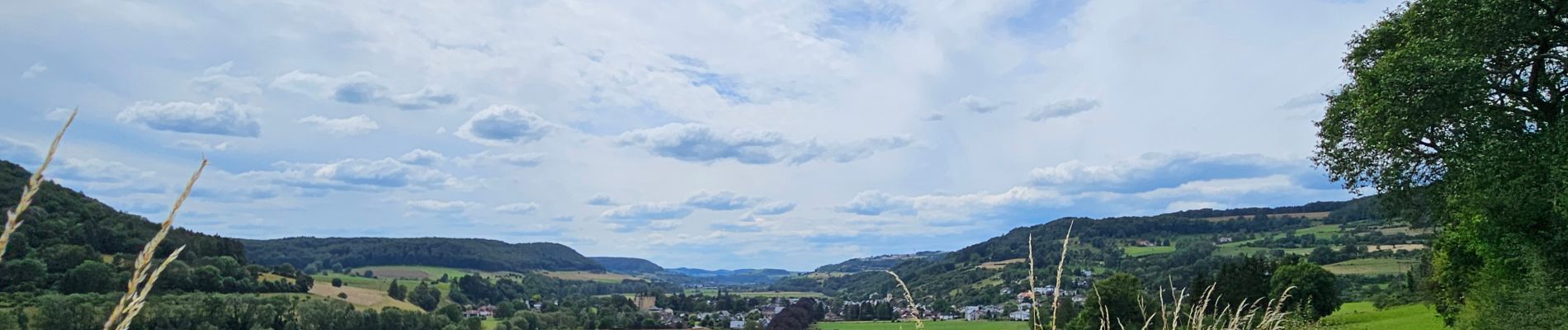
Belle randonnée variée, sur les crêtes entre la vallée de la Sûre et celle de l'Our.