


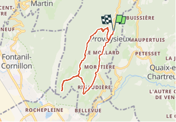

10.9 km | 26 km-effort

User


FREE GPS app for hiking
 SityTrail
IGN / Geographical institutes
SityTrail World
The world is yours!
Trail Walking of 7.2 km to be discovered at Auvergne-Rhône-Alpes, Isère, Proveysieux. This trail is proposed by Mich&Agnès.
comme souvent en Chartreuse, une montée ardue. Promenade à couvert la plupart du temps. quelques beaux points de vue sur les sommets d'en face.
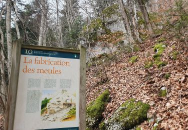
"Les Essarts sont des espaces nouvellement défrichés, ici dans le but de rééquilibrer les espaces et la diversité"


Walking

Walking

Walking

Walking

Walking

Walking

Mountain bike
Walking
Touring skiing