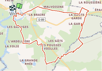
![](/images/other/stat-length.png)
![Trail Walking Vouvant - Vouvant - Photo](https://media.geolcdn.com/t/1900/400/1771e93e-e2ff-41f2-baad-f036a556c899.jpg&format=pjpeg&maxdim=2)
Vouvant
helmut68
User
![Length](/images/other/stat-length.png)
![Max alt](https://static1.geolcdn.com/siteimages/upload/files/1508320355ic_sort_altitude_max_24dp.png)
![Uphill gradient](https://static1.geolcdn.com/siteimages/upload/files/1508320355ic_sort_den_pos_24dp.png)
![Km-Effort](/images/other/stat-length.png)
![Min alt](https://static1.geolcdn.com/siteimages/upload/files/1508320355ic_sort_altitude_min_24dp.png)
![Downhill gradient](https://static1.geolcdn.com/siteimages/upload/files/1508320355ic_sort_den_neg_24dp.png)
![Boucle](https://static1.geolcdn.com/siteimages/upload/files/16400158638029165_repeat_loop_refresh_sync_direction_icon.png)
![Walking](https://static1.geolcdn.com/sitytour/trail-icons/101.png)
2h58
Difficulty : Medium
![Scan this QR Code to open this trail in the SityTrail application](https://capi.geolives.com/qq0zvz2zws4bq2lad0pu/sitytour/trails/3391014/qr.png?size=200)
FREE GPS app for hiking
About
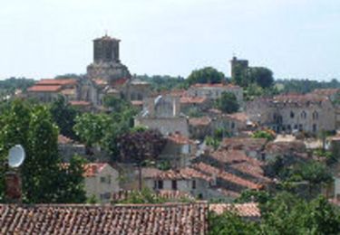
Trail Walking of 13 km to be discovered at Pays de la Loire, Vendée, Vouvant. This trail is proposed by helmut68.
Description
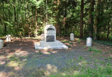
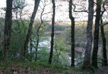
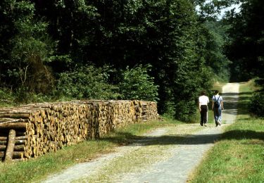
A l'orée de la forêt de Mervent -Vouvant.
Depuis la place du Bail prendre la rue du Duc d'Aquitaine, passer devant l'église et rejoindre par la droite le pont médiéval en empruntant la rue de la Porte aux Moines. Remonter par la D30 jusqu'au Rorteau . Tourner à droite, laisser Malvoisie à gauche et continuer par le chemin tout droit. 500 m après La Rochette virer à gauche. Dans le village de Benancisiére, prendre à droite et encore à droite jusqu'a la D89 . Continuer en face , suivre le GR364 et le GRP de Mélusine jusqu'à la stèle des Martyrs. S'engager en face dans le sentier qui descend vers le ruisseau des Verreries. Traverser le ruisseau et remonter le petit sentier sur votre gauche . Longer la D31 à droite sur 100m et virer à gauche . Au lieu dit les Blavettes , laisser le GR 364 en tournant à droite. Quitter la forêt par le chemin empierré en face . Prendre à gauche,puis longer le sentier herbeux en arrivant au hameau de la Petite Rhée . Au stop , à gauche , 700m plus loin, s'engager sur le chemin à droite. Emprunter la route à gauche et aussitôt le sentier à droite.
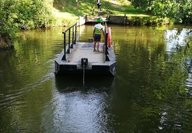
Pour finir longer la Mère par la gauche , traverser le pont pour rejoindre le point de départ.
Balisage : Rectangle jaune / point jaune.
Alors à vos chaussures !
Positioning
Comments
Trails nearby
![Trail Walking Vouvant - rando du 02/082024 - Photo](https://media.geolcdn.com/t/375/260/ext.jpg?maxdim=2&url=https%3A%2F%2Fstatic1.geolcdn.com%2Fsiteimages%2Fupload%2Ffiles%2F1553511878bg_sport_marche.png)
![Walking Walking](https://static1.geolcdn.com/sitytour/trail-icons/101.png)
Walking
![](/images/other/stat-length.png)
![](https://static1.geolcdn.com/siteimages/upload/files/16400158638029165_repeat_loop_refresh_sync_direction_icon.png)
![Trail Walking Vouvant - pr vendee - Photo](https://media.geolcdn.com/t/375/260/ext.jpg?maxdim=2&url=https%3A%2F%2Fstatic1.geolcdn.com%2Fsiteimages%2Fupload%2Ffiles%2F1553511878bg_sport_marche.png)
![Walking Walking](https://static1.geolcdn.com/sitytour/trail-icons/101.png)
Walking
![](/images/other/stat-length.png)
![](https://static1.geolcdn.com/siteimages/upload/files/16400158638029165_repeat_loop_refresh_sync_direction_icon.png)
![Trail Walking Vouvant - Vouvant_Cite_Medievale - Photo](https://media.geolcdn.com/t/375/260/3f2d808a-0d8b-41f6-bfd0-2bd32992224f.jpg&format=jpg&maxdim=2)
![Walking Walking](https://static1.geolcdn.com/sitytour/trail-icons/101.png)
Walking
![](/images/other/stat-length.png)
![](https://static1.geolcdn.com/siteimages/upload/files/16400158638029165_repeat_loop_refresh_sync_direction_icon.png)
![Trail Walking Cezais - collines de cezais - Photo](https://media.geolcdn.com/t/375/260/cade275a-6153-4f19-8826-d0c426d046d7.jpg&format=jpg&maxdim=2)
![Walking Walking](https://static1.geolcdn.com/sitytour/trail-icons/101.png)
Walking
![](/images/other/stat-length.png)
![](https://static1.geolcdn.com/siteimages/upload/files/16400158638029165_repeat_loop_refresh_sync_direction_icon.png)
![Trail Walking Saint-Maurice-des-Noues - rando du 29-05-2021. famille viault-durand - Photo](https://media.geolcdn.com/t/375/260/7ff857b0-2830-4d17-b3a4-b707fa148f09.jpg&format=jpg&maxdim=2)
![Walking Walking](https://static1.geolcdn.com/sitytour/trail-icons/101.png)
Walking
![](/images/other/stat-length.png)
![](https://static1.geolcdn.com/siteimages/upload/files/16400158638029165_repeat_loop_refresh_sync_direction_icon.png)
![Trail Mountain bike Cezais - boucle cezais vouvant - Photo](https://media.geolcdn.com/t/375/260/d193d496-d1fb-413f-a108-45aad5a24721.jpg&format=jpg&maxdim=2)
![Mountain bike Mountain bike](https://static1.geolcdn.com/sitytour/trail-icons/202.png)
Mountain bike
![](/images/other/stat-length.png)
![](https://static1.geolcdn.com/siteimages/upload/files/16400158638029165_repeat_loop_refresh_sync_direction_icon.png)
![Trail Mountain bike Vouvant - Forêt de Mervent - Photo](https://media.geolcdn.com/t/375/260/ext.jpg?maxdim=2&url=https%3A%2F%2Fservices.sitytrail.com%2FGeolivesWS%2FDownloadMedia.ashx%3FTrailID%3D100756%26Media%3D268_2.jpg)
![Mountain bike Mountain bike](https://static1.geolcdn.com/sitytour/trail-icons/202.png)
Mountain bike
![](/images/other/stat-length.png)
![](https://static1.geolcdn.com/siteimages/upload/files/16400158638029165_repeat_loop_refresh_sync_direction_icon.png)
![Trail Mountain bike Mervent - Boucle des Minières - Photo](https://media.geolcdn.com/t/375/260/ext.jpg?maxdim=2&url=https%3A%2F%2Fservices.sitytrail.com%2FGeolivesWS%2FDownloadMedia.ashx%3FTrailID%3D100755%26Media%3D267_2.jpg)
![Mountain bike Mountain bike](https://static1.geolcdn.com/sitytour/trail-icons/202.png)
Mountain bike
![](/images/other/stat-length.png)
![](https://static1.geolcdn.com/siteimages/upload/files/16400158638029165_repeat_loop_refresh_sync_direction_icon.png)
![Trail Mountain bike Mervent - Boucle de Pierre Brune - Photo](https://media.geolcdn.com/t/375/260/ext.jpg?maxdim=2&url=https%3A%2F%2Fservices.sitytrail.com%2FGeolivesWS%2FDownloadMedia.ashx%3FTrailID%3D100753%26Media%3D265_2.jpg)
![Mountain bike Mountain bike](https://static1.geolcdn.com/sitytour/trail-icons/202.png)
Mountain bike
![](/images/other/stat-length.png)
![](https://static1.geolcdn.com/siteimages/upload/files/16400158638029165_repeat_loop_refresh_sync_direction_icon.png)