Trail Walking Aouste-sur-Sye - Grane jour 2 - Photo
© OpenStreetMap contributors
Length
Length
10.6 km
Max alt
Max alt
461 m
Uphill gradient
Uphill gradient
299 m
Km-Effort
Km-Effort  
14.6 km
Min alt
Min alt
202 m
Downhill gradient
Downhill gradient
299 m
Boucle
Boucle
Yes
Creation date :
2022-09-12 06:45:47.127
Updated on :
2022-09-12 09:36:00.509

(1 Reviews)

Walking
Walking
2h49
Difficulty : Easy

Scan this QR Code to open this trail in the SityTrail application

FREE GPS app for hiking

Logo SityTrail SityTrail

IGN / Geographical institutes

Download SityTrail from the App Store Download SityTrail from Google Play

Logo SityTrail SityTrail World

The world is yours!

Download SityTrail from the App Store Download SityTrail from Google Play Download SityTrail on Huawei AppGallery

About

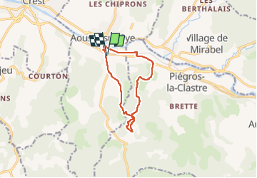
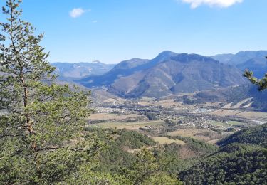
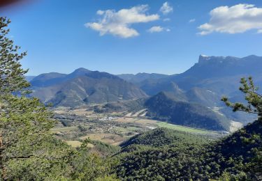
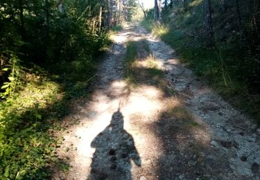
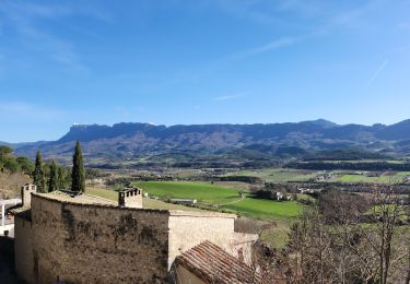
Trail Walking of 10.6 km to be discovered at Auvergne-Rhône-Alpes, Drôme, Aouste-sur-Sye. This trail is proposed by Jackoyo .

Elevation profile

Photos

Positioning

Country:
France
Region :
Auvergne-Rhône-Alpes
Department/Province :
Drôme
Municipality :
Aouste-sur-Sye
Location:
Unknown
Start:(UTM)
663116 ; 4952698 (31T) N.

Comments

Please log in to post a review or rate the element


bien


Trails nearby

Trail Walking Crest - Crest / Col de Bessot  - Photo
Walking
patchil

Walking

Medium
(2)
Crest, Auvergne-Rhône-Alpes, Drôme, France
19.5 km | 28 km-effort
5h 52min
Yes
Trail Walking Piégros-la-Clastre - La Chapelle Saint-Médard - Description et vidéo - Photo
Walking
bob2023

Walking

Medium
(1)
Piégros-la-Clastre, Auvergne-Rhône-Alpes, Drôme, France
14.9 km | 25 km-effort
5h 16min
Yes
Trail Walking Piégros-la-Clastre - Pas de Lauzen Col de la Chaudière - Photo
Walking
denis.benoit

Walking

Very difficult
(1)
Piégros-la-Clastre, Auvergne-Rhône-Alpes, Drôme, France
19.6 km | 42 km-effort
7h 36min
No
Trail Walking Piégros-la-Clastre - cht de Piegros, chap de Médard - Photo
Walking
GUIDE
nadd73

Walking

Medium
Piégros-la-Clastre, Auvergne-Rhône-Alpes, Drôme, France
16.3 km | 27 km-effort
4h 35min
Yes
Trail Walking Mirabel-et-Blacons - Mirabel et Balcons de La Drôme 16km - Photo
Walking
GUIDE
thonyc

Walking

Medium
Mirabel-et-Blacons, Auvergne-Rhône-Alpes, Drôme, France
16.1 km | 24 km-effort
3h 30min
Yes
Trail Mountain bike Aouste-sur-Sye - vtt vcs 120922 - Photo
Mountain bike
denis.benoit

Mountain bike

Medium
(1)
Aouste-sur-Sye, Auvergne-Rhône-Alpes, Drôme, France
37 km | 49 km-effort
3h 29min
No
Trail Walking Mirabel-et-Blacons - Col de Pourcheton - Photo
Walking
AIGUIER

Walking

Medium
Mirabel-et-Blacons, Auvergne-Rhône-Alpes, Drôme, France
11.7 km | 18.3 km-effort
4h 24min
Yes
Trail Walking Mirabel-et-Blacons - Le vieux Mirabel - Photo
Walking
Fanchon_24

Walking

Easy
Mirabel-et-Blacons, Auvergne-Rhône-Alpes, Drôme, France
17.2 km | 22 km-effort
3h 20min
No
Trail Walking Aouste-sur-Sye - crête de Saint Alban. Aoust - Photo
Walking
Fanchon_24

Walking

Difficult
Aouste-sur-Sye, Auvergne-Rhône-Alpes, Drôme, France
9.7 km | 12.1 km-effort
2h 42min
No


Close
My subscriptions