![](/images/other/stat-length.png)
![Trail Walking Eysines - GR Bordeaux Métropole. EYSINES MAGUDAS. - Photo](https://media.geolcdn.com/t/1900/400/91b4e53c-8028-4e29-8bf2-0ff221a4fcc2.jpeg&format=pjpeg&maxdim=2)
GR Bordeaux Métropole. EYSINES MAGUDAS.
piba2
User
![Length](/images/other/stat-length.png)
Length
16.1 km
![Max alt](https://static1.geolcdn.com/siteimages/upload/files/1508320355ic_sort_altitude_max_24dp.png)
Max alt
42 m
![Uphill gradient](https://static1.geolcdn.com/siteimages/upload/files/1508320355ic_sort_den_pos_24dp.png)
Uphill gradient
128 m
![Km-Effort](/images/other/stat-length.png)
Km-Effort
17.7 km
![Min alt](https://static1.geolcdn.com/siteimages/upload/files/1508320355ic_sort_altitude_min_24dp.png)
Min alt
10 m
![Downhill gradient](https://static1.geolcdn.com/siteimages/upload/files/1508320355ic_sort_den_neg_24dp.png)
Downhill gradient
111 m
![Boucle](https://static1.geolcdn.com/siteimages/upload/files/16400158638029165_repeat_loop_refresh_sync_direction_icon.png)
Boucle
No
Creation date :
2022-09-11 09:29:25.0
Updated on :
2022-09-12 11:14:02.329
![Walking](https://static1.geolcdn.com/sitytour/trail-icons/101.png)
3h37
Difficulty : Very easy
![Scan this QR Code to open this trail in the SityTrail application](https://capi.geolives.com/qq0zvz2zws4bq2lad0pu/sitytour/trails/3387122/qr.png?size=200)
FREE GPS app for hiking
About
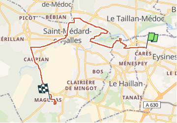
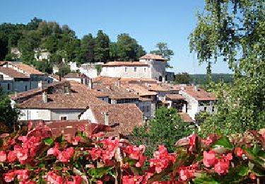
Trail Walking of 16.1 km to be discovered at New Aquitaine, Gironde, Eysines. This trail is proposed by piba2.
Description
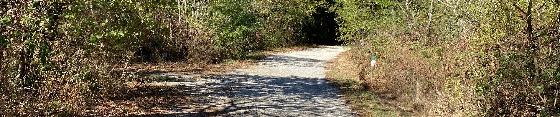
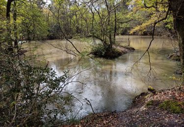
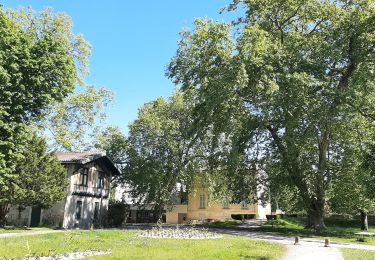
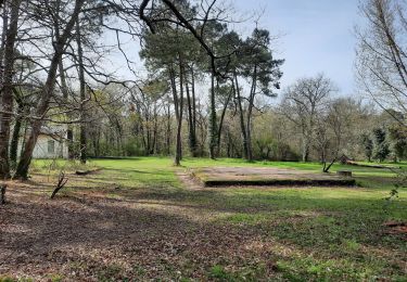
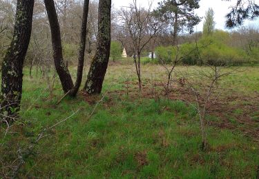
Marche souvent à l'ombre des arbres, en forêt, en sous-bois, sauf le dernier tiers, en zone périurbaine, mais qui reste agréable.
On arrive par le tram D, Les Sources.
On repart vers Bordeaux par le bus 71, Village de Magudas. Le dimanche, un bus toutes les heures seulement.
Positioning
Country:
France
Region :
New Aquitaine
Department/Province :
Gironde
Municipality :
Eysines
Location:
Unknown
Start:(Dec)
Start:(UTM)
684619 ; 4973330 (30T) N.
Comments
Trails nearby
![Trail Walking Blanquefort - Pnl Tanais - Photo](https://media.geolcdn.com/t/375/260/d5d98c98-c615-4cb3-9bf4-916690b17932.jpg&format=jpg&maxdim=2)
![Walking Walking](https://static1.geolcdn.com/sitytour/trail-icons/101.png)
Pnl Tanais
Walking
Medium
(1)
Blanquefort,
New Aquitaine,
Gironde,
France
![](/images/other/stat-length.png)
10.3 km | 11.4 km-effort
3h 55min
![](https://static1.geolcdn.com/siteimages/upload/files/16400158638029165_repeat_loop_refresh_sync_direction_icon.png)
Yes
![Trail Walking Blanquefort - Circuit autour de Blanquefort - Photo](https://media.geolcdn.com/t/375/260/e929d0b7-3df3-414f-8052-5790c33dbb56.jpg&format=jpg&maxdim=2)
![Walking Walking](https://static1.geolcdn.com/sitytour/trail-icons/101.png)
Circuit autour de Blanquefort
Walking
Difficult
Blanquefort,
New Aquitaine,
Gironde,
France
![](/images/other/stat-length.png)
12.4 km | 13.8 km-effort
3h 7min
![](https://static1.geolcdn.com/siteimages/upload/files/16400158638029165_repeat_loop_refresh_sync_direction_icon.png)
No
![Trail Walking Blanquefort - Blanquefort/ Le Pian-Medoc - Photo](https://media.geolcdn.com/t/375/260/661631f6-1335-49e9-a8c6-69d8a45a6939.jpg&format=jpg&maxdim=2)
![Walking Walking](https://static1.geolcdn.com/sitytour/trail-icons/101.png)
Blanquefort/ Le Pian-Medoc
Walking
Medium
Blanquefort,
New Aquitaine,
Gironde,
France
![](/images/other/stat-length.png)
14.6 km | 15.9 km-effort
4h 0min
![](https://static1.geolcdn.com/siteimages/upload/files/16400158638029165_repeat_loop_refresh_sync_direction_icon.png)
Yes
![Trail Walking Blanquefort - Tanais finalisé - Photo](https://media.geolcdn.com/t/375/260/65129eed-45b3-4fa6-9c6a-476d886a3a2f.jpg&format=jpg&maxdim=2)
![Walking Walking](https://static1.geolcdn.com/sitytour/trail-icons/101.png)
Tanais finalisé
Walking
Very easy
Blanquefort,
New Aquitaine,
Gironde,
France
![](/images/other/stat-length.png)
19.3 km | 21 km-effort
5h 24min
![](https://static1.geolcdn.com/siteimages/upload/files/16400158638029165_repeat_loop_refresh_sync_direction_icon.png)
Yes
![Trail Walking Bruges - JFT YB ETAPE 15 13-5-2014 - Photo](https://media.geolcdn.com/t/375/260/ext.jpg?maxdim=2&url=https%3A%2F%2Fservices.sitytrail.com%2FGeolivesWS%2FDownloadMedia.ashx%3FTrailID%3D301267%26Media%3Dfix__20140513144815.jpg)
![Walking Walking](https://static1.geolcdn.com/sitytour/trail-icons/101.png)
JFT YB ETAPE 15 13-5-2014
Walking
Easy
Bruges,
New Aquitaine,
Gironde,
France
![](/images/other/stat-length.png)
17.2 km | 18.7 km-effort
3h 55min
![](https://static1.geolcdn.com/siteimages/upload/files/16400158638029165_repeat_loop_refresh_sync_direction_icon.png)
No
![Trail Motor Bruges - Escapade en Charente 2012 - Photo](https://media.geolcdn.com/t/375/260/ext.jpg?maxdim=2&url=https%3A%2F%2Fservices.sitytrail.com%2FGeolivesWS%2FDownloadMedia.ashx%3FTrailID%3D141858%26Media%3D52823fb7-1ddd-4b13-b35d-27ae7b597f4d.jpg)
![Motor Motor](https://static1.geolcdn.com/sitytour/trail-icons/400.png)
Escapade en Charente 2012
Motor
Very easy
Bruges,
New Aquitaine,
Gironde,
France
![](/images/other/stat-length.png)
245 km | 280 km-effort
Unknown
![](https://static1.geolcdn.com/siteimages/upload/files/16400158638029165_repeat_loop_refresh_sync_direction_icon.png)
Yes
![Trail Walking Le Taillan-Médoc - 2010-09-02 - 19h41m27 - Photo](https://media.geolcdn.com/t/375/260/ext.jpg?maxdim=2&url=https%3A%2F%2Fservices.sitytrail.com%2FGeolivesWS%2FDownloadMedia.ashx%3FTrailID%3D45181%26Media%3Dimage2.jpg)
![Walking Walking](https://static1.geolcdn.com/sitytour/trail-icons/101.png)
2010-09-02 - 19h41m27
Walking
Very easy
Le Taillan-Médoc,
New Aquitaine,
Gironde,
France
![](/images/other/stat-length.png)
8.5 km | 9.3 km-effort
Unknown
![](https://static1.geolcdn.com/siteimages/upload/files/16400158638029165_repeat_loop_refresh_sync_direction_icon.png)
Yes
![Trail Walking Saint-Médard-en-Jalles - Dehes - Photo](https://media.geolcdn.com/t/375/260/e1c74e07-5af3-4c24-b4d0-3b4d9bd8c189.jpg&format=jpg&maxdim=2)
![Walking Walking](https://static1.geolcdn.com/sitytour/trail-icons/101.png)
Dehes
Walking
Medium
Saint-Médard-en-Jalles,
New Aquitaine,
Gironde,
France
![](/images/other/stat-length.png)
6.1 km | 6.7 km-effort
3h 0min
![](https://static1.geolcdn.com/siteimages/upload/files/16400158638029165_repeat_loop_refresh_sync_direction_icon.png)
Yes
![Trail Walking Le Taillan-Médoc - le Taillan - Photo](https://media.geolcdn.com/t/375/260/77418fbb-a3e1-4c2e-919b-dd8588ff5855.jpg&format=jpg&maxdim=2)
![Walking Walking](https://static1.geolcdn.com/sitytour/trail-icons/101.png)
le Taillan
Walking
Medium
Le Taillan-Médoc,
New Aquitaine,
Gironde,
France
![](/images/other/stat-length.png)
5.9 km | 6.5 km-effort
2h 22min
![](https://static1.geolcdn.com/siteimages/upload/files/16400158638029165_repeat_loop_refresh_sync_direction_icon.png)
Yes