![](/images/other/stat-length.png)
![Trail Walking Saint-Marcel-lès-Valence - balade VSM N° 9 Les Chanalets - Photo](https://media.geolcdn.com/t/1900/400/ext.pjpeg?maxdim=2&url=https%3A%2F%2Fstatic1.geolcdn.com%2Fsiteimages%2Fupload%2Ffiles%2F1553511878bg_sport_marche.png)
balade VSM N° 9 Les Chanalets
michelguilhou
User
![Length](/images/other/stat-length.png)
![Max alt](https://static1.geolcdn.com/siteimages/upload/files/1508320355ic_sort_altitude_max_24dp.png)
![Uphill gradient](https://static1.geolcdn.com/siteimages/upload/files/1508320355ic_sort_den_pos_24dp.png)
![Km-Effort](/images/other/stat-length.png)
![Min alt](https://static1.geolcdn.com/siteimages/upload/files/1508320355ic_sort_altitude_min_24dp.png)
![Downhill gradient](https://static1.geolcdn.com/siteimages/upload/files/1508320355ic_sort_den_neg_24dp.png)
![Boucle](https://static1.geolcdn.com/siteimages/upload/files/16400158638029165_repeat_loop_refresh_sync_direction_icon.png)
![Walking](https://static1.geolcdn.com/sitytour/trail-icons/101.png)
2h30
Difficulty : Easy
![Scan this QR Code to open this trail in the SityTrail application](https://capi.geolives.com/qq0zvz2zws4bq2lad0pu/sitytour/trails/338583/qr.png?size=200)
FREE GPS app for hiking
About
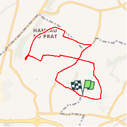
Trail Walking of 8.5 km to be discovered at Auvergne-Rhône-Alpes, Drôme, Saint-Marcel-lès-Valence. This trail is proposed by michelguilhou.
Description
Si départ de la mairie, ajouter 6 km aller-retour
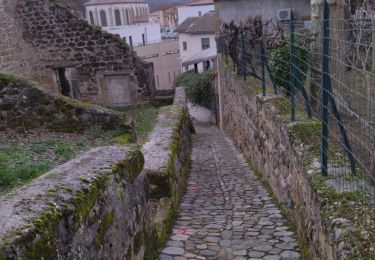
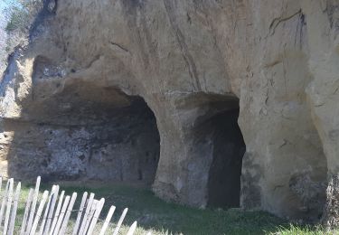
Pour rejoindre le hameau de Marquet, monter Côte du Vallon. En haut de la côte, prendre direction INRA, suivre la route et la direction INRA jusqu’à l’indication de Marquet. Se garer à l’entrée du hameau.
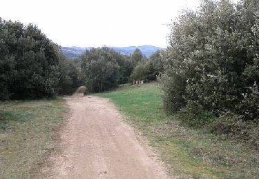
1) Traverser le hameau et poursuivre en prenant le chemin de terre tout droit jusqu’à la route.
2) Prendre sur la Droite la route goudronnée (attention peu de visibilité dans la montée). Monter et laisser sur la Gauche le « Domaine de la Caillette ». Passer sous deux lignes à HT, et un chemin de terre et vous continuez sur la route.
3) Attention : 100 m avant un groupe de maisons, prendre à Gauche le chemin pierreux et le suivre.
4) Virage sur la Droite, en laissant la ferme « Cotte » à 100 m sur la gauche, puis virage sur la Gauche (plantation de kiwis à droite).
5) A l’intersection en étoile à 5 branches, suivre le panneau « Chanalets » ou « Drôme à vélo »
Laisser la route direction « Royet » sur la Droite et descendre tout droit dans le hameau « Le Prat ». A la sortie du hameau, continuer tout droit, vous apercevez alors le toit du château des Chanalets, sur la droite.
6) Attention, à la sortie du hameau des Chanalets, tourner à Gauche « en épingle à cheveux », au niveau d’une maison rénovée, direction « Les Selles »
Cette route tourne ensuite à Droite, descend puis remonte, en traversant le golf.
7) En haut, à la ferme « Roux », écurie des Selles, prendre à Droite le chemin de terre (sur la gauche, manège des chevaux, la ferme sur la droite), le suivre, passer aux abords de la ferme des Selles, continuer.
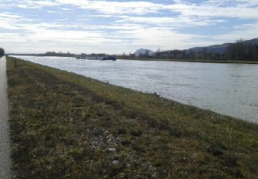
8) Vous arrivez alors sur une route goudronnée que vous traversez pour continuer un chemin empierré, bordé d’une haie brise-vent sur la gauche. Marcher jusqu’à la route goudronnée, la descendre sur la Droite vers le domaine de Gotheron. Traverser le domaine puis continuer la route.
9) Laisser à gauche la route des « Reys » puis prendre la 1ière route à Droite en direction de Marquet.
Points of interest
Positioning
Comments
Trails nearby
![Trail Walking Châteauneuf-sur-Isère - Châteauneuf d isere le chemin des carriers - Photo](https://media.geolcdn.com/t/375/260/ext.jpg?maxdim=2&url=https%3A%2F%2Fstatic1.geolcdn.com%2Fsiteimages%2Fupload%2Ffiles%2F1553511878bg_sport_marche.png)
![Walking Walking](https://static1.geolcdn.com/sitytour/trail-icons/101.png)
Walking
![](/images/other/stat-length.png)
![](https://static1.geolcdn.com/siteimages/upload/files/16400158638029165_repeat_loop_refresh_sync_direction_icon.png)
![Trail Walking Saint-Marcel-lès-Valence - Balade VSM N° 5 - pour rejoindre le Guimand - Photo](https://media.geolcdn.com/t/375/260/ext.jpg?maxdim=2&url=https%3A%2F%2Fstatic1.geolcdn.com%2Fsiteimages%2Fupload%2Ffiles%2F1553511878bg_sport_marche.png)
![Walking Walking](https://static1.geolcdn.com/sitytour/trail-icons/101.png)
Walking
![](/images/other/stat-length.png)
![](https://static1.geolcdn.com/siteimages/upload/files/16400158638029165_repeat_loop_refresh_sync_direction_icon.png)
![Trail Walking Châteauneuf-sur-Isère - 26 Châteauneuf didier - Photo](https://media.geolcdn.com/t/375/260/a4c5edcc-8f3c-45e2-8c8a-8f7fc0f64334.jpg&format=jpg&maxdim=2)
![Walking Walking](https://static1.geolcdn.com/sitytour/trail-icons/101.png)
Walking
![](/images/other/stat-length.png)
![](https://static1.geolcdn.com/siteimages/upload/files/16400158638029165_repeat_loop_refresh_sync_direction_icon.png)
![Trail Walking Châteauneuf-sur-Isère - Châteauneuf/isere - Photo](https://media.geolcdn.com/t/375/260/231a22ca-832d-4248-a718-db7a90127622.jpg&format=jpg&maxdim=2)
![Walking Walking](https://static1.geolcdn.com/sitytour/trail-icons/101.png)
Walking
![](/images/other/stat-length.png)
![](https://static1.geolcdn.com/siteimages/upload/files/16400158638029165_repeat_loop_refresh_sync_direction_icon.png)
![Trail Walking Saint-Marcel-lès-Valence - Vers le Guimand - Photo](https://media.geolcdn.com/t/375/260/57b98d48-2046-42f0-8662-00caa40854e6.jpg&format=jpg&maxdim=2)
![Walking Walking](https://static1.geolcdn.com/sitytour/trail-icons/101.png)
Walking
![](/images/other/stat-length.png)
![](https://static1.geolcdn.com/siteimages/upload/files/16400158638029165_repeat_loop_refresh_sync_direction_icon.png)
![Trail Walking Châteauneuf-sur-Isère - le chemin des carriers à Châteauneuf-sur-Isère - Photo](https://media.geolcdn.com/t/375/260/cb23e02f-b5eb-4dbe-8338-aa328ff00145.jpg&format=jpg&maxdim=2)
![Walking Walking](https://static1.geolcdn.com/sitytour/trail-icons/101.png)
Walking
![](/images/other/stat-length.png)
![](https://static1.geolcdn.com/siteimages/upload/files/16400158638029165_repeat_loop_refresh_sync_direction_icon.png)
![Trail Mountain bike Guilherand-Granges - guilherand-st peray-tracol-st peray-Cornas-guilherand - Photo](https://media.geolcdn.com/t/375/260/ext.jpg?maxdim=2&url=https%3A%2F%2Fservices.sitytrail.com%2FGeolivesWS%2FDownloadMedia.ashx%3FTrailID%3D400229%26Media%3Dfix__20150326105918.jpg)
![Mountain bike Mountain bike](https://static1.geolcdn.com/sitytour/trail-icons/202.png)
Mountain bike
![](/images/other/stat-length.png)
![](https://static1.geolcdn.com/siteimages/upload/files/16400158638029165_repeat_loop_refresh_sync_direction_icon.png)
![Trail Cycle Guilherand-Granges - de guilherand à guilherand via Voie bleue-la roche de glun-tournon-tain l'hermitage-bourg les valence - Photo](https://media.geolcdn.com/t/375/260/ext.jpg?maxdim=2&url=https%3A%2F%2Fservices.sitytrail.com%2FGeolivesWS%2FDownloadMedia.ashx%3FTrailID%3D391884%26Media%3Dfix__20150303114559.jpg)
![Cycle Cycle](https://static1.geolcdn.com/sitytour/trail-icons/200.png)
Cycle
![](/images/other/stat-length.png)
![](https://static1.geolcdn.com/siteimages/upload/files/16400158638029165_repeat_loop_refresh_sync_direction_icon.png)
![Trail Electric bike Bourg-lès-Valence - Bourg-les-Valence-retour - Photo](https://media.geolcdn.com/t/375/260/57158cec-995d-4dd0-a48c-ec1a210ca5ab.jpg&format=jpg&maxdim=2)
![Electric bike Electric bike](https://static1.geolcdn.com/sitytour/trail-icons/205.png)
Electric bike
![](/images/other/stat-length.png)
![](https://static1.geolcdn.com/siteimages/upload/files/16400158638029165_repeat_loop_refresh_sync_direction_icon.png)