


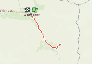

6.3 km | 11.2 km-effort


User


FREE GPS app for hiking
 SityTrail
IGN / Geographical institutes
SityTrail World
The world is yours!
Trail Walking of 13.4 km to be discovered at Auvergne-Rhône-Alpes, Isère, Saint-Christophe-en-Oisans. This trail is proposed by rapako.
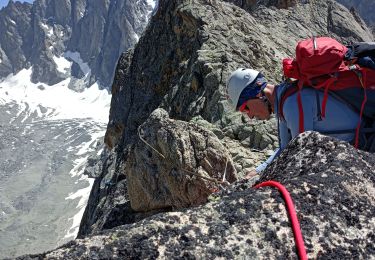
Accueil très sympathique au Refuge.
Les chemins sont très bien entretenus.
L'usage des bâtons est conseillé surtout pour la descente.

Walking

Walking

Walking

Walking

Walking
Walking

Walking

Walking

Walking