


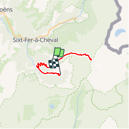

19.8 km | 37 km-effort


User


FREE GPS app for hiking
 SityTrail
IGN / Geographical institutes
SityTrail World
The world is yours!
Trail Walking of 21 km to be discovered at Auvergne-Rhône-Alpes, Upper Savoy, Sixt-Fer-à-Cheval. This trail is proposed by arno55v.
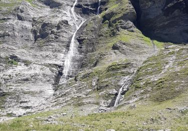
15 cm de neige le 16 aout 2014.

Walking

Walking

Walking

Walking

Walking

Walking

Walking

Walking
Walking