![](/images/other/stat-length.png)
![Trail Walking Vaire - vaire le petit - Photo](https://media.geolcdn.com/t/1900/400/8f23000f-8031-4a3e-b8c7-010445a2b43b.jpg&format=pjpeg&maxdim=2)
vaire le petit
eltonnermou
User
![Length](/images/other/stat-length.png)
![Max alt](https://static1.geolcdn.com/siteimages/upload/files/1508320355ic_sort_altitude_max_24dp.png)
![Uphill gradient](https://static1.geolcdn.com/siteimages/upload/files/1508320355ic_sort_den_pos_24dp.png)
![Km-Effort](/images/other/stat-length.png)
![Min alt](https://static1.geolcdn.com/siteimages/upload/files/1508320355ic_sort_altitude_min_24dp.png)
![Downhill gradient](https://static1.geolcdn.com/siteimages/upload/files/1508320355ic_sort_den_neg_24dp.png)
![Boucle](https://static1.geolcdn.com/siteimages/upload/files/16400158638029165_repeat_loop_refresh_sync_direction_icon.png)
![Walking](https://static1.geolcdn.com/sitytour/trail-icons/101.png)
4h52
Difficulty : Very easy
![Scan this QR Code to open this trail in the SityTrail application](https://capi.geolives.com/qq0zvz2zws4bq2lad0pu/sitytour/trails/3372118/qr.png?size=200)
FREE GPS app for hiking
About
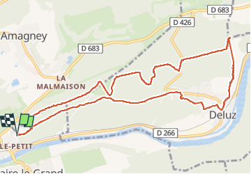
Trail Walking of 12.1 km to be discovered at Bourgogne-Franche-Comté, Doubs, Vaire. This trail is proposed by eltonnermou.
Description
parking : haut du village, intersection rue Vignes et Acacias
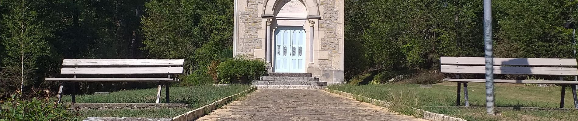
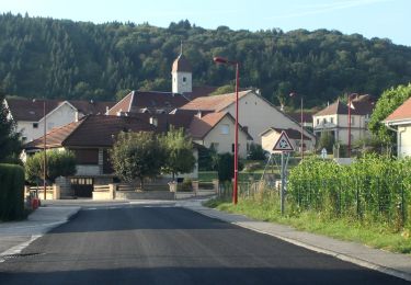
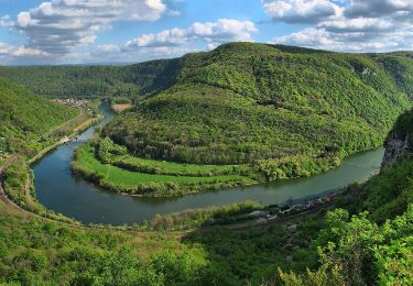
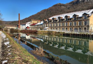
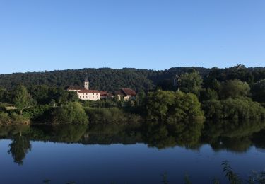
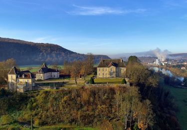
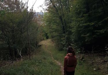
randonnée avec une difficulté : la montée après la traversée du village de Deluz (bâtons fortement conseillés). Mais tout au long de cette montée de superbes points de vue sur la vallée du Doubs, le mont Souvance, la montagne Notre Dame, le mont de la Côte au Bœuf, sur le val de Roulans. La grotte "sous roche" n'est pas du tout accessible, admirez son porche d'entrée.
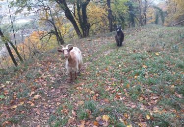
Laissez vous surprendre par le passage d'un (ou plusieurs) animal "sauvage" et suivant la saison observez la flore.
Positioning
Comments
Trails nearby
![Trail On foot Nancray - Sentier du Tour des Landes - Photo](https://media.geolcdn.com/t/375/260/dca2d2cb-2448-41ff-970e-c18701afcb22.jpeg&format=jpg&maxdim=2)
![On foot On foot](https://static1.geolcdn.com/sitytour/trail-icons/100.png)
On foot
![](/images/other/stat-length.png)
![](https://static1.geolcdn.com/siteimages/upload/files/16400158638029165_repeat_loop_refresh_sync_direction_icon.png)
![Trail On foot Deluz - Sentier du Château Loriot - Photo](https://media.geolcdn.com/t/375/260/a6c0a960-bcfb-4e05-ab1e-cb250b6d6d40.jpeg&format=jpg&maxdim=2)
![On foot On foot](https://static1.geolcdn.com/sitytour/trail-icons/100.png)
On foot
![](/images/other/stat-length.png)
![](https://static1.geolcdn.com/siteimages/upload/files/16400158638029165_repeat_loop_refresh_sync_direction_icon.png)
![Trail On foot Deluz - Sentier du Patrimoine - Photo](https://media.geolcdn.com/t/375/260/3858c5b3-abf9-4504-8767-bbab2b7352b8.jpeg&format=jpg&maxdim=2)
![On foot On foot](https://static1.geolcdn.com/sitytour/trail-icons/100.png)
On foot
![](/images/other/stat-length.png)
![](https://static1.geolcdn.com/siteimages/upload/files/16400158638029165_repeat_loop_refresh_sync_direction_icon.png)
![Trail On foot Vaire - Sentier des Sources 2 - Photo](https://media.geolcdn.com/t/375/260/0ecedb62-3c33-4251-8982-81e9743d8322.jpeg&format=jpg&maxdim=2)
![On foot On foot](https://static1.geolcdn.com/sitytour/trail-icons/100.png)
On foot
![](/images/other/stat-length.png)
![](https://static1.geolcdn.com/siteimages/upload/files/16400158638029165_repeat_loop_refresh_sync_direction_icon.png)
![Trail On foot Vaire - Sentier des Sources 1 - Photo](https://media.geolcdn.com/t/375/260/3b895425-3268-42d6-8ef6-757959f26627.jpeg&format=jpg&maxdim=2)
![On foot On foot](https://static1.geolcdn.com/sitytour/trail-icons/100.png)
On foot
![](/images/other/stat-length.png)
![](https://static1.geolcdn.com/siteimages/upload/files/16400158638029165_repeat_loop_refresh_sync_direction_icon.png)
![Trail Walking Braillans - Braillans - Photo](https://media.geolcdn.com/t/375/260/ext.jpg?maxdim=2&url=https%3A%2F%2Fstatic1.geolcdn.com%2Fsiteimages%2Fupload%2Ffiles%2F1553511878bg_sport_marche.png)
![Walking Walking](https://static1.geolcdn.com/sitytour/trail-icons/101.png)
Walking
![](/images/other/stat-length.png)
![](https://static1.geolcdn.com/siteimages/upload/files/16400158638029165_repeat_loop_refresh_sync_direction_icon.png)
![Trail Walking Amagney - Amagney Ferme de Rufille Marchaux Amagney - Photo](https://media.geolcdn.com/t/375/260/ffd6ac8b-8fb9-4275-8d55-80b04a29e6ed.jpg&format=jpg&maxdim=2)
![Walking Walking](https://static1.geolcdn.com/sitytour/trail-icons/101.png)
Walking
![](/images/other/stat-length.png)
![](https://static1.geolcdn.com/siteimages/upload/files/16400158638029165_repeat_loop_refresh_sync_direction_icon.png)
![Trail Walking Gennes - Source d'Arcier - Photo](https://media.geolcdn.com/t/375/260/ccadba48-d083-43f7-8a9d-9b2ad3b4bf3c.jpg&format=jpg&maxdim=2)
![Walking Walking](https://static1.geolcdn.com/sitytour/trail-icons/101.png)
Walking
![](/images/other/stat-length.png)
![](https://static1.geolcdn.com/siteimages/upload/files/16400158638029165_repeat_loop_refresh_sync_direction_icon.png)
![Trail Walking Vaire - arcier sources - Photo](https://media.geolcdn.com/t/375/260/1cc2b255-5b58-4bd7-a8cc-0c9388f8ad25.jpg&format=jpg&maxdim=2)
![Walking Walking](https://static1.geolcdn.com/sitytour/trail-icons/101.png)
Walking
![](/images/other/stat-length.png)
![](https://static1.geolcdn.com/siteimages/upload/files/16400158638029165_repeat_loop_refresh_sync_direction_icon.png)