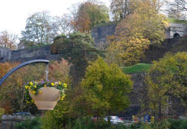
Trail Walking Namur - ✅ La citadelle de Namur et son château  - Photo

✅ La citadelle de Namur et son château

 Benjamin27
Benjamin27

User GUIDE

© OpenStreetMap contributors
Length
Length
4.2 km
Max alt
Max alt
222 m
Uphill gradient
Uphill gradient
167 m
Km-Effort
Km-Effort  
6.5 km
Min alt
Min alt
76 m
Downhill gradient
Downhill gradient
164 m
Boucle
Boucle
Yes
Creation date :
2022-08-27 12:15:42.48
Updated on :
2022-09-01 12:28:47.532

(0 Reviews)

Walking
Walking
1h27
Difficulty : Medium

Scan this QR Code to open this trail in the SityTrail application

FREE GPS app for hiking

Logo SityTrail SityTrail

IGN / Geographical institutes

Download SityTrail from the App Store Download SityTrail from Google Play

Logo SityTrail SityTrail World

The world is yours!

Download SityTrail from the App Store Download SityTrail from Google Play Download SityTrail on Huawei AppGallery

About

Trail Walking of 4.2 km to be discovered at Wallonia, Namur, Namur. This trail is proposed by Benjamin27.

Description

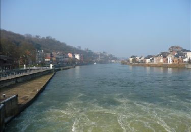
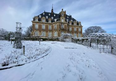
La citadelle de Namur est un ancien château fort devenu citadelle se trouvant à la confluence entre la Sambre et la Meuse. De là, vous pouvez contempler la ville magnifique en contrebas et profiter du très joli château de Namur qui se trouve en son sein.

👣 Distance : 4,2km - balisage losange bleu.

📍Départ : parking confluence (payant) au « grognon », rue du grognon 2 - 5000 Namur.

🚂🚍 Aller à la gare de Namur et prendre le bus TEC 1,2 ou 9 jusqu’à l’arrêt « Namur Pont de France ».

Elevation profile

Photos

Positioning

Country:
Belgium
Region :
Wallonia
Department/Province :
Namur
Municipality :
Namur
Location:
Namur
Start:(UTM)
632683 ; 5591599 (31U) N.

Trails nearby

Trail Walking Namur - Balade dans le bois de la Vecquée - Photo
Walking
GUIDE
Desrumaux

Walking

Medium
(6)
Namur, Wallonia, Namur, Belgium
13.2 km | 18.4 km-effort
3h 20min
Yes
Trail Walking Namur - Nuit du scoutisme - Namur  - Photo
Walking
PRO

Walking

Medium
(7)
Namur, Wallonia, Namur, Belgium
5.5 km | 6.1 km-effort
1h 32min
Yes
Trail Walking Namur - De Naninne vers Dave par les Fonds de Lustin et les Bois d'Acremont - Photo
Walking
GUIDE
Desrumaux

Walking

Medium
(5)
Namur, Wallonia, Namur, Belgium
19 km | 25 km-effort
5h 0min
Yes
Trail Walking Namur - La Plante 16 Km - Photo
Walking
GUIDE
rvapeldo

Walking

Easy
(1)
Namur, Wallonia, Namur, Belgium
15.9 km | 21 km-effort
5h 34min
Yes
Trail Walking Namur - De Boninne aux Rochers de Marche-les-Dames - Photo
Walking
GUIDE
Desrumaux

Walking

Easy
(1)
Namur, Wallonia, Namur, Belgium
10.8 km | 14.6 km-effort
3h 5min
Yes
Trail Walking Namur - Balade à Wépion - Photo
Walking
GUIDE
Desrumaux

Walking

Easy
(4)
Namur, Wallonia, Namur, Belgium
11.7 km | 15.2 km-effort
3h 15min
Yes
Trail Walking Namur - La balade des quais à Namur - Photo
Walking
GUIDE
Desrumaux

Walking

Very easy
(3)
Namur, Wallonia, Namur, Belgium
7.6 km | 8.6 km-effort
1h 53min
Yes
Trail Walking Namur - Naninne - Bois de Dave - Photo
Walking
Laveugle

Walking

Easy
(5)
Namur, Wallonia, Namur, Belgium
11.4 km | 15.1 km-effort
2h 10min
Yes
Trail Cycle Namur - Route du vin un jour Route du vin toujours - Photo
Cycle
GUIDE+

Cycle

Easy
(1)
Namur, Wallonia, Namur, Belgium
33 km | 38 km-effort
2h 11min
Yes


Close
My subscriptions