Villeneuve_Chateaux_Bacchus
jagarnier
User GUIDE
Length
7.4 km
Max alt
655 m
Uphill gradient
272 m
Km-Effort
11 km
Min alt
504 m
Downhill gradient
274 m
Boucle
Yes
Creation date :
2022-08-25 14:26:41.811
Updated on :
2023-04-26 12:37:52.399
2h15
Difficulty : Medium
FREE GPS app for hiking
About
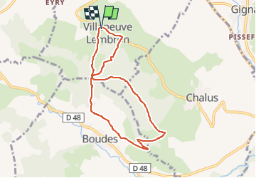
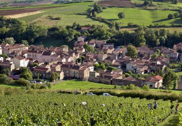
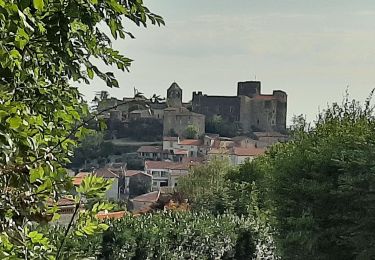
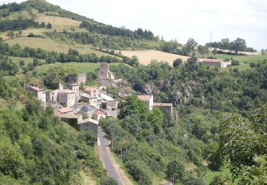
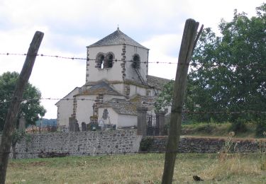
Trail Walking of 7.4 km to be discovered at Auvergne-Rhône-Alpes, Puy-de-Dôme, Villeneuve. This trail is proposed by jagarnier.
Description
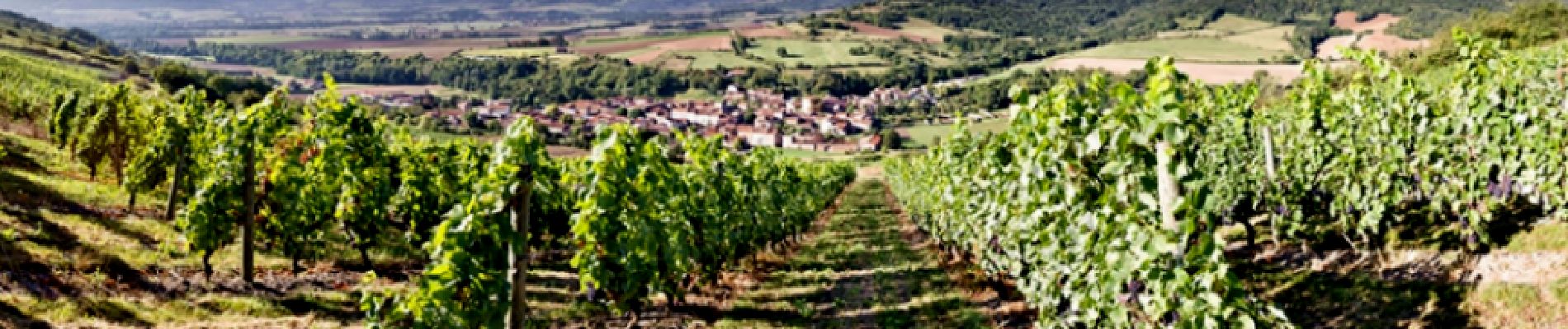
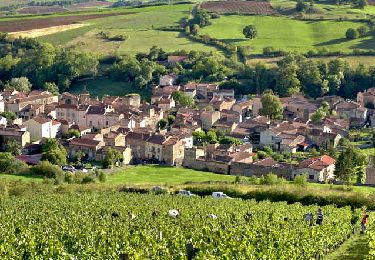
Une promenade entre les paysages agricoles des villages de Villeuneuve-Lembron et Chalus et les paysages vinicoles du village de Boudes.
Positioning
Country:
France
Region :
Auvergne-Rhône-Alpes
Department/Province :
Puy-de-Dôme
Municipality :
Villeneuve
Location:
Unknown
Start:(Dec)
Start:(UTM)
514504 ; 5036010 (31T) N.
Comments
Trails nearby
Boudes_Vallee_Saints
Walking
Medium
(1)
Boudes,
Auvergne-Rhône-Alpes,
Puy-de-Dôme,
France
10.9 km | 15.1 km-effort
3h 15min
Yes
Villeneuve, Boudes, Chalus
On foot
Easy
Boudes,
Auvergne-Rhône-Alpes,
Puy-de-Dôme,
France
9 km | 13.3 km-effort
3h 0min
Yes
Bard et Letz
On foot
Easy
Madriat,
Auvergne-Rhône-Alpes,
Puy-de-Dôme,
France
9.9 km | 13.3 km-effort
3h 1min
Yes
La Vallee des Saints
On foot
Easy
(1)
Boudes,
Auvergne-Rhône-Alpes,
Puy-de-Dôme,
France
8.1 km | 11.1 km-effort
2h 31min
Yes
La Chaux et le Bois de Jaby
On foot
Easy
Mareugheol,
Auvergne-Rhône-Alpes,
Puy-de-Dôme,
France
10.1 km | 13.7 km-effort
3h 7min
Yes
Vodable et Colamine
On foot
Easy
Villeneuve,
Auvergne-Rhône-Alpes,
Puy-de-Dôme,
France
12 km | 16.6 km-effort
3h 45min
No
Le Puy d'Ysson
On foot
Easy
Solignat,
Auvergne-Rhône-Alpes,
Puy-de-Dôme,
France
6.8 km | 9.6 km-effort
2h 10min
No
Les Coteaux et la Chaux
On foot
Medium
Gignat,
Auvergne-Rhône-Alpes,
Puy-de-Dôme,
France
15.5 km | 20 km-effort
4h 34min
Yes
Entre béal et pigeonniers - Saint Germain Lembron
Walking
Medium
(1)
Saint-Germain-Lembron,
Auvergne-Rhône-Alpes,
Puy-de-Dôme,
France
9.8 km | 11.1 km-effort
2h 30min
Yes