


16.7 km | 31 km-effort


User


FREE GPS app for hiking
 SityTrail
IGN / Geographical institutes
SityTrail World
The world is yours!
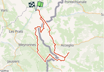
Trail Walking of 88 km to be discovered at Provence-Alpes-Côte d'Azur, Alpes-de-Haute-Provence, Saint-Paul-sur-Ubaye. This trail is proposed by aris.
Inspiré du site https://www.rando-alpes-haute-provence.fr/trek/297843-Ubaye---Pays-du-Viso-en-5-jours-(GRP®)-:-Tour-du-Chambeyron , avec quelques variantes (notamment passage par le col de Mallemort au lieu du col de Saustron lors de l'étape Larche->refuge du Chambeyron).
Le tour vraiment beau, et assez exigeant, avec des dénivellées positifs > 1000m (sauf le 1er jour Maljasset->Chiappera qui est tranquille). Et l'on visite des villages italiens de caractère (Chialvetta, Chiappera, Pratorotondo)
A noter l'existence d'un refuge à Viviere, qui économise 200m de dénivellée jusqu'à Chialvetta, à l'aller et au retour (mais il était plein quand j'ai réservé).

Walking

Other activity
Walking

Walking
Walking

Walking
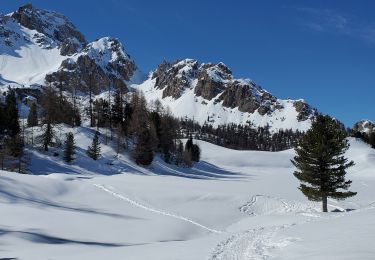
Snowshoes

Walking
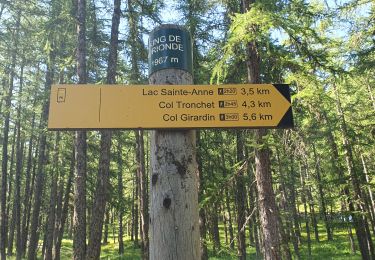
Walking