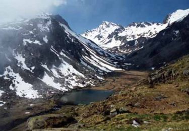
9.1 km | 18.9 km-effort
camping st bazerque-gay
cyrille78
User
Length
14.9 km
Max alt
1742 m
Uphill gradient
1207 m
Km-Effort
28 km
Min alt
824 m
Downhill gradient
331 m
Boucle
No
Creation date :
2022-08-18 07:53:32.234
Updated on :
2022-08-22 07:07:48.584
10h24
Difficulty : Difficult
FREE GPS app for hiking
About
Trail Walking of 14.9 km to be discovered at . This trail is proposed by cyrille78.
Positioning
Country:
Unknown
Region :
Unknown
Department/Province :
Unknown
Municipality :
Unknown
Location:
Unknown
Start:(Dec)
Start:(UTM)
745180 ; 4746668 (30T) N.
Comments
Trails nearby
Le Pic Bergons
Walking
Medium
(2)
Luz-Saint-Sauveur,
Occitania,
Hautespyrenees,
France
4.6 km | 10.2 km-effort
2h 10min
Yes
SityTrail - ESTERRE Viella / Luz / Esquieze / Esterre en boucle bis
On foot
Very easy
(1)
Esterre,
Occitania,
Hautespyrenees,
France
9.4 km | 15.5 km-effort
Unknown
Yes
Pic Bergons 2068m
Walking
Medium
(1)
Luz-Saint-Sauveur,
Occitania,
Hautespyrenees,
France
5.9 km | 14 km-effort
6h 0min
Yes
Lac de Bastampe 2019m
Walking
Difficult
(1)
Sazos,
Occitania,
Hautespyrenees,
France
13 km | 27 km-effort
5h 0min
Yes
Lacot de l'Oule
Walking
Difficult
(1)
Gavarnie-Gèdre,
Occitania,
Hautespyrenees,
France
6.5 km | 15.7 km-effort
4h 30min
No
Lacs de Cestrède et Antarrouyes
Walking
Very difficult
(1)
Gavarnie-Gèdre,
Occitania,
Hautespyrenees,
France
4.4 km | 10.7 km-effort
3h 0min
No
ESTERRE Villenave st Sauveur Luz Esterre G4 "3613212"
On foot
Easy
Esterre,
Occitania,
Hautespyrenees,
France
9.4 km | 14.2 km-effort
3h 13min
Yes
LUZ SAINT SAUVEUR Les chemins de l agnouede bis
On foot
Easy
Luz-Saint-Sauveur,
Occitania,
Hautespyrenees,
France
11.8 km | 18.5 km-effort
4h 12min
Yes