
Tunnel Tour

Summok
User

Length
4.2 km

Max alt
403 m

Uphill gradient
149 m

Km-Effort
6.2 km

Min alt
326 m

Downhill gradient
150 m
Boucle
Yes
Creation date :
2022-08-20 16:10:19.898
Updated on :
2022-08-24 21:10:35.437
1h24
Difficulty : Medium
25m
Difficulty : Easy
0m
Difficulty : Very easy

FREE GPS app for hiking
About
Trail Walking of 4.2 km to be discovered at Unknown, Canton Capellen, Habscht. This trail is proposed by Summok.
Description
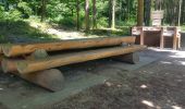
Départ à la Grill Platz. Belle descente jusqu'à l'entrée du tunnel. Traversée du tunnel. Remontée en pente modérée avec un bon petit raid.
Facile à se garer. Possibilité de Pic Nic et de barbecue.
Gardez l'endroit propre ;-)
Positioning
Country:
Luxembourg
Region :
Unknown
Department/Province :
Canton Capellen
Municipality :
Habscht
Location:
Unknown
Start:(Dec)
Start:(UTM)
709260 ; 5509695 (31U) N.
Comments
Trails nearby
Clairefontaine - Circuit Natura 2000, des sites qui valent le détour - Lx15


Walking
Easy
(2)
Arlon,
Wallonia,
Luxembourg,
Belgium

4.1 km | 5.3 km-effort
1h 11min
Yes
Guirsch, vallée des moulins


Walking
Very easy
(1)
Arlon,
Wallonia,
Luxembourg,
Belgium

5.8 km | 7.2 km-effort
1h 33min
No

RF-Lu-15 - Une randonnée (trans)frontalière : Clairefontaine


Walking
Very easy
(3)
Arlon,
Wallonia,
Luxembourg,
Belgium

11.1 km | 14.7 km-effort
3h 11min
Yes

N° 8 - Waltzing-Eischen, balade belgo-luxembourgeoise


On foot
Easy
Arlon,
Wallonia,
Luxembourg,
Belgium

10.3 km | 13 km-effort
2h 57min
Yes
N° 10 - Clairefontaine : Ermesinde


On foot
Easy
Arlon,
Wallonia,
Luxembourg,
Belgium

4 km | 5.1 km-effort
1h 9min
Yes

N° 7 - Clairefontaine - L'Eisch


On foot
Easy
Arlon,
Wallonia,
Luxembourg,
Belgium

4.1 km | 5.4 km-effort
1h 13min
Yes
N° 9 - Guirsch - Village classé


On foot
Easy
Arlon,
Wallonia,
Luxembourg,
Belgium

6.5 km | 8.8 km-effort
1h 59min
Yes
Oberpallen Wanderpfad / FB BL


On foot
Easy
(1)
Beckerich,
Unknown,
Canton Redange,
Luxembourg

8.2 km | 9.8 km-effort
2h 13min
Yes
Auto-Pedestre Beckerich


On foot
Easy
Beckerich,
Unknown,
Canton Redange,
Luxembourg

11.6 km | 15.5 km-effort
3h 30min
Yes


 SityTrail


