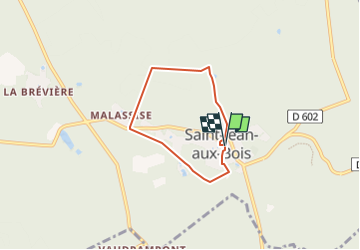
![](/images/other/stat-length.png)
![Trail Walking Saint-Jean-aux-Bois - SAINT JEAN AUX BOIS, le village et les bois - Photo](https://media.geolcdn.com/t/1900/400/cbd4d574-4b06-4403-8920-57abc85ecbc5.jpg&format=pjpeg&maxdim=2)
SAINT JEAN AUX BOIS, le village et les bois
jeannine grandjean
User
![Length](/images/other/stat-length.png)
![Max alt](https://static1.geolcdn.com/siteimages/upload/files/1508320355ic_sort_altitude_max_24dp.png)
![Uphill gradient](https://static1.geolcdn.com/siteimages/upload/files/1508320355ic_sort_den_pos_24dp.png)
![Km-Effort](/images/other/stat-length.png)
![Min alt](https://static1.geolcdn.com/siteimages/upload/files/1508320355ic_sort_altitude_min_24dp.png)
![Downhill gradient](https://static1.geolcdn.com/siteimages/upload/files/1508320355ic_sort_den_neg_24dp.png)
![Boucle](https://static1.geolcdn.com/siteimages/upload/files/16400158638029165_repeat_loop_refresh_sync_direction_icon.png)
![Walking](https://static1.geolcdn.com/sitytour/trail-icons/101.png)
1h11
Difficulty : Easy
![Scan this QR Code to open this trail in the SityTrail application](https://capi.geolives.com/qq0zvz2zws4bq2lad0pu/sitytour/trails/3358098/qr.png?size=200)
FREE GPS app for hiking
About
Trail Walking of 4.6 km to be discovered at Hauts-de-France, Oise, Saint-Jean-aux-Bois. This trail is proposed by jeannine grandjean.
Description
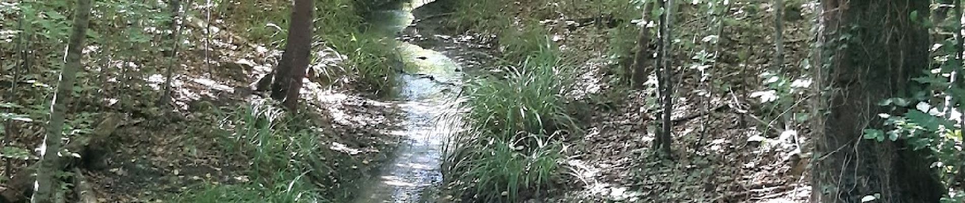
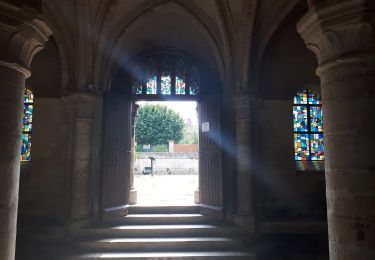
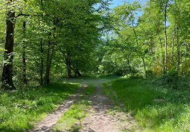
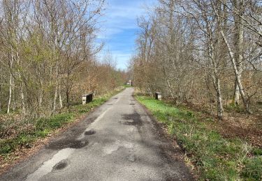
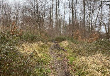
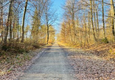
Très agréable balade, qui part du très pittoresque village de Saint-Jean. Ne pas manquer la porte fortifiée et son pont-levis pont qui enjambe le Ru des Planchettes pour se rendre à l'église sur l'emplacement de l'ancienne abbaye. Emprunter la magnifique rue des Abbesses, puis quitter le village pour entrer dans la forêt sur un circuit bien balisé qui mène au "Vieux Chêne", qui aurait plus de 800 ans. Nombreux rus sur le chemin du retour. balade bien ombragée.
Positioning
Comments
Trails nearby
![Trail On foot Pierrefonds - Le Voliard - Photo](https://media.geolcdn.com/t/375/260/4781613a-076f-4ad8-be25-8d021ddb8fa3.jpeg&format=jpg&maxdim=2)
![On foot On foot](https://static1.geolcdn.com/sitytour/trail-icons/100.png)
On foot
![](/images/other/stat-length.png)
![](https://static1.geolcdn.com/siteimages/upload/files/16400158638029165_repeat_loop_refresh_sync_direction_icon.png)
![Trail On foot Saint-Jean-aux-Bois - Promenade du Chêne de Saint-Jean - Photo](https://media.geolcdn.com/t/375/260/660f8de9-0f4a-4545-bfd3-d9c82cefa146.jpeg&format=jpg&maxdim=2)
![On foot On foot](https://static1.geolcdn.com/sitytour/trail-icons/100.png)
On foot
![](/images/other/stat-length.png)
![](https://static1.geolcdn.com/siteimages/upload/files/16400158638029165_repeat_loop_refresh_sync_direction_icon.png)
![Trail Walking Vieux-Moulin - Rando douce Vieux moulin 14/8/2022 - Photo](https://media.geolcdn.com/t/375/260/ext.jpg?maxdim=2&url=https%3A%2F%2Fstatic1.geolcdn.com%2Fsiteimages%2Fupload%2Ffiles%2F1553511878bg_sport_marche.png)
![Walking Walking](https://static1.geolcdn.com/sitytour/trail-icons/101.png)
Walking
![](/images/other/stat-length.png)
![](https://static1.geolcdn.com/siteimages/upload/files/16400158638029165_repeat_loop_refresh_sync_direction_icon.png)
![Trail Walking Vieux-Moulin - Gorges du Han - ATPC ARVAL - Photo](https://media.geolcdn.com/t/375/260/ext.jpg?maxdim=2&url=https%3A%2F%2Fstatic1.geolcdn.com%2Fsiteimages%2Fupload%2Ffiles%2F1553511878bg_sport_marche.png)
![Walking Walking](https://static1.geolcdn.com/sitytour/trail-icons/101.png)
Walking
![](/images/other/stat-length.png)
![](https://static1.geolcdn.com/siteimages/upload/files/16400158638029165_repeat_loop_refresh_sync_direction_icon.png)
![Trail Walking Compiègne - en Forêt de Compiègne_50_les Routes des Beaux Monts, de Morpigny et des Nymphes - Photo](https://media.geolcdn.com/t/375/260/9c55d9c0-6825-4d4d-9591-f5323b93b433.jpg&format=jpg&maxdim=2)
![Walking Walking](https://static1.geolcdn.com/sitytour/trail-icons/101.png)
Walking
![](/images/other/stat-length.png)
![](https://static1.geolcdn.com/siteimages/upload/files/16400158638029165_repeat_loop_refresh_sync_direction_icon.png)
![Trail Walking Compiègne - en forêt de Compiègne_48_sur les Routes de la Mariolle et du Grand Veneur - Photo](https://media.geolcdn.com/t/375/260/7316114b-cb1c-453b-b79a-8461b3c901b1.jpg&format=jpg&maxdim=2)
![Walking Walking](https://static1.geolcdn.com/sitytour/trail-icons/101.png)
Walking
![](/images/other/stat-length.png)
![](https://static1.geolcdn.com/siteimages/upload/files/16400158638029165_repeat_loop_refresh_sync_direction_icon.png)
![Trail Walking Saint-Jean-aux-Bois - Saint Jean au Bois 13,4 km - Photo](https://media.geolcdn.com/t/375/260/ddfb4125-3dc9-462c-8144-537eda5ffbb6.jpg&format=jpg&maxdim=2)
![Walking Walking](https://static1.geolcdn.com/sitytour/trail-icons/101.png)
Walking
![](/images/other/stat-length.png)
![](https://static1.geolcdn.com/siteimages/upload/files/16400158638029165_repeat_loop_refresh_sync_direction_icon.png)
![Walking Walking](https://static1.geolcdn.com/sitytour/trail-icons/101.png)
Walking
![](/images/other/stat-length.png)
![](https://static1.geolcdn.com/siteimages/upload/files/16400158638029165_repeat_loop_refresh_sync_direction_icon.png)
![Trail On foot Trosly-Breuil - Le Mont-Collet - Photo](https://media.geolcdn.com/t/375/260/ee705b5e-8f72-4c8f-a8a8-b0b1fed66154.jpeg&format=jpg&maxdim=2)
![On foot On foot](https://static1.geolcdn.com/sitytour/trail-icons/100.png)
On foot
![](/images/other/stat-length.png)
![](https://static1.geolcdn.com/siteimages/upload/files/16400158638029165_repeat_loop_refresh_sync_direction_icon.png)