Trail Walking Basse-sur-le-Rupt - Presle - Photo
 PatRando
PatRando

User

© OpenStreetMap contributors
Length
Length
10.6 km
Max alt
Max alt
1029 m
Uphill gradient
Uphill gradient
292 m
Km-Effort
Km-Effort  
14.5 km
Min alt
Min alt
806 m
Downhill gradient
Downhill gradient
292 m
Boucle
Boucle
Yes
Creation date :
2016-12-17 00:00:00.0
Updated on :
2016-12-17 00:00:00.0

(0 Reviews)

Walking
Walking
3h12
Difficulty : Easy

Scan this QR Code to open this trail in the SityTrail application

FREE GPS app for hiking

Logo SityTrail SityTrail

IGN / Geographical institutes

Download SityTrail from the App Store Download SityTrail from Google Play

Logo SityTrail SityTrail World

The world is yours!

Download SityTrail from the App Store Download SityTrail from Google Play Download SityTrail on Huawei AppGallery

About

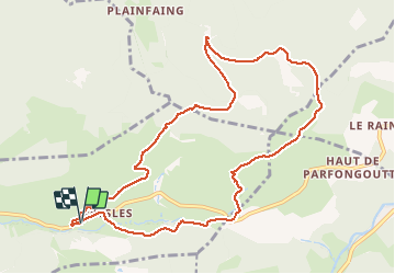
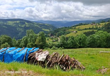
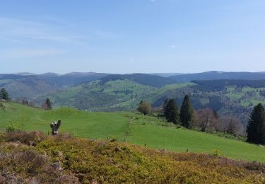
Trail Walking of 10.6 km to be discovered at Grand Est, Vosges, Basse-sur-le-Rupt. This trail is proposed by PatRando.

Description

15 Août 2014
Départ depuis le Gite Vosges en marche que je vous recommande vivement.
La roche des Chat - Étang de Jemnofeing

Elevation profile

Photos

Points of interest

Point of interest Basse-sur-le-Rupt - Point 9 - Photo
PatRando
BASSE-SUR-LE-RUPT 
Point of interest Basse-sur-le-Rupt - Point 10 - Photo
PatRando
BASSE-SUR-LE-RUPT 
Point of interest Rochesson - Chalet - Photo
PatRando
ROCHESSON 
Point of interest Rochesson - Les Charmes - Photo
PatRando
ROCHESSON 
Point of interest Basse-sur-le-Rupt - Vosges en Marche - Photo
PatRando
BASSE-SUR-LE-RUPT 

Positioning

Country:
France
Region :
Grand Est
Department/Province :
Vosges
Municipality :
Basse-sur-le-Rupt
Location:
Unknown
Start:(UTM)
335399 ; 5317244 (32T) N.

Trails nearby

Trail Walking La Bresse - Le Couchetat - Photo
Walking
fedinois1

Walking

Very easy
(2)
La Bresse, Grand Est, Vosges, France
4.8 km | 7.4 km-effort
1h 50min
Yes
Trail Horseback riding Gerbamont - 2022-06-05 Rando CVA Gerbamont Dommartin les Remiremont - Photo
Horseback riding
GUIDE
holtzv

Horseback riding

Difficult
Gerbamont, Grand Est, Vosges, France
24 km | 34 km-effort
5h 10min
No
Trail Horseback riding Gerbamont - 2022-06-04 Rando CVA Gerbamont Boucle Foret de Noire Goutte - Photo
Horseback riding
GUIDE
holtzv

Horseback riding

Very difficult
Gerbamont, Grand Est, Vosges, France
31 km | 43 km-effort
6h 2min
Yes
Trail Walking Saulxures-sur-Moselotte -  Vosges saulxure sur Moselotte Etang des fées  coteau du bambois 3,6km 22072019 - Photo
Walking
alain.guillaume

Walking

Easy
(2)
Saulxures-sur-Moselotte, Grand Est, Vosges, France
3.6 km | 4.7 km-effort
1h 22min
Yes
Trail Walking La Bresse - la montagne aux Lamas - Photo
Walking
Le grand Claude

Walking

Easy
La Bresse, Grand Est, Vosges, France
12.9 km | 18.9 km-effort
9h 19min
Yes
Trail Walking Cornimont - Croix des Moinats - Photo
Walking
triburemy

Walking

Easy
Cornimont, Grand Est, Vosges, France
5.7 km | 7.6 km-effort
1h 15min
Yes
Trail Walking Saulxures-sur-Moselotte - circuit depuis col des Hayes  - Photo
Walking
Emmanuel Remy

Walking

Medium
(1)
Saulxures-sur-Moselotte, Grand Est, Vosges, France
5.2 km | 7.3 km-effort
1h 41min
Yes
Trail sport La Bresse - Lac du pré Thia Auberge du Couchetat au nord ouest de La Bresse jour 6 - Photo
sport
henriba

sport

Very easy
(1)
La Bresse, Grand Est, Vosges, France
11.3 km | 16.2 km-effort
Unknown
Yes
Trail Walking Thiéfosse - tiens vagbey gorge de croqery - Photo
Walking
ghislaine61

Walking

Medium
Thiéfosse, Grand Est, Vosges, France
8.9 km | 12 km-effort
2h 47min
Yes


Close
My subscriptions