Trail Mountain bike Coquelles - 90-kms-raid-du-roc-d-opale - Photo

90-kms-raid-du-roc-d-opale

 topolino
topolino

User

© OpenStreetMap contributors
Length
Length
90 km
Max alt
Max alt
174 m
Uphill gradient
Uphill gradient
1495 m
Km-Effort
Km-Effort  
110 km
Min alt
Min alt
6 m
Downhill gradient
Downhill gradient
1496 m
Boucle
Boucle
Yes
Creation date :
2022-08-12 16:06:24.453
Updated on :
2022-08-12 16:06:24.453

(0 Reviews)

Mountain bike
Mountain bike
7h38
Difficulty : Very difficult

Scan this QR Code to open this trail in the SityTrail application

FREE GPS app for hiking

Logo SityTrail SityTrail

IGN / Geographical institutes

Download SityTrail from the App Store Download SityTrail from Google Play

Logo SityTrail SityTrail World

The world is yours!

Download SityTrail from the App Store Download SityTrail from Google Play Download SityTrail on Huawei AppGallery

About

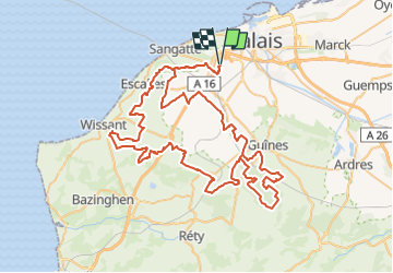
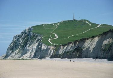
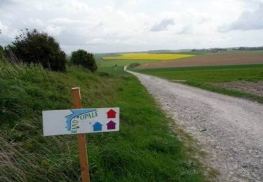
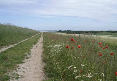
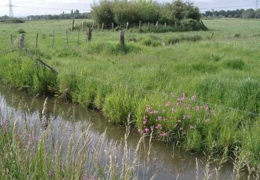
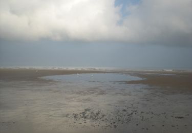
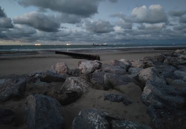
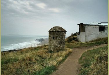
Trail Mountain bike of 90 km to be discovered at Hauts-de-France, Pas-de-Calais, Coquelles. This trail is proposed by topolino.

Description

parcours du 90 kms du Raid du Roc d'Opale

Elevation profile

Positioning

Country:
France
Region :
Hauts-de-France
Department/Province :
Pas-de-Calais
Municipality :
Coquelles
Location:
Unknown
Start:(UTM)
416439 ; 5643068 (31U) N.

Trails nearby

Trail Walking Sangatte - Les Noires Mottes - Sangatte - Photo
Walking
tracegps

Walking

Medium
(1)
Sangatte, Hauts-de-France, Pas-de-Calais, France
19.6 km | 25 km-effort
4h 0min
No
Trail Walking Calais - Calais visite vie - Photo
Walking
RoMo

Walking

Easy
Calais, Hauts-de-France, Pas-de-Calais, France
5.7 km | 6.2 km-effort
1h 49min
Yes
Trail On foot Calais - GRP Tour du Calaisis - Photo
On foot
PRO

On foot

Medium
Calais, Hauts-de-France, Pas-de-Calais, France
24 km | 28 km-effort
6h 15min
No
Trail Walking Bonningues-lès-Calais - Chemin de la Folie - Bonningues-les-Calais - Photo
Walking
tracegps

Walking

Medium
Bonningues-lès-Calais, Hauts-de-France, Pas-de-Calais, France
9.8 km | 11.5 km-effort
2h 30min
Yes
Trail Walking Peuplingues - Sentier des fonds - Peuplingues - Photo
Walking
tracegps

Walking

Medium
(1)
Peuplingues, Hauts-de-France, Pas-de-Calais, France
11.2 km | 13.3 km-effort
2h 49min
Yes
Trail Walking Saint-Tricat - La boucle des marais - St Tricat - Photo
Walking
tracegps

Walking

Medium
Saint-Tricat, Hauts-de-France, Pas-de-Calais, France
10.5 km | 11.3 km-effort
2h 40min
Yes
Trail Walking Sangatte - Sur les traces de Blériot - Sangatte - Photo
Walking
tracegps

Walking

Medium
Sangatte, Hauts-de-France, Pas-de-Calais, France
9.9 km | 10.2 km-effort
2h 30min
Yes
Trail Other activity Sangatte - Ballade le long de la plage de Sangatte  - Photo
Other activity
dudu42

Other activity

Very easy
Sangatte, Hauts-de-France, Pas-de-Calais, France
8.9 km | 9.3 km-effort
1h 47min
Yes
Trail Mountain bike Calais - Le littoral de Calais à Wimereux - Photo
Mountain bike
tracegps

Mountain bike

Medium
Calais, Hauts-de-France, Pas-de-Calais, France
42 km | 48 km-effort
3h 0min
No


Close
My subscriptions