![](/images/other/stat-length.png)
![Trail Walking Crisnée - Le long de la rivière Geer à Lauw - Photo](https://media.geolcdn.com/t/1900/400/40f99ee7-f765-490b-b3f6-81270c870ae1.jpg&format=pjpeg&maxdim=2)
Le long de la rivière Geer à Lauw
Benjamin27
User GUIDE
![Length](/images/other/stat-length.png)
![Max alt](https://static1.geolcdn.com/siteimages/upload/files/1508320355ic_sort_altitude_max_24dp.png)
![Uphill gradient](https://static1.geolcdn.com/siteimages/upload/files/1508320355ic_sort_den_pos_24dp.png)
![Km-Effort](/images/other/stat-length.png)
![Min alt](https://static1.geolcdn.com/siteimages/upload/files/1508320355ic_sort_altitude_min_24dp.png)
![Downhill gradient](https://static1.geolcdn.com/siteimages/upload/files/1508320355ic_sort_den_neg_24dp.png)
![Boucle](https://static1.geolcdn.com/siteimages/upload/files/16400158638029165_repeat_loop_refresh_sync_direction_icon.png)
![Walking](https://static1.geolcdn.com/sitytour/trail-icons/101.png)
1h32
Difficulty : Medium
![Scan this QR Code to open this trail in the SityTrail application](https://capi.geolives.com/qq0zvz2zws4bq2lad0pu/sitytour/trails/3350288/qr.png?size=200)
FREE GPS app for hiking
About
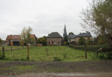
Trail Walking of 6.1 km to be discovered at Wallonia, Liège, Crisnée. This trail is proposed by Benjamin27.
Description
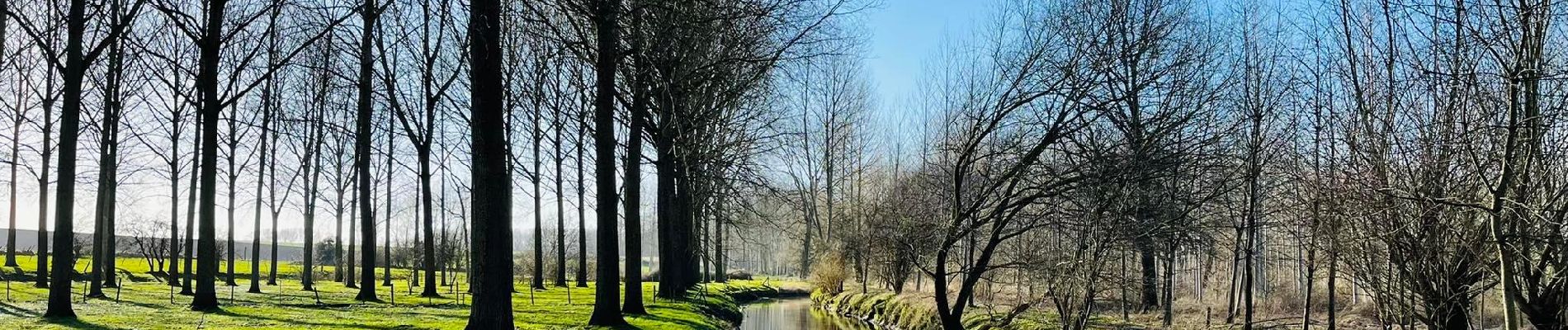
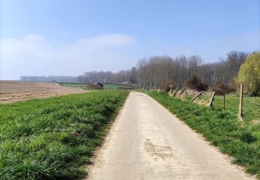
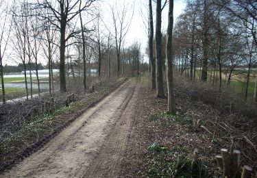
Cette promenade vous emmène, au fil de l’eau, dans le village et la vallée du Geer. Cette vallée est à cheval sur la Wallonie et la Flandre et est un territoire très propice aux vergers caractéristiques de la région agro-géographique de Hesbaye.
👣 Distance : 6km - balisage flèche rouge.
📍Départ : parking prévu à Schutterijstraat - 3700 Tongeren.
🚂🚍 Aller à la gare de Tongres et prendre le bus DE LIJN T3 jusqu’à l’arrêt « Lauw - Brug ».
Positioning
Comments
Trails nearby
![Trail Walking Tongeren - Promenade de la beauté cachée à Lauw - Photo](https://media.geolcdn.com/t/375/260/e09aa99f-84cb-4b46-8a0c-50d633d5a7ef.jpg&format=jpg&maxdim=2)
![Walking Walking](https://static1.geolcdn.com/sitytour/trail-icons/101.png)
Walking
![](/images/other/stat-length.png)
![](https://static1.geolcdn.com/siteimages/upload/files/16400158638029165_repeat_loop_refresh_sync_direction_icon.png)
![Trail On foot Tongeren - Rond de bronnen van de Mombeek - Photo](https://media.geolcdn.com/t/375/260/13e3acb7-2467-4a11-bfa7-f876dab6b0eb.jpeg&format=jpg&maxdim=2)
![On foot On foot](https://static1.geolcdn.com/sitytour/trail-icons/100.png)
On foot
![](/images/other/stat-length.png)
![](https://static1.geolcdn.com/siteimages/upload/files/16400158638029165_repeat_loop_refresh_sync_direction_icon.png)
![Trail On foot Tongeren - Widooie - Photo](https://media.geolcdn.com/t/375/260/1460d0c9-37d5-4e75-86eb-ce79ff244b22.jpeg&format=jpg&maxdim=2)
![On foot On foot](https://static1.geolcdn.com/sitytour/trail-icons/100.png)
![Trail On foot Herstappe - Jan Zonder Vrees groen - Photo](https://media.geolcdn.com/t/375/260/8c994372-58a4-4468-b951-db2635919c01.jpeg&format=jpg&maxdim=2)
![On foot On foot](https://static1.geolcdn.com/sitytour/trail-icons/100.png)
On foot
![](/images/other/stat-length.png)
![](https://static1.geolcdn.com/siteimages/upload/files/16400158638029165_repeat_loop_refresh_sync_direction_icon.png)
![Trail On foot Herstappe - Jan Zonder Vrees geel - Photo](https://media.geolcdn.com/t/375/260/8c994372-58a4-4468-b951-db2635919c01.jpeg&format=jpg&maxdim=2)
![On foot On foot](https://static1.geolcdn.com/sitytour/trail-icons/100.png)
On foot
![](/images/other/stat-length.png)
![](https://static1.geolcdn.com/siteimages/upload/files/16400158638029165_repeat_loop_refresh_sync_direction_icon.png)
![Trail On foot Tongeren - Rutten - Photo](https://media.geolcdn.com/t/375/260/128745d3-c995-43bd-9aeb-f310fcbdef14.jpeg&format=jpg&maxdim=2)
![On foot On foot](https://static1.geolcdn.com/sitytour/trail-icons/100.png)
![Trail On foot Tongeren - Evermaruspad - Photo](https://media.geolcdn.com/t/375/260/f7674873-62f0-49d5-a77c-72417cfbbe5a.jpeg&format=jpg&maxdim=2)
![On foot On foot](https://static1.geolcdn.com/sitytour/trail-icons/100.png)
On foot
![](/images/other/stat-length.png)
![](https://static1.geolcdn.com/siteimages/upload/files/16400158638029165_repeat_loop_refresh_sync_direction_icon.png)
![Trail On foot Tongeren - Lauw Rode pijl - Photo](https://media.geolcdn.com/t/375/260/84c62846-6479-45e1-9eb2-db2c2970fa27.jpeg&format=jpg&maxdim=2)
![On foot On foot](https://static1.geolcdn.com/sitytour/trail-icons/100.png)
On foot
![](/images/other/stat-length.png)
![](https://static1.geolcdn.com/siteimages/upload/files/16400158638029165_repeat_loop_refresh_sync_direction_icon.png)
![Trail On foot Heers - Heks Gele zeshoek - Photo](https://media.geolcdn.com/t/375/260/36df117b-7339-4784-a777-c6e22daa321b.jpeg&format=jpg&maxdim=2)
![On foot On foot](https://static1.geolcdn.com/sitytour/trail-icons/100.png)
On foot
![](/images/other/stat-length.png)
![](https://static1.geolcdn.com/siteimages/upload/files/16400158638029165_repeat_loop_refresh_sync_direction_icon.png)