![](/images/other/stat-length.png)
![Trail Walking Sint-Truiden - Le site géologique d'Engelmanshoven - Photo](https://media.geolcdn.com/t/1900/400/1cd9f61a-00ed-406a-b741-5cecfcd7b4ef.jpeg&format=pjpeg&maxdim=2)
Le site géologique d'Engelmanshoven
Benjamin27
User GUIDE
![Length](/images/other/stat-length.png)
![Max alt](https://static1.geolcdn.com/siteimages/upload/files/1508320355ic_sort_altitude_max_24dp.png)
![Uphill gradient](https://static1.geolcdn.com/siteimages/upload/files/1508320355ic_sort_den_pos_24dp.png)
![Km-Effort](/images/other/stat-length.png)
![Min alt](https://static1.geolcdn.com/siteimages/upload/files/1508320355ic_sort_altitude_min_24dp.png)
![Downhill gradient](https://static1.geolcdn.com/siteimages/upload/files/1508320355ic_sort_den_neg_24dp.png)
![Boucle](https://static1.geolcdn.com/siteimages/upload/files/16400158638029165_repeat_loop_refresh_sync_direction_icon.png)
![Walking](https://static1.geolcdn.com/sitytour/trail-icons/101.png)
18m
Difficulty : Easy
![Scan this QR Code to open this trail in the SityTrail application](https://capi.geolives.com/qq0zvz2zws4bq2lad0pu/sitytour/trails/3350258/qr.png?size=200)
FREE GPS app for hiking
About
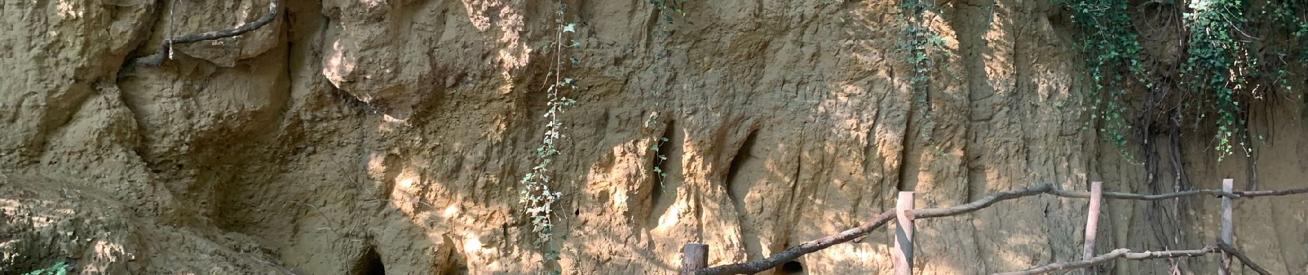
Trail Walking of 1.1 km to be discovered at Flanders, Limburg, Sint-Truiden. This trail is proposed by Benjamin27.
Description
Très courte mais riche en paysages magnifiques! Très agréable et tranquille. Je recommande !
👣 Distance : 1km - balisage flèche bleue.
📍 Départ : croisement entre Engelmanshoven-dorp et Bosstraat à Sint-Truiden.
🚂🚍 Aller à la gare de Saint-Trond, prendre le bus DE LIJN 26 jusqu’à l’arrêt « Gelinden Sint-Jansberg » et marcher 16 minutes jusqu’au départ.
Positioning
Comments
Trails nearby
![Trail Walking Sint-Truiden - Aalst Dorp - Photo](https://media.geolcdn.com/t/375/260/ext.jpg?maxdim=2&url=https%3A%2F%2Fservices.sitytrail.com%2FGeolivesWS%2FDownloadMedia.ashx%3FTrailID%3D238221%26Media%3Dfix__20131125132034.jpg)
![Walking Walking](https://static1.geolcdn.com/sitytour/trail-icons/101.png)
Walking
![](/images/other/stat-length.png)
![](https://static1.geolcdn.com/siteimages/upload/files/16400158638029165_repeat_loop_refresh_sync_direction_icon.png)
![Trail On foot Borgloon - Perenboomgaardwandeling - Photo](https://media.geolcdn.com/t/375/260/83d08ccc-3d46-4f67-87f8-eb2b08e4c23b.jpeg&format=jpg&maxdim=2)
![On foot On foot](https://static1.geolcdn.com/sitytour/trail-icons/100.png)
On foot
![](/images/other/stat-length.png)
![](https://static1.geolcdn.com/siteimages/upload/files/16400158638029165_repeat_loop_refresh_sync_direction_icon.png)
![Trail On foot Heers - Hornbos Groen - Photo](https://media.geolcdn.com/t/375/260/504e6508-a890-4ba4-87e9-eb16d6acfb97.jpeg&format=jpg&maxdim=2)
![On foot On foot](https://static1.geolcdn.com/sitytour/trail-icons/100.png)
![Trail On foot Sint-Truiden - Groot-Gelmen oranje bol - Photo](https://media.geolcdn.com/t/375/260/e3c1a60f-45b7-489f-b886-f877e1eeeb3d.jpeg&format=jpg&maxdim=2)
![On foot On foot](https://static1.geolcdn.com/sitytour/trail-icons/100.png)
On foot
![](/images/other/stat-length.png)
![](https://static1.geolcdn.com/siteimages/upload/files/16400158638029165_repeat_loop_refresh_sync_direction_icon.png)
![Trail On foot Sint-Truiden - Gelinden rode driehoek - Photo](https://media.geolcdn.com/t/375/260/dc0c05ae-7bd4-4447-94f8-784a4fb67064.jpeg&format=jpg&maxdim=2)
![On foot On foot](https://static1.geolcdn.com/sitytour/trail-icons/100.png)
On foot
![](/images/other/stat-length.png)
![](https://static1.geolcdn.com/siteimages/upload/files/16400158638029165_repeat_loop_refresh_sync_direction_icon.png)
![Trail On foot Heers - Mettekoven Oranje bol - Photo](https://media.geolcdn.com/t/375/260/90108129-83cc-42c0-874e-26bc3dd1e893.jpeg&format=jpg&maxdim=2)
![On foot On foot](https://static1.geolcdn.com/sitytour/trail-icons/100.png)
On foot
![](/images/other/stat-length.png)
![](https://static1.geolcdn.com/siteimages/upload/files/16400158638029165_repeat_loop_refresh_sync_direction_icon.png)
![Trail On foot Heers - Mettekoven Rode driehoek - Photo](https://media.geolcdn.com/t/375/260/396414c0-a30e-4c91-a80e-8e7581686d25.jpeg&format=jpg&maxdim=2)
![On foot On foot](https://static1.geolcdn.com/sitytour/trail-icons/100.png)
On foot
![](/images/other/stat-length.png)
![](https://static1.geolcdn.com/siteimages/upload/files/16400158638029165_repeat_loop_refresh_sync_direction_icon.png)
![Trail Walking Borgloon - Borgloon - Photo](https://media.geolcdn.com/t/375/260/b21eedb8-76a7-4233-ba36-331585646a91.jpg&format=jpg&maxdim=2)
![Walking Walking](https://static1.geolcdn.com/sitytour/trail-icons/101.png)
![Trail Walking Heers - Klein-Gelmen - Photo](https://media.geolcdn.com/t/375/260/b974d725-307d-4727-9f84-41626858fa2c.jpg&format=jpg&maxdim=2)
![Walking Walking](https://static1.geolcdn.com/sitytour/trail-icons/101.png)
Walking
![](/images/other/stat-length.png)
![](https://static1.geolcdn.com/siteimages/upload/files/16400158638029165_repeat_loop_refresh_sync_direction_icon.png)