


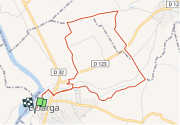

9.6 km | 11.4 km-effort


User


FREE GPS app for hiking
 SityTrail
IGN / Geographical institutes
SityTrail World
The world is yours!
Trail of 6.2 km to be discovered at Occitania, Hérault, Bélarga. This trail is proposed by jeanne2209.
Situé au sud de la vallée de l’Hérault, au coeur de la plaine viticole et sur les rives du fleuve Hérault, le village de Bélarga s’intègre dans un paysage d’une grande diversité. Son développement et son histoire furent étroitement liés à la proximité du fleuve et de ses deux affluents : le Rouviège et le Dardaillon. Cette variante courte du PR De Rouviège à Dardaillon traverse le ruisseau de Rouviège sur le pont dit 'd'Hannibal'
Walking

Walking
Mountain bike
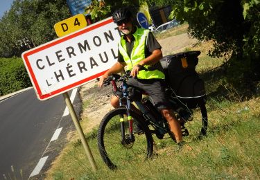
Bicycle tourism
Walking
Walking
Walking
Walking
Walking