


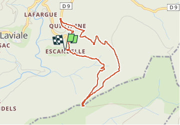

6.4 km | 10 km-effort


User


FREE GPS app for hiking
 SityTrail
IGN / Geographical institutes
SityTrail World
The world is yours!
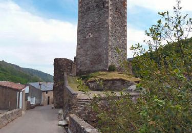
Trail Walking of 4.6 km to be discovered at Occitania, Aude, Castans. This trail is proposed by louisng.
Par le chemin de Paulette puis le chemin de la source pour suivre l'usqu'a l'ancien relais que l'on contourne jusqu'au poirier.
On peut revenir en suivant la piste vers l'est jusqu'au chemin qui revient à Escandelle par-là bergerie d'Adrien.

Walking
On foot

On foot

On foot

On foot

On foot
Walking
Walking
Walking