Trail Walking Le Biot - Le Biot - Seytroux - Photo
© OpenStreetMap contributors
Length
Length
9.3 km
Max alt
Max alt
947 m
Uphill gradient
Uphill gradient
373 m
Km-Effort
Km-Effort  
14.3 km
Min alt
Min alt
705 m
Downhill gradient
Downhill gradient
371 m
Boucle
Boucle
Yes
Creation date :
2014-12-10 00:00:00.0
Updated on :
2014-12-10 00:00:00.0

(0 Reviews)

Walking
Walking
3h05
Difficulty : Unknown

Scan this QR Code to open this trail in the SityTrail application

FREE GPS app for hiking

Logo SityTrail SityTrail

IGN / Geographical institutes

Download SityTrail from the App Store Download SityTrail from Google Play

Logo SityTrail SityTrail World

The world is yours!

Download SityTrail from the App Store Download SityTrail from Google Play Download SityTrail on Huawei AppGallery

About

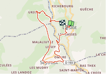
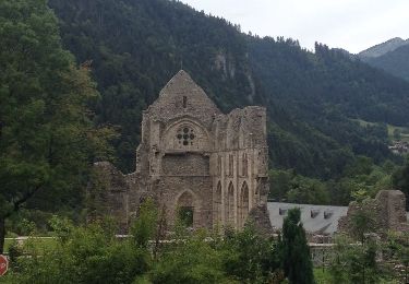
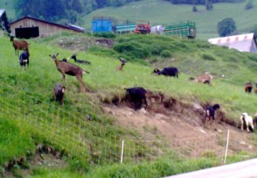
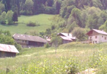
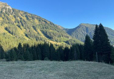
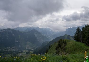
Trail Walking of 9.3 km to be discovered at Auvergne-Rhône-Alpes, Upper Savoy, Le Biot. This trail is proposed by thierry13710.

Description

Circuit entre Le Biot, Urine, Seytroux

Elevation profile

Positioning

Country:
France
Region :
Auvergne-Rhône-Alpes
Department/Province :
Upper Savoy
Municipality :
Le Biot
Location:
Unknown
Start:(UTM)
317344 ; 5125873 (32T) N.

Trails nearby

Trail Walking La Vernaz - Pont du Diable - La Touvière - Lac du Jotty - Photo
Walking
GUIDE
Kargil

Walking

Difficult
La Vernaz, Auvergne-Rhône-Alpes, Upper Savoy, France
16.8 km | 29 km-effort
4h 49min
Yes
Trail Walking Vailly - Pointe d'Ireuse par les Nifflons - Photo
Walking
christophe7406

Walking

Difficult
(1)
Vailly, Auvergne-Rhône-Alpes, Upper Savoy, France
8.5 km | 16.9 km-effort
4h 0min
Yes
Trail On foot Saint-Jean-d'Aulps - Tour des Portes du Soleil - Photo
On foot
GUIDE+

On foot

Very difficult
Saint-Jean-d'Aulps, Auvergne-Rhône-Alpes, Upper Savoy, France
34 km | 66 km-effort
15h 3min
No
Trail Walking Saint-Jean-d'Aulps - Lac de Damoz des Moulins - Photo
Walking
thierry13710

Walking

Medium
Saint-Jean-d'Aulps, Auvergne-Rhône-Alpes, Upper Savoy, France
11.4 km | 22 km-effort
3h 9min
Yes
Trail Walking Le Biot - La Pointe de la Croix depuis le Biot - Photo
Walking
thierry13710

Walking

Medium
Le Biot, Auvergne-Rhône-Alpes, Upper Savoy, France
19.3 km | 34 km-effort
7h 2min
Yes
Trail Walking Saint-Jean-d'Aulps - St Jean D'Aulps - Abondance - St Jean D'Aulps - Photo
Walking
tracegps

Walking

Difficult
Saint-Jean-d'Aulps, Auvergne-Rhône-Alpes, Upper Savoy, France
24 km | 42 km-effort
5h 0min
Yes
Trail Walking Saint-Jean-d'Aulps - La Grande Terche - Le Biot - Le Sey - La Grande Terche - Photo
Walking
tracegps

Walking

Medium
Saint-Jean-d'Aulps, Auvergne-Rhône-Alpes, Upper Savoy, France
18.1 km | 27 km-effort
3h 30min
Yes
Trail Walking Saint-Jean-d'Aulps - Les Mellis, La chaux , le col de l’écuelle , le pré nouveau  - Photo
Walking
ppapy

Walking

Difficult
Saint-Jean-d'Aulps, Auvergne-Rhône-Alpes, Upper Savoy, France
9.9 km | 17.9 km-effort
3h 39min
Yes
Trail Walking Saint-Jean-d'Aulps - La Pointe de la Croix 1815 m, depuis les Onchets - Saint Jean d''Aulps - Photo
Walking
tracegps

Walking

Easy
Saint-Jean-d'Aulps, Auvergne-Rhône-Alpes, Upper Savoy, France
9 km | 19.5 km-effort
4h 30min
Yes


Close
My subscriptions