Trail Electric bike Baiersbronn - buhlbach - Photo
 apa
apa

User

© OpenStreetMap contributors
Length
Length
52 km
Max alt
Max alt
1013 m
Uphill gradient
Uphill gradient
1004 m
Km-Effort
Km-Effort  
65 km
Min alt
Min alt
460 m
Downhill gradient
Downhill gradient
1007 m
Boucle
Boucle
Yes
Creation date :
2022-08-01 18:43:33.941
Updated on :
2022-08-01 18:45:18.678

(0 Reviews)

Electric bike
Electric bike
0m
Difficulty : Medium

Scan this QR Code to open this trail in the SityTrail application

FREE GPS app for hiking

Logo SityTrail SityTrail

IGN / Geographical institutes

Download SityTrail from the App Store Download SityTrail from Google Play

Logo SityTrail SityTrail World

The world is yours!

Download SityTrail from the App Store Download SityTrail from Google Play Download SityTrail on Huawei AppGallery

About

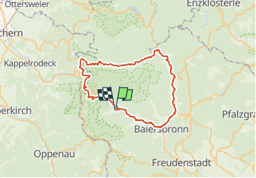
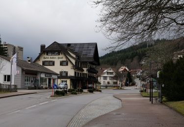
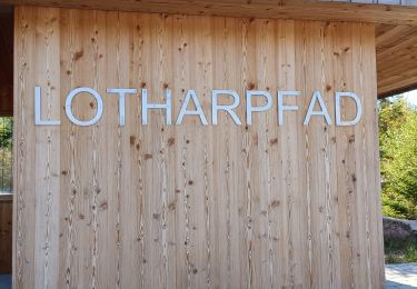
Trail Electric bike of 52 km to be discovered at Baden-Württemberg, Landkreis Freudenstadt, Baiersbronn. This trail is proposed by apa.

Elevation profile

Positioning

Country:
Germany
Region :
Baden-Württemberg
Department/Province :
Landkreis Freudenstadt
Municipality :
Baiersbronn
Location:
Unknown
Start:(UTM)
447041 ; 5375581 (32U) N.

Trails nearby

Trail On foot Seebach - Genießerpfad - Bosensteiner Almpfad - Photo
On foot
GUIDE+

On foot

Easy
Seebach, Baden-Württemberg, Ortenaukreis, Germany
8.5 km | 12.7 km-effort
2h 53min
Yes
Trail On foot Baiersbronn - Mitteltal - Dreirevierstein - Photo
On foot
GUIDE+

On foot

Easy
Baiersbronn, Baden-Württemberg, Landkreis Freudenstadt, Germany
6.6 km | 10.7 km-effort
2h 25min
No
Trail On foot Baiersbronn - Schöner Platz-Hänger - Photo
On foot
GUIDE+

On foot

Easy
Baiersbronn, Baden-Württemberg, Landkreis Freudenstadt, Germany
5.9 km | 7.4 km-effort
1h 40min
No
Trail On foot Baiersbronn - Mitteltal - Kniebis - Photo
On foot
GUIDE+

On foot

Easy
Baiersbronn, Baden-Württemberg, Landkreis Freudenstadt, Germany
6.6 km | 10.6 km-effort
2h 24min
No
Trail On foot Baiersbronn - Obertal - Ruhestein - Photo
On foot
GUIDE+

On foot

Easy
Baiersbronn, Baden-Württemberg, Landkreis Freudenstadt, Germany
7 km | 10.3 km-effort
2h 20min
No
Trail On foot Baiersbronn - Obertal - Zuflucht - Photo
On foot
GUIDE+

On foot

Easy
Baiersbronn, Baden-Württemberg, Landkreis Freudenstadt, Germany
6.8 km | 11.1 km-effort
2h 30min
No
Trail Walking Baiersbronn - Lotharpfad - Photo
Walking
apa

Walking

Easy
Baiersbronn, Baden-Württemberg, Landkreis Freudenstadt, Germany
877 m | 1 km-effort
22min
Yes
Trail On foot Baiersbronn - Spaltbächle-Lotharpfad - Photo
On foot
GUIDE+

On foot

Easy
Baiersbronn, Baden-Württemberg, Landkreis Freudenstadt, Germany
3.2 km | 5.4 km-effort
1h 13min
No
Trail On foot Baiersbronn - Terrainkurweg - Photo
On foot
GUIDE+

On foot

Easy
Baiersbronn, Baden-Württemberg, Landkreis Freudenstadt, Germany
5.2 km | 6.4 km-effort
1h 27min
No


Close
My subscriptions