Trail Walking Les Belleville - FR - VAL THORENS - Lac du Lou (en passant par Pepe Nicolas)  - Photo

FR - VAL THORENS - Lac du Lou (en passant par Pepe Nicolas)

 pecha
pecha

User

© OpenStreetMap contributors
Length
Length
10.9 km
Max alt
Max alt
2054 m
Uphill gradient
Uphill gradient
414 m
Km-Effort
Km-Effort  
16.4 km
Min alt
Min alt
1747 m
Downhill gradient
Downhill gradient
406 m
Boucle
Boucle
Yes
Creation date :
2015-05-30 00:00:00.0
Updated on :
2015-05-30 00:00:00.0

(1 Reviews)

Walking
Walking
5h20
Difficulty : Easy

Scan this QR Code to open this trail in the SityTrail application

FREE GPS app for hiking

Logo SityTrail SityTrail

IGN / Geographical institutes

Download SityTrail from the App Store Download SityTrail from Google Play

Logo SityTrail SityTrail World

The world is yours!

Download SityTrail from the App Store Download SityTrail from Google Play Download SityTrail on Huawei AppGallery

About

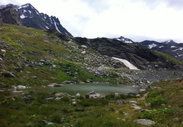
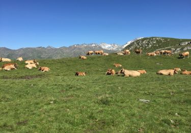
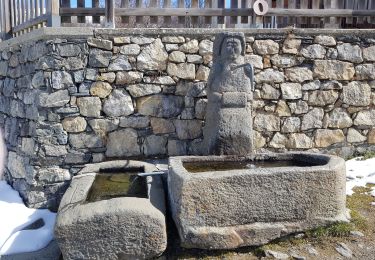
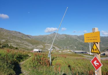
Trail Walking of 10.9 km to be discovered at Auvergne-Rhône-Alpes, Savoy, Les Belleville. This trail is proposed by pecha.

Description

Randonnée magnifique mais très fréquentée. Partir tôt pour bénéficier d'un peu de tranquillité.

Elevation profile

Photos

Points of interest

Point of interest Les Belleville - Chez Pépé Nicolas - Photo
pecha
LES BELLEVILLE 

Positioning

Country:
France
Region :
Auvergne-Rhône-Alpes
Department/Province :
Savoy
Municipality :
Les Belleville
Location:
Saint-Martin-de-Belleville
Start:(UTM)
306963 ; 5021081 (32T) N.

Comments

Please log in to post a review or rate the element


Trails nearby

Trail Walking Les Belleville - FR - VAL THORENS - Circuit des lacs de Val-Thorens - Photo
Walking
pecha

Walking

Very easy
(1)
Les Belleville, Auvergne-Rhône-Alpes, Savoy, France
6.2 km | 8.6 km-effort
4h 15min
Yes
Trail Walking Les Belleville - FR - VAL THORENS - Lac du Montaulever - Photo
Walking
pecha

Walking

Very easy
(2)
Les Belleville, Auvergne-Rhône-Alpes, Savoy, France
4.5 km | 8.3 km-effort
2h 9min
Yes
Trail Walking Les Belleville - le lou-la masse-les lacs - Photo
Walking
stef54

Walking

Very difficult
(1)
Les Belleville, Auvergne-Rhône-Alpes, Savoy, France
23 km | 43 km-effort
7h 2min
No
Trail Walking Les Belleville - Le sentier des Choumes ( N °9) - Photo
Walking
GUIDE
mumu.larandonneuse

Walking

Easy
Les Belleville, Auvergne-Rhône-Alpes, Savoy, France
6.7 km | 8.8 km-effort
1h 36min
No
Trail Walking Les Belleville - N°1 - La découverte des village au fil du Doron - Photo
Walking
GUIDE
mumu.larandonneuse

Walking

Easy
Les Belleville, Auvergne-Rhône-Alpes, Savoy, France
9.4 km | 12.4 km-effort
1h 54min
No
Trail Walking Les Belleville - Le sentier Giraud - N° 8 - Photo
Walking
GUIDE
mumu.larandonneuse

Walking

Easy
Les Belleville, Auvergne-Rhône-Alpes, Savoy, France
5 km | 6.5 km-effort
1h 9min
No
Trail Walking Les Belleville - La Croisette  - Le Plan d'eau des Bruyères  - Photo
Walking
GUIDE
mumu.larandonneuse

Walking

Easy
Les Belleville, Auvergne-Rhône-Alpes, Savoy, France
7.7 km | 10.5 km-effort
1h 53min
Yes
Trail Walking Les Belleville - Lac du Lou  - Photo
Walking
GUIDE
lhomme.ph

Walking

Medium
Les Belleville, Auvergne-Rhône-Alpes, Savoy, France
11.3 km | 15.5 km-effort
4h 38min
Yes
Trail Walking Les Belleville - descente point de la masse - Photo
Walking
zby32

Walking

Medium
(1)
Les Belleville, Auvergne-Rhône-Alpes, Savoy, France
9.3 km | 13.3 km-effort
3h 30min
No


Close
My subscriptions