Trail Walking Saint-Julien-en-Beauchêne - Durbonas depuis Baumugne, par le col de la Becha - Photo

Durbonas depuis Baumugne, par le col de la Becha

© OpenStreetMap contributors
Length
Length
11.9 km
Max alt
Max alt
2074 m
Uphill gradient
Uphill gradient
1086 m
Km-Effort
Km-Effort  
26 km
Min alt
Min alt
1034 m
Downhill gradient
Downhill gradient
1087 m
Boucle
Boucle
Yes
Creation date :
2022-08-01 04:46:40.94
Updated on :
2022-08-01 12:03:25.075

(0 Reviews)

Walking
Walking
5h49
Difficulty : Difficult

Scan this QR Code to open this trail in the SityTrail application

FREE GPS app for hiking

Logo SityTrail SityTrail

IGN / Geographical institutes

Download SityTrail from the App Store Download SityTrail from Google Play

Logo SityTrail SityTrail World

The world is yours!

Download SityTrail from the App Store Download SityTrail from Google Play Download SityTrail on Huawei AppGallery

About

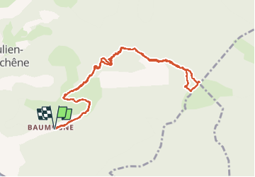
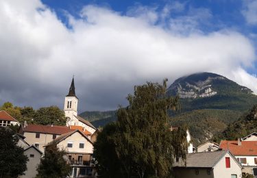
Trail Walking of 11.9 km to be discovered at Provence-Alpes-Côte d'Azur, Hautes-Alpes, Saint-Julien-en-Beauchêne. This trail is proposed by jcpistono.

Description

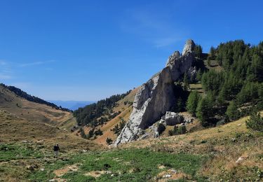
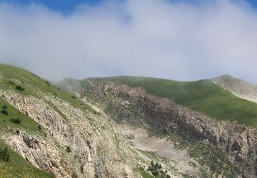
ascension tres sympa. 1086 m de d .
4 heures de marche.
Montée très raide entre  le col de la Becha et les premiers herbages du ''plateau''.
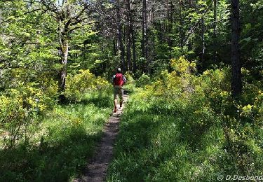
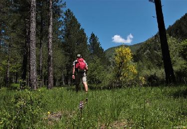
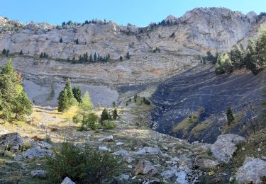
Parcours en quasi totalité a l'ombre.
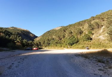
descente possible vers Durbon (en laissant une 2eme voiture sur cjemin du retour après les colonies.

Elevation profile

Positioning

Country:
France
Region :
Provence-Alpes-Côte d'Azur
Department/Province :
Hautes-Alpes
Municipality :
Saint-Julien-en-Beauchêne
Location:
Unknown
Start:(UTM)
716242 ; 4942526 (31T) N.

Trails nearby

Trail Walking La Faurie - R40   Les Marmites du Diable - Photo
Walking
GUIDE+

Walking

Medium
(6)
La Faurie, Provence-Alpes-Côte d'Azur, Hautes-Alpes, France
5.9 km | 10.4 km-effort
2h 7min
Yes
Trail Walking Saint-Julien-en-Beauchêne - Chamousset - Photo
Walking
GUIDE
Marco05

Walking

Difficult
Saint-Julien-en-Beauchêne, Provence-Alpes-Côte d'Azur, Hautes-Alpes, France
11.2 km | 22 km-effort
5h 1min
Yes
Trail On foot Montbrand - 9587037(1) - Photo
On foot
GUIDE+

On foot

Easy
Montbrand, Provence-Alpes-Côte d'Azur, Hautes-Alpes, France
3.5 km | 4.6 km-effort
1h 2min
Yes
Trail On foot Aspres-sur-Buëch - 9587028 - Photo
On foot
GUIDE+

On foot

Easy
Aspres-sur-Buëch, Provence-Alpes-Côte d'Azur, Hautes-Alpes, France
3.4 km | 5.3 km-effort
1h 12min
Yes
Trail Walking Saint-Julien-en-Beauchêne - tour des 4 cols - Photo
Walking
GuyVachet

Walking

Very difficult
Saint-Julien-en-Beauchêne, Provence-Alpes-Côte d'Azur, Hautes-Alpes, France
13.2 km | 24 km-effort
5h 25min
Yes
Trail Walking Saint-Julien-en-Beauchêne - Dorbon l'ancienne chartreuse  - Photo
Walking
GILOU440

Walking

Medium
Saint-Julien-en-Beauchêne, Provence-Alpes-Côte d'Azur, Hautes-Alpes, France
12.6 km | 20 km-effort
4h 15min
Yes
Trail Walking Saint-Julien-en-Beauchêne - Chamousset (Lus-La-Croix-Haute) - Photo
Walking
Philindy26

Walking

Difficult
Saint-Julien-en-Beauchêne, Provence-Alpes-Côte d'Azur, Hautes-Alpes, France
12 km | 25 km-effort
4h 30min
Yes
Trail Walking Saint-Julien-en-Beauchêne - les 4 cols - Photo
Walking
elibelle

Walking

Medium
Saint-Julien-en-Beauchêne, Provence-Alpes-Côte d'Azur, Hautes-Alpes, France
13.7 km | 23 km-effort
5h 12min
Yes
Trail Walking La Faurie - les marmites du Diable - Photo
Walking
Thierry.T

Walking

Difficult
La Faurie, Provence-Alpes-Côte d'Azur, Hautes-Alpes, France
6.1 km | 10.4 km-effort
2h 59min
Yes


Close
My subscriptions