![](/images/other/stat-length.png)
![Trail Hybrid bike Bouin - Bouin-Boucle marais et digues - Photo](https://media.geolcdn.com/t/1900/400/76a8df03-2986-44c5-9c04-b5c448f6a754.jpg&format=pjpeg&maxdim=2)
Bouin-Boucle marais et digues
Sigmut
User
![Length](/images/other/stat-length.png)
![Max alt](https://static1.geolcdn.com/siteimages/upload/files/1508320355ic_sort_altitude_max_24dp.png)
![Uphill gradient](https://static1.geolcdn.com/siteimages/upload/files/1508320355ic_sort_den_pos_24dp.png)
![Km-Effort](/images/other/stat-length.png)
![Min alt](https://static1.geolcdn.com/siteimages/upload/files/1508320355ic_sort_altitude_min_24dp.png)
![Downhill gradient](https://static1.geolcdn.com/siteimages/upload/files/1508320355ic_sort_den_neg_24dp.png)
![Boucle](https://static1.geolcdn.com/siteimages/upload/files/16400158638029165_repeat_loop_refresh_sync_direction_icon.png)
![Hybrid bike](https://static1.geolcdn.com/sitytour/trail-icons/203.png)
1h29
Difficulty : Very easy
![Scan this QR Code to open this trail in the SityTrail application](https://capi.geolives.com/qq0zvz2zws4bq2lad0pu/sitytour/trails/3336721/qr.png?size=200)
FREE GPS app for hiking
About
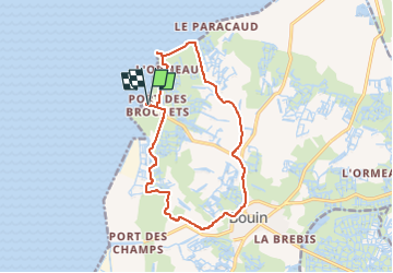
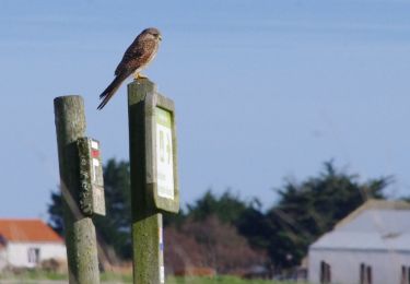
Trail Hybrid bike of 14.2 km to be discovered at Pays de la Loire, Vendée, Bouin. This trail is proposed by Sigmut.
Description
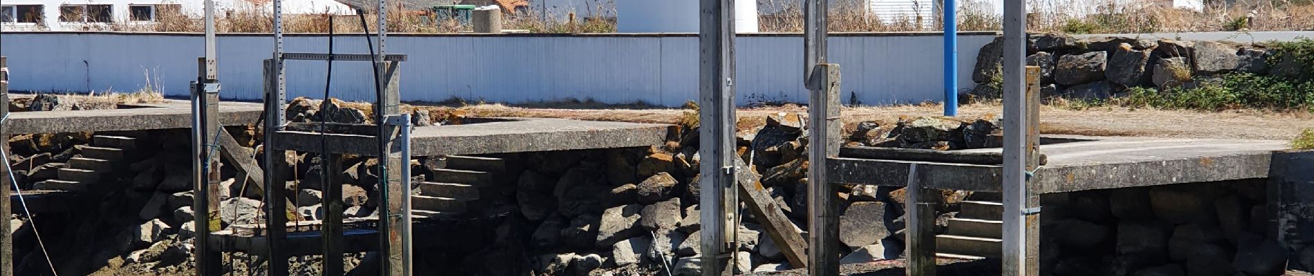
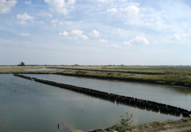
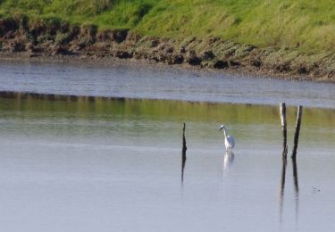
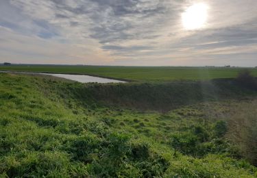
Balade vélo très agréable avec des paysages diverses.
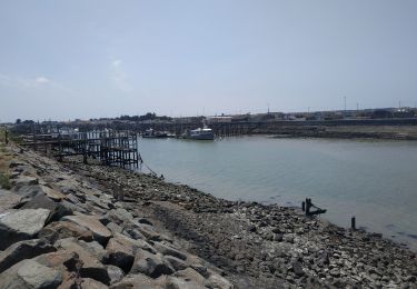
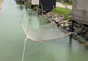
Réserver absolument un repas à midi au restaurant et bar à huîtres "Gratt'huîtres". Tout est local et délicieux.
Faire ses courses à "La Rose des Vents" pour acheter ses huitres fraiches et locales ainsi que le sel de Bouin beaucoup moins cher et moins pollué qu'à Noirmoitier envahit par la bagnole.
Positioning
Comments
Trails nearby
![Trail Cycle Bouin - bouin - port des brochets - Photo](https://media.geolcdn.com/t/375/260/ext.jpg?maxdim=2&url=https%3A%2F%2Fstatic1.geolcdn.com%2Fsiteimages%2Fupload%2Ffiles%2F1524743154velo.jpg)
![Cycle Cycle](https://static1.geolcdn.com/sitytour/trail-icons/200.png)
Cycle
![](/images/other/stat-length.png)
![](https://static1.geolcdn.com/siteimages/upload/files/16400158638029165_repeat_loop_refresh_sync_direction_icon.png)
![Trail On foot Villeneuve-en-Retz - PDIPR:1224 - Photo](https://media.geolcdn.com/t/375/260/1a57d417-9132-4bf4-870f-21ad0636d79e.jpeg&format=jpg&maxdim=2)
![On foot On foot](https://static1.geolcdn.com/sitytour/trail-icons/100.png)
On foot
![](/images/other/stat-length.png)
![](https://static1.geolcdn.com/siteimages/upload/files/16400158638029165_repeat_loop_refresh_sync_direction_icon.png)
![Trail On foot Bouin - Vers la Mer et les Digues - Photo](https://media.geolcdn.com/t/375/260/4ef582e9-f45f-4cb1-9a18-91197588b89d.jpeg&format=jpg&maxdim=2)
![On foot On foot](https://static1.geolcdn.com/sitytour/trail-icons/100.png)
On foot
![](/images/other/stat-length.png)
![](https://static1.geolcdn.com/siteimages/upload/files/16400158638029165_repeat_loop_refresh_sync_direction_icon.png)
![Trail On foot Bouin - Chemin des Oiseaux - Photo](https://media.geolcdn.com/t/375/260/afc4cdca-c735-43d5-92c0-996474eda780.jpeg&format=jpg&maxdim=2)
![On foot On foot](https://static1.geolcdn.com/sitytour/trail-icons/100.png)
On foot
![](/images/other/stat-length.png)
![](https://static1.geolcdn.com/siteimages/upload/files/16400158638029165_repeat_loop_refresh_sync_direction_icon.png)
![Trail Walking Bouin - Bouin_Les écluses - Photo](https://media.geolcdn.com/t/375/260/ext.jpg?maxdim=2&url=https%3A%2F%2Fservices.sitytrail.com%2FGeolivesWS%2FDownloadMedia.ashx%3FTrailID%3D516620%26Media%3D8d4e5f51-9594-4d47-9f19-d8403743d274.JPG)
![Walking Walking](https://static1.geolcdn.com/sitytour/trail-icons/101.png)
Walking
![](/images/other/stat-length.png)
![](https://static1.geolcdn.com/siteimages/upload/files/16400158638029165_repeat_loop_refresh_sync_direction_icon.png)
![Trail Road bike Les Moutiers-en-Retz - 2023-06-25 port du collet -port des champs - port du bec A.R - Photo](https://media.geolcdn.com/t/375/260/239f987b-fb5d-4c97-a07a-46e1d6ee0353.jpg&format=jpg&maxdim=2)
![Road bike Road bike](https://static1.geolcdn.com/sitytour/trail-icons/201.png)
Road bike
![](/images/other/stat-length.png)
![](https://static1.geolcdn.com/siteimages/upload/files/16400158638029165_repeat_loop_refresh_sync_direction_icon.png)
![Trail Walking Bouin - Bouin - Photo](https://media.geolcdn.com/t/375/260/1b7acdf2-1617-4b0e-aa20-13ce31269f6d.jpg&format=jpg&maxdim=2)
![Walking Walking](https://static1.geolcdn.com/sitytour/trail-icons/101.png)
![Trail Walking Les Moutiers-en-Retz - Marais de Bouin et Polder de la Coupelasse - Photo](https://media.geolcdn.com/t/375/260/f081bbb9-084c-4842-a239-92edeaf6330f.jpg&format=jpg&maxdim=2)
![Walking Walking](https://static1.geolcdn.com/sitytour/trail-icons/101.png)
Walking
![](/images/other/stat-length.png)
![](https://static1.geolcdn.com/siteimages/upload/files/16400158638029165_repeat_loop_refresh_sync_direction_icon.png)
![Trail Walking Bouin - Bouin_Le port des champs - Photo](https://media.geolcdn.com/t/375/260/ext.jpg?maxdim=2&url=https%3A%2F%2Fservices.sitytrail.com%2FGeolivesWS%2FDownloadMedia.ashx%3FTrailID%3D517646%26Media%3Dd8693f7d-a190-4a8e-893c-e13ff6aed3e7.JPG)
![Walking Walking](https://static1.geolcdn.com/sitytour/trail-icons/101.png)
Walking
![](/images/other/stat-length.png)
![](https://static1.geolcdn.com/siteimages/upload/files/16400158638029165_repeat_loop_refresh_sync_direction_icon.png)