Trail Walking Campan - Penz Lounque par Cap de la Taoula en boucle - Photo

Penz Lounque par Cap de la Taoula en boucle

 Prala
Prala

User

© OpenStreetMap contributors
Length
Length
12.2 km
Max alt
Max alt
2261 m
Uphill gradient
Uphill gradient
1168 m
Km-Effort
Km-Effort  
28 km
Min alt
Min alt
1124 m
Downhill gradient
Downhill gradient
1160 m
Boucle
Boucle
No
Creation date :
2022-07-30 05:47:50.98
Updated on :
2022-07-30 13:14:16.218

(0 Reviews)

Walking
Walking
3h57
Difficulty : Medium

Scan this QR Code to open this trail in the SityTrail application

FREE GPS app for hiking

Logo SityTrail SityTrail

IGN / Geographical institutes

Download SityTrail from the App Store Download SityTrail from Google Play

Logo SityTrail SityTrail World

The world is yours!

Download SityTrail from the App Store Download SityTrail from Google Play Download SityTrail on Huawei AppGallery

About

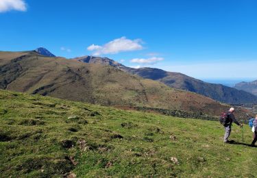
Trail Walking of 12.2 km to be discovered at Occitania, Hautespyrenees, Campan. This trail is proposed by Prala.

Description

Penz Lounque par Cap de la Taoula en boucle et retour par granges de Tramazaïe

Elevation profile

Positioning

Country:
France
Region :
Occitania
Department/Province :
Hautespyrenees
Municipality :
Campan
Location:
Unknown
Start:(UTM)
272731 ; 4758050 (31T) N.

Trails nearby

Trail Walking Campan - Lac d'Arizes - Campan - Photo
Walking
tracegps

Walking

Medium
(1)
Campan, Occitania, Hautespyrenees, France
10.2 km | 20 km-effort
3h 30min
Yes
Trail On foot Campan - SityTrail - 2444920 - artigues-la-mongie-g3-lpc-corrigex - Photo
On foot
JACQUESD

On foot

Very easy
(1)
Campan, Occitania, Hautespyrenees, France
7.8 km | 15.7 km-effort
Unknown
Yes
Trail Walking Campan - Pic Midi Bigorres - Photo
Walking
doume82

Walking

Difficult
(1)
Campan, Occitania, Hautespyrenees, France
9.2 km | 25 km-effort
4h 30min
No
Trail Walking Ancizan - CAMPAN/PAYOLLE le sarrouat les huîtres et les Esclozes
Walking
GUIDE
marmotte65

Walking

Medium
Ancizan, Occitania, Hautespyrenees, France
8 km | 11.1 km-effort
2h 31min
Yes
Trail Walking Ancizan - Les Granges esclozes - Photo
Walking
fred47

Walking

Easy
Ancizan, Occitania, Hautespyrenees, France
30 km | 36 km-effort
2h 49min
No
Trail Walking Campan - Fred et lolo  - Photo
Walking
fred47

Walking

Easy
Campan, Occitania, Hautespyrenees, France
4.2 km | 5.6 km-effort
2h 2min
Yes
Trail Walking Campan - pla de la serre depuis Ste Marie de Campan - Photo
Walking
GUIDE
lhomme.ph

Walking

Medium
Campan, Occitania, Hautespyrenees, France
9.1 km | 21 km-effort
6h 13min
Yes
Trail Walking Campan - Sarrat-cabane de Sarrède-col sous La Bèque-Sarrat - Photo
Walking
Martinet.Claude

Walking

Medium
Campan, Occitania, Hautespyrenees, France
6.9 km | 0 m-effort
2h 16min
Yes
Trail Walking Campan - Lac  d'Artizes - Photo
Walking
SabetMick

Walking

Difficult
Campan, Occitania, Hautespyrenees, France
10.6 km | 21 km-effort
4h 48min
Yes


Close
My subscriptions