Trail Walking Gemeinde Damüls - 2023 Oberdamuls 29 juli - Photo
© OpenStreetMap contributors
Length
Length
8.6 km
Max alt
Max alt
1678 m
Uphill gradient
Uphill gradient
315 m
Km-Effort
Km-Effort  
12.9 km
Min alt
Min alt
1368 m
Downhill gradient
Downhill gradient
349 m
Boucle
Boucle
No
Creation date :
2022-07-29 07:56:42.648
Updated on :
2022-07-29 13:11:42.265

(0 Reviews)

Walking
Walking
3h13
Difficulty : Medium

Scan this QR Code to open this trail in the SityTrail application

FREE GPS app for hiking

Logo SityTrail SityTrail

IGN / Geographical institutes

Download SityTrail from the App Store Download SityTrail from Google Play

Logo SityTrail SityTrail World

The world is yours!

Download SityTrail from the App Store Download SityTrail from Google Play Download SityTrail on Huawei AppGallery

About

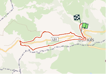
Trail Walking of 8.6 km to be discovered at Vorarlberg, Bezirk Bregenz, Gemeinde Damüls. This trail is proposed by herman ve.

Description

rondgang

Elevation profile

Positioning

Country:
Austria
Region :
Vorarlberg
Department/Province :
Bezirk Bregenz
Municipality :
Gemeinde Damüls
Location:
Unknown
Start:(UTM)
567175 ; 5237018 (32T) N.

Trails nearby

Trail Walking Gemeinde Sonntag - walser_26 - Photo
Walking
GUIDE+

Walking

Very easy
Gemeinde Sonntag, Vorarlberg, Bezirk Bludenz, Austria
14.1 km | 29 km-effort
Unknown
No
Trail Walking Gemeinde Damüls -  Damüls 2023 rundgang - Photo
Walking
herman ve

Walking

Difficult
Gemeinde Damüls, Vorarlberg, Bezirk Bregenz, Austria
11.7 km | 18.1 km-effort
5h 17min
No


Close
My subscriptions