![](/images/other/stat-length.png)
![Trail Walking Brousse-le-Château - J12:Brousse le Château-Villeneuve sur Tarn-200522 - Photo](https://media.geolcdn.com/t/1900/400/75f3ce81-fbc4-4c0b-8e11-1f347aef5b72.jpg&format=pjpeg&maxdim=2)
J12:Brousse le Château-Villeneuve sur Tarn-200522
canardDenis
User
![Length](/images/other/stat-length.png)
Length
23 km
![Max alt](https://static1.geolcdn.com/siteimages/upload/files/1508320355ic_sort_altitude_max_24dp.png)
Max alt
454 m
![Uphill gradient](https://static1.geolcdn.com/siteimages/upload/files/1508320355ic_sort_den_pos_24dp.png)
Uphill gradient
602 m
![Km-Effort](/images/other/stat-length.png)
Km-Effort
31 km
![Min alt](https://static1.geolcdn.com/siteimages/upload/files/1508320355ic_sort_altitude_min_24dp.png)
Min alt
208 m
![Downhill gradient](https://static1.geolcdn.com/siteimages/upload/files/1508320355ic_sort_den_neg_24dp.png)
Downhill gradient
628 m
![Boucle](https://static1.geolcdn.com/siteimages/upload/files/16400158638029165_repeat_loop_refresh_sync_direction_icon.png)
Boucle
No
Creation date :
2022-07-26 13:24:08.042
Updated on :
2022-07-28 09:03:53.234
![Walking](https://static1.geolcdn.com/sitytour/trail-icons/101.png)
7h02
Difficulty : Medium
![Scan this QR Code to open this trail in the SityTrail application](https://capi.geolives.com/qq0zvz2zws4bq2lad0pu/sitytour/trails/3330265/qr.png?size=200)
FREE GPS app for hiking
About
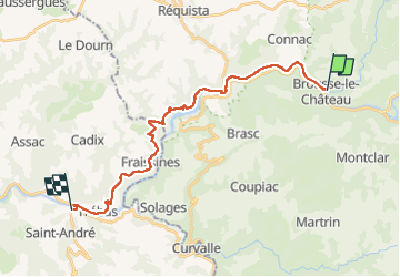
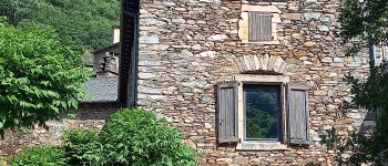
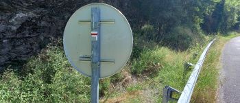
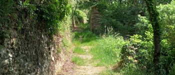
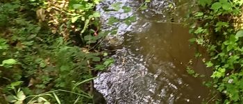
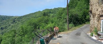
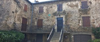
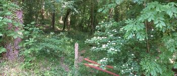
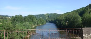
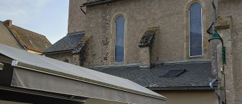
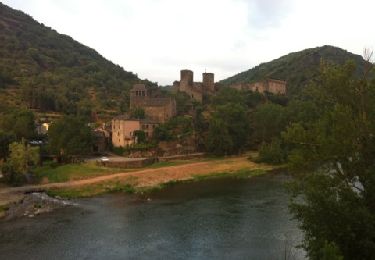
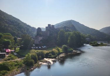
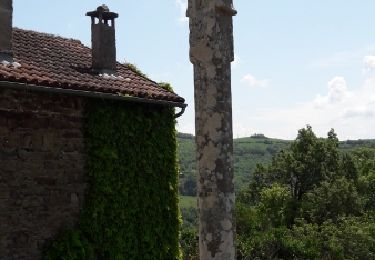
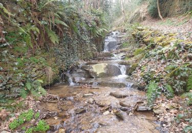
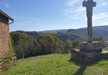
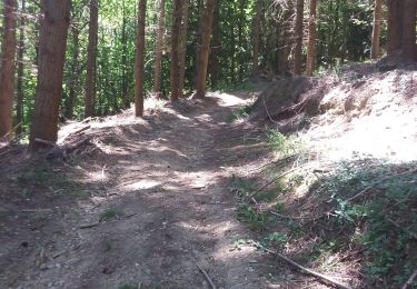
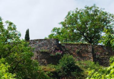
Trail Walking of 23 km to be discovered at Occitania, Aveyron, Brousse-le-Château. This trail is proposed by canardDenis.
Description
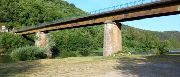
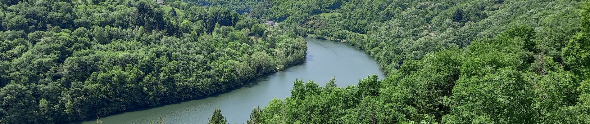
Suivre le Tarn au bord de l'eau depuis Brousse-le-Château puis Lincou. Le voir de plus haut en continuant à grimper en Rive Droite par des hameaux endormis pour redescendre après le 4ème barrage des Raspes, celui de La Croux et se reposer en Rive Gauche à Curvalle.
Points of interest
Positioning
Country:
France
Region :
Occitania
Department/Province :
Aveyron
Municipality :
Brousse-le-Château
Location:
Unknown
Start:(Dec)
Start:(UTM)
469916 ; 4871672 (31T) N.
Comments
Trails nearby
![Trail Walking Brousse-le-Château - Brousse Le Chateau et les alentours - Photo](https://media.geolcdn.com/t/375/260/ext.jpg?maxdim=2&url=https%3A%2F%2Fservices.sitytrail.com%2FGeolivesWS%2FDownloadMedia.ashx%3FTrailID%3D136506%26Media%3D20120630200246.jpg)
![Walking Walking](https://static1.geolcdn.com/sitytour/trail-icons/101.png)
Brousse Le Chateau et les alentours
Walking
Medium
(1)
Brousse-le-Château,
Occitania,
Aveyron,
France
![](/images/other/stat-length.png)
18.4 km | 27 km-effort
4h 54min
![](https://static1.geolcdn.com/siteimages/upload/files/16400158638029165_repeat_loop_refresh_sync_direction_icon.png)
Yes
![Trail Walking Brousse-le-Château - Boucle au départ de Brousse-le-château - Photo](https://media.geolcdn.com/t/375/260/4ff846f3-b937-48ee-b7df-8ca7906fca22.jpg&format=jpg&maxdim=2)
![Walking Walking](https://static1.geolcdn.com/sitytour/trail-icons/101.png)
Boucle au départ de Brousse-le-château
Walking
Difficult
Brousse-le-Château,
Occitania,
Aveyron,
France
![](/images/other/stat-length.png)
8.8 km | 13.3 km-effort
3h 1min
![](https://static1.geolcdn.com/siteimages/upload/files/16400158638029165_repeat_loop_refresh_sync_direction_icon.png)
Yes
![Trail Walking Brousse-le-Château - Brousse st martin - Photo](https://media.geolcdn.com/t/375/260/ext.jpg?maxdim=2&url=https%3A%2F%2Fservices.sitytrail.com%2FGeolivesWS%2FDownloadMedia.ashx%3FTrailID%3D1092812%26Media%3Dfix__20180520125323.jpg)
![Walking Walking](https://static1.geolcdn.com/sitytour/trail-icons/101.png)
Brousse st martin
Walking
Difficult
Brousse-le-Château,
Occitania,
Aveyron,
France
![](/images/other/stat-length.png)
8.5 km | 12.9 km-effort
2h 55min
![](https://static1.geolcdn.com/siteimages/upload/files/16400158638029165_repeat_loop_refresh_sync_direction_icon.png)
Yes
![Trail Walking Coupiac - coupiac in live - Photo](https://media.geolcdn.com/t/375/260/6a82bbd5-1aa3-417b-9db4-6de20dcabb3e.jpg&format=jpg&maxdim=2)
![Walking Walking](https://static1.geolcdn.com/sitytour/trail-icons/101.png)
coupiac in live
Walking
Medium
Coupiac,
Occitania,
Aveyron,
France
![](/images/other/stat-length.png)
18.9 km | 27 km-effort
4h 31min
![](https://static1.geolcdn.com/siteimages/upload/files/16400158638029165_repeat_loop_refresh_sync_direction_icon.png)
Yes
![Trail Walking Brousse-le-Château - brousse le chateau - Photo](https://media.geolcdn.com/t/375/260/3288565d-51e6-466e-8ae6-460dbde2126e.jpg&format=jpg&maxdim=2)
![Walking Walking](https://static1.geolcdn.com/sitytour/trail-icons/101.png)
brousse le chateau
Walking
Medium
Brousse-le-Château,
Occitania,
Aveyron,
France
![](/images/other/stat-length.png)
16.5 km | 24 km-effort
4h 28min
![](https://static1.geolcdn.com/siteimages/upload/files/16400158638029165_repeat_loop_refresh_sync_direction_icon.png)
Yes
![Trail Walking Connac - Boucle Connac Lincou - Photo](https://media.geolcdn.com/t/375/260/d851833b-ea89-4969-961c-6ec623654255.jpg&format=jpg&maxdim=2)
![Walking Walking](https://static1.geolcdn.com/sitytour/trail-icons/101.png)
Boucle Connac Lincou
Walking
Difficult
Connac,
Occitania,
Aveyron,
France
![](/images/other/stat-length.png)
20 km | 29 km-effort
7h 8min
![](https://static1.geolcdn.com/siteimages/upload/files/16400158638029165_repeat_loop_refresh_sync_direction_icon.png)
Yes
![Trail Walking Brousse-le-Château - Brousse lechateau 2025-01 - Photo](https://media.geolcdn.com/t/375/260/ext.jpg?maxdim=2&url=https%3A%2F%2Fstatic1.geolcdn.com%2Fsiteimages%2Fupload%2Ffiles%2F1553511878bg_sport_marche.png)
![Walking Walking](https://static1.geolcdn.com/sitytour/trail-icons/101.png)
Brousse lechateau 2025-01
Walking
Very difficult
Brousse-le-Château,
Occitania,
Aveyron,
France
![](/images/other/stat-length.png)
21 km | 30 km-effort
6h 53min
![](https://static1.geolcdn.com/siteimages/upload/files/16400158638029165_repeat_loop_refresh_sync_direction_icon.png)
Yes
![Trail Walking Réquista - Lincou - Cannac 2024 - Photo](https://media.geolcdn.com/t/375/260/ext.jpg?maxdim=2&url=https%3A%2F%2Fstatic1.geolcdn.com%2Fsiteimages%2Fupload%2Ffiles%2F1553511878bg_sport_marche.png)
![Walking Walking](https://static1.geolcdn.com/sitytour/trail-icons/101.png)
Lincou - Cannac 2024
Walking
Very difficult
Réquista,
Occitania,
Aveyron,
France
![](/images/other/stat-length.png)
22 km | 32 km-effort
7h 19min
![](https://static1.geolcdn.com/siteimages/upload/files/16400158638029165_repeat_loop_refresh_sync_direction_icon.png)
Yes
![Trail Walking Brousse-le-Château - randonnée de castel brousse le château - Photo](https://media.geolcdn.com/t/375/260/721e0465-fd17-43d3-b8e8-22b8fcbb65c3.jpg&format=jpg&maxdim=2)
![Walking Walking](https://static1.geolcdn.com/sitytour/trail-icons/101.png)
randonnée de castel brousse le château
Walking
Medium
Brousse-le-Château,
Occitania,
Aveyron,
France
![](/images/other/stat-length.png)
8.1 km | 12.6 km-effort
2h 38min
![](https://static1.geolcdn.com/siteimages/upload/files/16400158638029165_repeat_loop_refresh_sync_direction_icon.png)
Yes