Trail Walking Valtournenche - de Pereres a Crepin - Photo

de Pereres a Crepin

© OpenStreetMap contributors
Length
Length
13.6 km
Max alt
Max alt
2451 m
Uphill gradient
Uphill gradient
765 m
Km-Effort
Km-Effort  
25 km
Min alt
Min alt
1591 m
Downhill gradient
Downhill gradient
1005 m
Boucle
Boucle
No
Creation date :
2022-07-24 08:44:53.538
Updated on :
2022-07-24 15:28:59.708

(0 Reviews)

Walking
Walking
6h40
Difficulty : Medium

Scan this QR Code to open this trail in the SityTrail application

FREE GPS app for hiking

Logo SityTrail SityTrail

IGN / Geographical institutes

Download SityTrail from the App Store Download SityTrail from Google Play

Logo SityTrail SityTrail World

The world is yours!

Download SityTrail from the App Store Download SityTrail from Google Play Download SityTrail on Huawei AppGallery

About

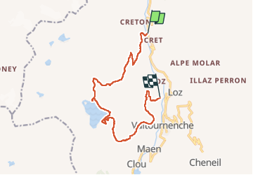
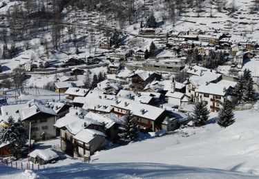
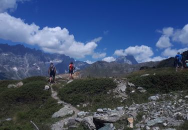
Trail Walking of 13.6 km to be discovered at Aosta Valley, Unknown, Valtournenche. This trail is proposed by David Toussaint.

Description

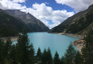
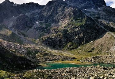
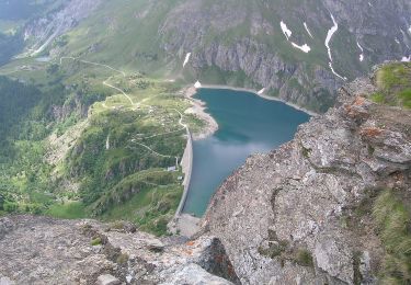
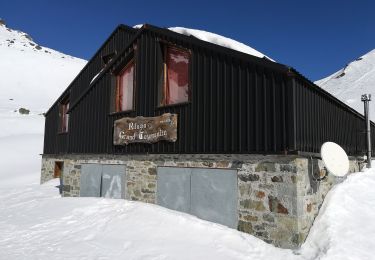
partant de Pererez au nord de Valtournenche, retour a Crepin par l'ascension avec vue imprenable sur le Cervin en arrière plan, puis passage au col et descente au lac artificiel de Cignana et refuge Barmasse, en redescente vers Cremin.
ballade pas difficile mais longue. a prendre en compte si marcheurs inexpérimentés.

Elevation profile

Positioning

Country:
Italy
Region :
Aosta Valley
Department/Province :
Unknown
Municipality :
Valtournenche
Location:
Unknown
Start:(UTM)
392616 ; 5084797 (32T) N.

Trails nearby

Trail On foot Bionaz - Itinerario 11 Diga di Bionaz Alpeggio Bella Tsa - Photo
On foot
GUIDE+

On foot

Easy
Bionaz, Aosta Valley, Unknown, Italy
8.5 km | 12.1 km-effort
2h 44min
No
Trail On foot Valtournenche - Alta Via n. 1 della Valle d'Aosta - Tappa 10 - Photo
On foot
GUIDE+

On foot

Difficult
Valtournenche, Aosta Valley, Unknown, Italy
16.1 km | 33 km-effort
7h 24min
No
Trail On foot Valtournenche - Alta Via n. 1 della Valle d'Aosta - Tappa 9 - Photo
On foot
GUIDE+

On foot

Easy
Valtournenche, Aosta Valley, Unknown, Italy
4.5 km | 11.2 km-effort
2h 32min
No
Trail On foot Valtournenche - (SI F17) Valtournenche - Rifugio Grand Tournalin - Photo
On foot
GUIDE+

On foot

Medium
Valtournenche, Aosta Valley, Unknown, Italy
8.7 km | 23 km-effort
5h 13min
No
Trail On foot Valtournenche - (SI F16) Rifugio Barmasse - Valtournenche - Photo
On foot
GUIDE+

On foot

Easy
Valtournenche, Aosta Valley, Unknown, Italy
4.6 km | 7 km-effort
1h 34min
No
Trail On foot Valtournenche - Itinerario 11 Rifugio Bobba Cervinia - Photo
On foot
GUIDE+

On foot

Easy
Valtournenche, Aosta Valley, Unknown, Italy
4 km | 11.5 km-effort
2h 37min
No
Trail On foot Valtournenche - Itinerario 17 Breuil/Cervinia-Bec Pio Merlo - Photo
On foot
GUIDE+

On foot

Easy
Valtournenche, Aosta Valley, Unknown, Italy
4.5 km | 10.7 km-effort
2h 25min
No
Trail On foot Valtournenche - Itinerario n. 2 Moulin Cortina - Photo
On foot
GUIDE+

On foot

Easy
Valtournenche, Aosta Valley, Unknown, Italy
3.7 km | 11.4 km-effort
2h 34min
No
Trail Walking Valtournenche - Cheneil a Crepin via lago Doz - Photo
Walking
David Toussaint

Walking

Difficult
Valtournenche, Aosta Valley, Unknown, Italy
17.8 km | 31 km-effort
5h 12min
No


Close
My subscriptions