Trail Bicycle tourism Plogoff - Activity - Photo
© OpenStreetMap contributors
Length
Length
21 km
Max alt
Max alt
69 m
Uphill gradient
Uphill gradient
222 m
Km-Effort
Km-Effort  
24 km
Min alt
Min alt
-4 m
Downhill gradient
Downhill gradient
278 m
Boucle
Boucle
No
Creation date :
2022-07-23 12:48:58.257
Updated on :
2022-07-23 12:52:12.595

(1 Reviews)

Bicycle tourism
Bicycle tourism
0m
Difficulty : Very easy

Scan this QR Code to open this trail in the SityTrail application

FREE GPS app for hiking

Logo SityTrail SityTrail

IGN / Geographical institutes

Download SityTrail from the App Store Download SityTrail from Google Play

Logo SityTrail SityTrail World

The world is yours!

Download SityTrail from the App Store Download SityTrail from Google Play Download SityTrail on Huawei AppGallery

About

Trail Bicycle tourism of 21 km to be discovered at Brittany, Finistère, Plogoff. This trail is proposed by Sarah92130.

Description

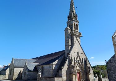
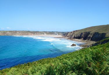
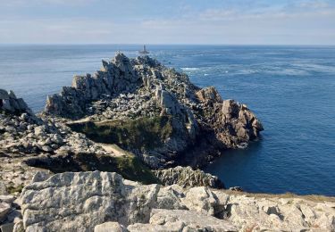
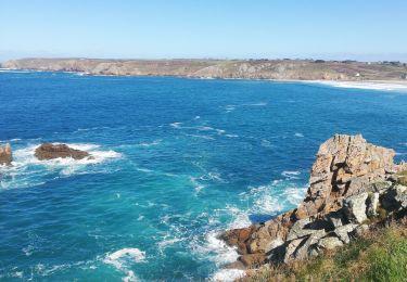
extrait du site france vélo tourisme : Cette étape de la véloroute littorale vous transporte au bout du monde au cœur d’un paysage grandiose et d’une nature sauvage. Laissez derrière vous le Grand Site de France de la Pointe du Raz, pour cheminer vers Audierne et son port de pêche et de plaisance. De l’itinéraire, jetez un œil aux ports abris, notamment celui de Bestrée, aménagés par les hommes pour protéger leurs bateaux des assauts de la mer. Les amateurs de patrimoine ne manqueront pas la chapelle de Saint-Tugen, en passant par le bourg de Primelin, un bel exemple de l'architecture de la Renaissance bretonne. Avant le centre d'Audierne, la véloroute longe la plage de Sainte-Evette, abritée et sûre.

Elevation profile

Positioning

Country:
France
Region :
Brittany
Department/Province :
Finistère
Municipality :
Plogoff
Location:
Unknown
Start:(UTM)
372060 ; 5321885 (30U) N.

Comments

Please log in to post a review or rate the element


Trails nearby

Trail Walking Plogoff - TREK RCY GR34 J4 2022 Pointe du Raz/ baie des trépassés - Photo
Walking
GUIDE
chessyca

Walking

Easy
Plogoff, Brittany, Finistère, France
13.9 km | 18.3 km-effort
3h 42min
No
Trail Walking Cléden-Cap-Sizun - Pointe du Van - Pointe du Raz par le GR34 - 13.5km 310m 4h10 (40mn) - 2019 09 04 - Photo
Walking
GUIDE
Orcal37

Walking

Medium
Cléden-Cap-Sizun, Brittany, Finistère, France
13.5 km | 17.6 km-effort
4h 10min
Yes
Trail Walking Plogoff - la pointe du Raz - Photo
Walking
GUIDE
amiral13

Walking

Difficult
Plogoff, Brittany, Finistère, France
5.3 km | 7 km-effort
2h 56min
Yes
Trail Walking Plogoff - plogoff loual - Photo
Walking
fl29790

Walking

Easy
(1)
Plogoff, Brittany, Finistère, France
4.1 km | 5 km-effort
1h 8min
Yes
Trail Walking Plogoff - la pointe du raz Bretagne - Photo
Walking
lagoisb

Walking

Very easy
(1)
Plogoff, Brittany, Finistère, France
6.8 km | 9 km-effort
2h 19min
Yes
Trail Walking Cléden-Cap-Sizun - point du van - Photo
Walking
jlesacher

Walking

Medium
(1)
Cléden-Cap-Sizun, Brittany, Finistère, France
10.6 km | 13.9 km-effort
Unknown
Yes
Trail Walking Cléden-Cap-Sizun - GR34 Pointe de Brézelec -- Cléden-Cap-Sizun  (Pointe du Raz) - Photo
Walking
donda

Walking

Very difficult
Cléden-Cap-Sizun, Brittany, Finistère, France
23 km | 30 km-effort
6h 54min
No
Trail Walking Cléden-Cap-Sizun - POINTE DU RAZ - Photo
Walking
Miclm

Walking

Easy
Cléden-Cap-Sizun, Brittany, Finistère, France
15.7 km | 20 km-effort
4h 38min
Yes
Trail Walking Plogoff - pointe du Raz - Photo
Walking
apa

Walking

Medium
Plogoff, Brittany, Finistère, France
6.4 km | 8.6 km-effort
2h 18min
Yes


Close
My subscriptions