


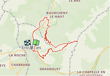

10.5 km | 21 km-effort


User


FREE GPS app for hiking
 SityTrail
IGN / Geographical institutes
SityTrail World
The world is yours!
Trail Walking of 21 km to be discovered at Auvergne-Rhône-Alpes, Isère, Entraigues. This trail is proposed by Maryma.
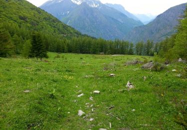
Hors sentier à partir de la Tête du Vêt jusqu'au Jas des Agneaux. La descente, bien qu'assez raide, se fait dans une partie herbeuse. Pas de problème pour se repérer ; on voit de la Tête le chemin à prendre tout en bas ;-))

Walking
Walking

Walking
Touring skiing
Walking
Walking
Walking
Walking
Walking