![](/images/other/stat-length.png)
![Trail Cycle Joué-l'Abbé - Cols en Sarthe - Photo](https://media.geolcdn.com/t/1900/400/ext.pjpeg?maxdim=2&url=https%3A%2F%2Fstatic1.geolcdn.com%2Fsiteimages%2Fupload%2Ffiles%2F1524743154velo.jpg)
Cols en Sarthe
bosses21
User
![Length](/images/other/stat-length.png)
Length
104 km
![Max alt](https://static1.geolcdn.com/siteimages/upload/files/1508320355ic_sort_altitude_max_24dp.png)
Max alt
287 m
![Uphill gradient](https://static1.geolcdn.com/siteimages/upload/files/1508320355ic_sort_den_pos_24dp.png)
Uphill gradient
1222 m
![Km-Effort](/images/other/stat-length.png)
Km-Effort
120 km
![Min alt](https://static1.geolcdn.com/siteimages/upload/files/1508320355ic_sort_altitude_min_24dp.png)
Min alt
49 m
![Downhill gradient](https://static1.geolcdn.com/siteimages/upload/files/1508320355ic_sort_den_neg_24dp.png)
Downhill gradient
1221 m
![Boucle](https://static1.geolcdn.com/siteimages/upload/files/16400158638029165_repeat_loop_refresh_sync_direction_icon.png)
Boucle
No
Creation date :
2014-12-10 00:00:00.0
Updated on :
2014-12-10 00:00:00.0
![Cycle](https://static1.geolcdn.com/sitytour/trail-icons/200.png)
6h51
Difficulty : Medium
![Scan this QR Code to open this trail in the SityTrail application](https://capi.geolives.com/qq0zvz2zws4bq2lad0pu/sitytour/trails/332058/qr.png?size=200)
FREE GPS app for hiking
About
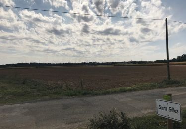
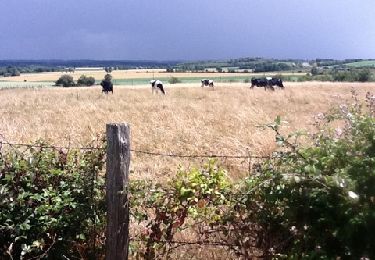
Trail Cycle of 104 km to be discovered at Pays de la Loire, Sarthe, Joué-l'Abbé. This trail is proposed by bosses21.
Description
Col de la Galerie - 258m
Col de la Vallée - 230m
Col de la Croix Lamare - 273m
Col de la Croix des 6 chemins - 168m
Col de la Source - 243m
Positioning
Country:
France
Region :
Pays de la Loire
Department/Province :
Sarthe
Municipality :
Joué-l'Abbé
Location:
Unknown
Start:(Dec)
Start:(UTM)
292981 ; 5332196 (31U) N.
Comments
Trails nearby
![Trail Walking Souillé - Souillé circuit chanvre - Photo](https://media.geolcdn.com/t/375/260/ext.jpg?maxdim=2&url=https%3A%2F%2Fservices.sitytrail.com%2FGeolivesWS%2FDownloadMedia.ashx%3FTrailID%3D1036938%26Media%3D20180909152027.jpg)
![Walking Walking](https://static1.geolcdn.com/sitytour/trail-icons/101.png)
Souillé circuit chanvre
Walking
Very easy
(1)
Souillé,
Pays de la Loire,
Sarthe,
France
![](/images/other/stat-length.png)
8.8 km | 9.6 km-effort
2h 0min
![](https://static1.geolcdn.com/siteimages/upload/files/16400158638029165_repeat_loop_refresh_sync_direction_icon.png)
Yes
![Trail Cycle Joué-l'Abbé - Cols en Sarthe et Mayenne - Photo](https://media.geolcdn.com/t/375/260/ext.jpg?maxdim=2&url=https%3A%2F%2Fstatic1.geolcdn.com%2Fsiteimages%2Fupload%2Ffiles%2F1524743154velo.jpg)
![Cycle Cycle](https://static1.geolcdn.com/sitytour/trail-icons/200.png)
Cols en Sarthe et Mayenne
Cycle
Medium
Joué-l'Abbé,
Pays de la Loire,
Sarthe,
France
![](/images/other/stat-length.png)
119 km | 140 km-effort
7h 55min
![](https://static1.geolcdn.com/siteimages/upload/files/16400158638029165_repeat_loop_refresh_sync_direction_icon.png)
Yes
![Trail Nordic walking Neuville-sur-Sarthe - Neuville sur Sarthe - Photo](https://media.geolcdn.com/t/375/260/ext.jpg?maxdim=2&url=https%3A%2F%2Fstatic1.geolcdn.com%2Fsiteimages%2Fupload%2Ffiles%2F1545311037marcheuse_200dpi.jpg)
![Nordic walking Nordic walking](https://static1.geolcdn.com/sitytour/trail-icons/102.png)
Neuville sur Sarthe
Nordic walking
Medium
Neuville-sur-Sarthe,
Pays de la Loire,
Sarthe,
France
![](/images/other/stat-length.png)
7.4 km | 8 km-effort
1h 37min
![](https://static1.geolcdn.com/siteimages/upload/files/16400158638029165_repeat_loop_refresh_sync_direction_icon.png)
Yes
![Trail Walking Sainte-Jamme-sur-Sarthe - La Sarthe-04-Montbizot - Le Mans - Photo](https://media.geolcdn.com/t/375/260/ext.jpg?maxdim=2&url=https%3A%2F%2Fstatic1.geolcdn.com%2Fsiteimages%2Fupload%2Ffiles%2F1553511878bg_sport_marche.png)
![Walking Walking](https://static1.geolcdn.com/sitytour/trail-icons/101.png)
La Sarthe-04-Montbizot - Le Mans
Walking
Easy
Sainte-Jamme-sur-Sarthe,
Pays de la Loire,
Sarthe,
France
![](/images/other/stat-length.png)
22 km | 23 km-effort
5h 9min
![](https://static1.geolcdn.com/siteimages/upload/files/16400158638029165_repeat_loop_refresh_sync_direction_icon.png)
No
![Trail Cycle Saint-Saturnin - training 1 - Photo](https://media.geolcdn.com/t/375/260/ext.jpg?maxdim=2&url=https%3A%2F%2Fstatic1.geolcdn.com%2Fsiteimages%2Fupload%2Ffiles%2F1524743154velo.jpg)
![Cycle Cycle](https://static1.geolcdn.com/sitytour/trail-icons/200.png)
training 1
Cycle
Very easy
Saint-Saturnin,
Pays de la Loire,
Sarthe,
France
![](/images/other/stat-length.png)
52 km | 59 km-effort
2h 28min
![](https://static1.geolcdn.com/siteimages/upload/files/16400158638029165_repeat_loop_refresh_sync_direction_icon.png)
Yes
![Trail Walking Souillé - Ste Jamme - La Bazoge - Photo](https://media.geolcdn.com/t/375/260/ext.jpg?maxdim=2&url=https%3A%2F%2Fservices.sitytrail.com%2FGeolivesWS%2FDownloadMedia.ashx%3FTrailID%3D67862%26Media%3D20110618145056.jpg)
![Walking Walking](https://static1.geolcdn.com/sitytour/trail-icons/101.png)
Ste Jamme - La Bazoge
Walking
Very easy
Souillé,
Pays de la Loire,
Sarthe,
France
![](/images/other/stat-length.png)
4.4 km | 4.9 km-effort
2h 16min
![](https://static1.geolcdn.com/siteimages/upload/files/16400158638029165_repeat_loop_refresh_sync_direction_icon.png)
No
![Trail Walking La Bazoge - Super U chemin Creu - Photo](https://media.geolcdn.com/t/375/260/ext.jpg?maxdim=2&url=https%3A%2F%2Fstatic1.geolcdn.com%2Fsiteimages%2Fupload%2Ffiles%2F1553511878bg_sport_marche.png)
![Walking Walking](https://static1.geolcdn.com/sitytour/trail-icons/101.png)
Super U chemin Creu
Walking
Easy
La Bazoge,
Pays de la Loire,
Sarthe,
France
![](/images/other/stat-length.png)
4.3 km | 5.2 km-effort
1h 10min
![](https://static1.geolcdn.com/siteimages/upload/files/16400158638029165_repeat_loop_refresh_sync_direction_icon.png)
Yes
![Trail Nordic walking Neuville-sur-Sarthe - Neuville-sur-Sarthe super grand tour - Photo](https://media.geolcdn.com/t/375/260/ext.jpg?maxdim=2&url=https%3A%2F%2Fstatic1.geolcdn.com%2Fsiteimages%2Fupload%2Ffiles%2F1545311037marcheuse_200dpi.jpg)
![Nordic walking Nordic walking](https://static1.geolcdn.com/sitytour/trail-icons/102.png)
Neuville-sur-Sarthe super grand tour
Nordic walking
Medium
Neuville-sur-Sarthe,
Pays de la Loire,
Sarthe,
France
![](/images/other/stat-length.png)
10.1 km | 11 km-effort
2h 22min
![](https://static1.geolcdn.com/siteimages/upload/files/16400158638029165_repeat_loop_refresh_sync_direction_icon.png)
Yes
![Trail Nordic walking Neuville-sur-Sarthe - Neuville-sur-Sarthe petite boucle - Photo](https://media.geolcdn.com/t/375/260/ext.jpg?maxdim=2&url=https%3A%2F%2Fstatic1.geolcdn.com%2Fsiteimages%2Fupload%2Ffiles%2F1545311037marcheuse_200dpi.jpg)
![Nordic walking Nordic walking](https://static1.geolcdn.com/sitytour/trail-icons/102.png)
Neuville-sur-Sarthe petite boucle
Nordic walking
Easy
Neuville-sur-Sarthe,
Pays de la Loire,
Sarthe,
France
![](/images/other/stat-length.png)
7.3 km | 7.9 km-effort
1h 36min
![](https://static1.geolcdn.com/siteimages/upload/files/16400158638029165_repeat_loop_refresh_sync_direction_icon.png)
Yes