VILLENAUXE LA GRANDE 1
jeannine grandjean
User
Length
11.3 km
Max alt
177 m
Uphill gradient
228 m
Km-Effort
14.4 km
Min alt
74 m
Downhill gradient
229 m
Boucle
Yes
Creation date :
2022-07-15 19:47:48.719
Updated on :
2022-07-30 13:41:41.387
3h10
Difficulty : Difficult
FREE GPS app for hiking
About
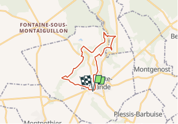
Trail Walking of 11.3 km to be discovered at Grand Est, Aube, Villenauxe-la-Grande. This trail is proposed by jeannine grandjean.
Description
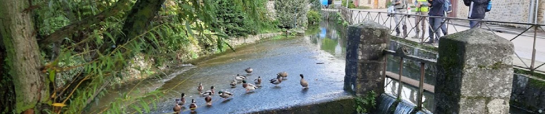
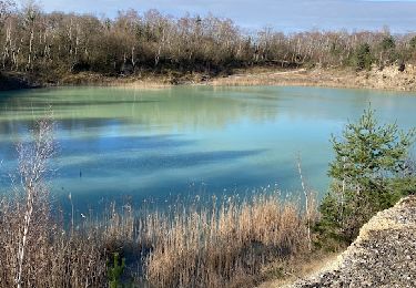
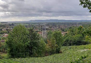
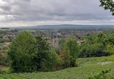
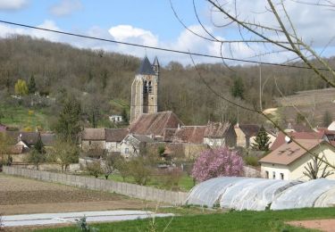
les vignes de Champagne, les bois, la petite rivière Noxe, les anciennes carrières d'argile, un superbe parcours, un bon dénivelé dans les bois.
ATTENTION : entre le km 5 et la bifurcation du Moulin des Roches, suivre uniquement, sur les arbres, le balisage jaune et blanc
Positioning
Country:
France
Region :
Grand Est
Department/Province :
Aube
Municipality :
Villenauxe-la-Grande
Location:
Unknown
Start:(Dec)
Start:(UTM)
540796 ; 5381632 (31U) N.
Comments
Trails nearby
MONTPOTHIER, LE VILLAGE ET LES ETANGS
Walking
Medium
(1)
Montpothier,
Grand Est,
Aube,
France
7.5 km | 9.1 km-effort
2h 4min
Yes
VILLENAUXE LA GRANDE, village et Val de Noxe
Walking
Medium
Villenauxe-la-Grande,
Grand Est,
Aube,
France
8.6 km | 10.6 km-effort
2h 24min
Yes
Villenauxe 3
Walking
Easy
Villenauxe-la-Grande,
Grand Est,
Aube,
France
4 km | 5 km-effort
1h 8min
Yes
Terroirs et vignes en Val de Noxe
Walking
Medium
(1)
Villenauxe-la-Grande,
Grand Est,
Aube,
France
18.4 km | 24 km-effort
5h 6min
Yes
Val de Noxe - Villenauxe la Grande
Walking
Medium
Villenauxe-la-Grande,
Grand Est,
Aube,
France
33 km | 39 km-effort
6h 30min
Yes
VILLENAUXE 2 le vignoble, les bois, la rivière Noxe, le village
Walking
Medium
(1)
Villenauxe-la-Grande,
Grand Est,
Aube,
France
7.8 km | 10.1 km-effort
2h 18min
Yes
Vignoble de Champagne et Vallée de la Noxe - Villenauxe la Grande
Cycle
Medium
(1)
Villenauxe-la-Grande,
Grand Est,
Aube,
France
66 km | 74 km-effort
3h 30min
Yes
Terroirs et vignes en Val de Noxe
Walking
Difficult
Villenauxe-la-Grande,
Grand Est,
Aube,
France
18.3 km | 23 km-effort
4h 15min
Yes