![](/images/other/stat-length.png)
![Trail Walking La Chapelle-en-Valgaudémar - lacs de Pétarels et col Beranne - Photo](https://media.geolcdn.com/t/1900/400/05949067-6e82-4890-9420-cf506bddda1e.jpg&format=pjpeg&maxdim=2)
lacs de Pétarels et col Beranne
scalpy
User
![Length](/images/other/stat-length.png)
Length
16 km
![Max alt](https://static1.geolcdn.com/siteimages/upload/files/1508320355ic_sort_altitude_max_24dp.png)
Max alt
2464 m
![Uphill gradient](https://static1.geolcdn.com/siteimages/upload/files/1508320355ic_sort_den_pos_24dp.png)
Uphill gradient
1248 m
![Km-Effort](/images/other/stat-length.png)
Km-Effort
33 km
![Min alt](https://static1.geolcdn.com/siteimages/upload/files/1508320355ic_sort_altitude_min_24dp.png)
Min alt
1262 m
![Downhill gradient](https://static1.geolcdn.com/siteimages/upload/files/1508320355ic_sort_den_neg_24dp.png)
Downhill gradient
1249 m
![Boucle](https://static1.geolcdn.com/siteimages/upload/files/16400158638029165_repeat_loop_refresh_sync_direction_icon.png)
Boucle
Yes
Creation date :
2022-07-13 07:38:45.357
Updated on :
2022-07-13 15:03:16.356
![Walking](https://static1.geolcdn.com/sitytour/trail-icons/101.png)
6h32
Difficulty : Difficult
![Scan this QR Code to open this trail in the SityTrail application](https://capi.geolives.com/qq0zvz2zws4bq2lad0pu/sitytour/trails/3314998/qr.png?size=200)
FREE GPS app for hiking
About
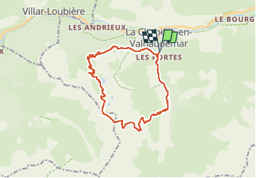
Trail Walking of 16 km to be discovered at Provence-Alpes-Côte d'Azur, Hautes-Alpes, La Chapelle-en-Valgaudémar. This trail is proposed by scalpy.
Description
au départ du hameau de Navette, montée agréable jusqu'aux lacs puis on poursuit la mo tee jusqu'au col et ensuite très longue descente en cailloux assez escarpée pour rejoindre la vallée. Vue splendide sur les sommets des Ecrins
Positioning
Country:
France
Region :
Provence-Alpes-Côte d'Azur
Department/Province :
Hautes-Alpes
Municipality :
La Chapelle-en-Valgaudémar
Location:
Unknown
Start:(Dec)
Start:(UTM)
278323 ; 4965877 (32T) N.
Comments
Trails nearby
![Trail Walking La Chapelle-en-Valgaudémar - circuit de la cabane de l'aup .08-06-14 - Photo](https://media.geolcdn.com/t/375/260/ext.jpg?maxdim=2&url=https%3A%2F%2Fservices.sitytrail.com%2FGeolivesWS%2FDownloadMedia.ashx%3FTrailID%3D310408%26Media%3Dfix__20140608140628.jpg)
![Walking Walking](https://static1.geolcdn.com/sitytour/trail-icons/101.png)
circuit de la cabane de l'aup .08-06-14
Walking
Very easy
(1)
La Chapelle-en-Valgaudémar,
Provence-Alpes-Côte d'Azur,
Hautes-Alpes,
France
![](/images/other/stat-length.png)
8.8 km | 13.6 km-effort
2h 37min
![](https://static1.geolcdn.com/siteimages/upload/files/16400158638029165_repeat_loop_refresh_sync_direction_icon.png)
Yes
![Trail Walking La Chapelle-en-Valgaudémar - Tour du Vieux Chaillol 2/5 - Du Gîte Le Casset au Refuge de Vallonpierre - Photo](https://media.geolcdn.com/t/375/260/ext.jpg?maxdim=2&url=https%3A%2F%2Fservices.sitytrail.com%2FGeolivesWS%2FDownloadMedia.ashx%3FTrailID%3D110181%26Media%3D5395_2.jpg)
![Walking Walking](https://static1.geolcdn.com/sitytour/trail-icons/101.png)
Tour du Vieux Chaillol 2/5 - Du Gîte Le Casset au Refuge de Vallonpierre
Walking
Medium
(1)
La Chapelle-en-Valgaudémar,
Provence-Alpes-Côte d'Azur,
Hautes-Alpes,
France
![](/images/other/stat-length.png)
11.8 km | 24 km-effort
4h 30min
![](https://static1.geolcdn.com/siteimages/upload/files/16400158638029165_repeat_loop_refresh_sync_direction_icon.png)
No
![Trail Walking Villar-Loubière - Pic Turbat - Photo](https://media.geolcdn.com/t/375/260/d62b8d76-41e7-46f4-8b33-5d2b5ae47cbd.jpg&format=jpg&maxdim=2)
![Walking Walking](https://static1.geolcdn.com/sitytour/trail-icons/101.png)
Pic Turbat
Walking
Very difficult
Villar-Loubière,
Provence-Alpes-Côte d'Azur,
Hautes-Alpes,
France
![](/images/other/stat-length.png)
19.8 km | 46 km-effort
10h 26min
![](https://static1.geolcdn.com/siteimages/upload/files/16400158638029165_repeat_loop_refresh_sync_direction_icon.png)
Yes
![Trail Walking La Chapelle-en-Valgaudémar - Lacs de Pétarel-Col de la Béranne - Photo](https://media.geolcdn.com/t/375/260/5e28ea7d-88f9-46a3-ba95-03bb6ef09059.jpg&format=jpg&maxdim=2)
![Walking Walking](https://static1.geolcdn.com/sitytour/trail-icons/101.png)
Lacs de Pétarel-Col de la Béranne
Walking
Medium
La Chapelle-en-Valgaudémar,
Provence-Alpes-Côte d'Azur,
Hautes-Alpes,
France
![](/images/other/stat-length.png)
11.1 km | 23 km-effort
7h 0min
![](https://static1.geolcdn.com/siteimages/upload/files/16400158638029165_repeat_loop_refresh_sync_direction_icon.png)
Yes
![Walking Walking](https://static1.geolcdn.com/sitytour/trail-icons/101.png)
Pas de l'Olan
Walking
Very difficult
La Chapelle-en-Valgaudémar,
Provence-Alpes-Côte d'Azur,
Hautes-Alpes,
France
![](/images/other/stat-length.png)
12.6 km | 34 km-effort
7h 37min
![](https://static1.geolcdn.com/siteimages/upload/files/16400158638029165_repeat_loop_refresh_sync_direction_icon.png)
Yes
![Trail Walking La Chapelle-en-Valgaudémar - Valgaudemar - La Chapelle (les Portes) forêt - 4.3km 285m 1h35 - 2018 07 05 - public - Photo](https://media.geolcdn.com/t/375/260/ext.jpg?maxdim=2&url=https%3A%2F%2Fservices.sitytrail.com%2FGeolivesWS%2FDownloadMedia.ashx%3FTrailID%3D999071%26Media%3Dfix__20180705073135.jpg)
![Walking Walking](https://static1.geolcdn.com/sitytour/trail-icons/101.png)
Valgaudemar - La Chapelle (les Portes) forêt - 4.3km 285m 1h35 - 2018 07 05 -...
Walking
Easy
La Chapelle-en-Valgaudémar,
Provence-Alpes-Côte d'Azur,
Hautes-Alpes,
France
![](/images/other/stat-length.png)
4.3 km | 8.1 km-effort
1h 40min
![](https://static1.geolcdn.com/siteimages/upload/files/16400158638029165_repeat_loop_refresh_sync_direction_icon.png)
Yes
![Trail Walking La Chapelle-en-Valgaudémar - Valgaudemar - La Chapelle Vallon de la Navette - 10.9km 420m 3h25 - 2018 06 30 - public - Photo](https://media.geolcdn.com/t/375/260/ext.jpg?maxdim=2&url=https%3A%2F%2Fservices.sitytrail.com%2FGeolivesWS%2FDownloadMedia.ashx%3FTrailID%3D998812%26Media%3Dfix__20180630163125.jpg)
![Walking Walking](https://static1.geolcdn.com/sitytour/trail-icons/101.png)
Valgaudemar - La Chapelle Vallon de la Navette - 10.9km 420m 3h25 - 2018 06 3...
Walking
Medium
La Chapelle-en-Valgaudémar,
Provence-Alpes-Côte d'Azur,
Hautes-Alpes,
France
![](/images/other/stat-length.png)
10.9 km | 16.4 km-effort
4h 30min
![](https://static1.geolcdn.com/siteimages/upload/files/16400158638029165_repeat_loop_refresh_sync_direction_icon.png)
Yes
![Trail Walking La Chapelle-en-Valgaudémar - Valgaudemar - La Chapelle Vallée de la Séveraisse Refuge du Clot - 15.9km 450m 4h35 - 2018 07 01 - public - Photo](https://media.geolcdn.com/t/375/260/ext.jpg?maxdim=2&url=https%3A%2F%2Fservices.sitytrail.com%2FGeolivesWS%2FDownloadMedia.ashx%3FTrailID%3D998805%26Media%3Dfix__20180701095057.jpg)
![Walking Walking](https://static1.geolcdn.com/sitytour/trail-icons/101.png)
Valgaudemar - La Chapelle Vallée de la Séveraisse Refuge du Clot - 15.9km 450...
Walking
Medium
La Chapelle-en-Valgaudémar,
Provence-Alpes-Côte d'Azur,
Hautes-Alpes,
France
![](/images/other/stat-length.png)
15.9 km | 22 km-effort
5h 55min
![](https://static1.geolcdn.com/siteimages/upload/files/16400158638029165_repeat_loop_refresh_sync_direction_icon.png)
Yes
![Trail Walking La Chapelle-en-Valgaudémar - le Chapeau - Photo](https://media.geolcdn.com/t/375/260/79b9f337-3d0f-4659-9c99-10613185a8cb.jpg&format=jpg&maxdim=2)
![Walking Walking](https://static1.geolcdn.com/sitytour/trail-icons/101.png)
le Chapeau
Walking
Difficult
La Chapelle-en-Valgaudémar,
Provence-Alpes-Côte d'Azur,
Hautes-Alpes,
France
![](/images/other/stat-length.png)
14.6 km | 31 km-effort
7h 37min
![](https://static1.geolcdn.com/siteimages/upload/files/16400158638029165_repeat_loop_refresh_sync_direction_icon.png)
Yes